The Mountains of West Texas
www.surgent.net |
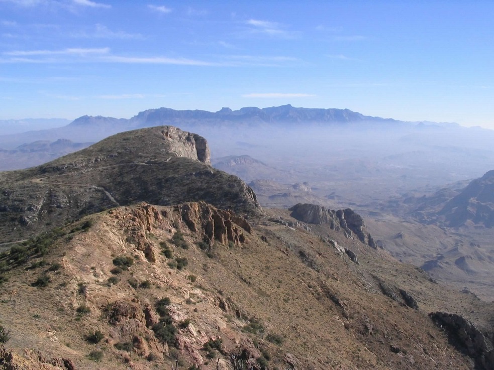
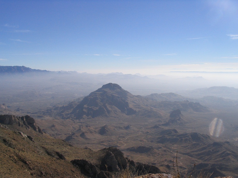
| Christmas Mountain |
• Highpoint: Christmas Mountains • Brewster County |
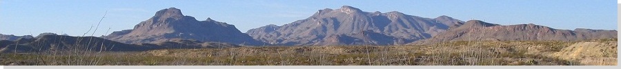
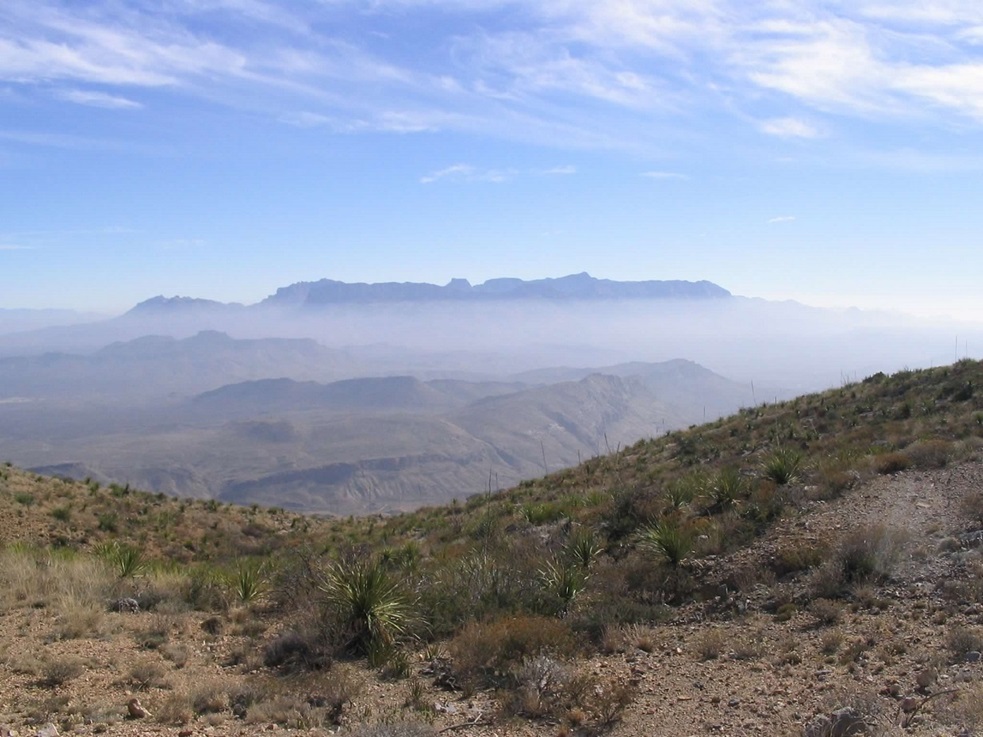
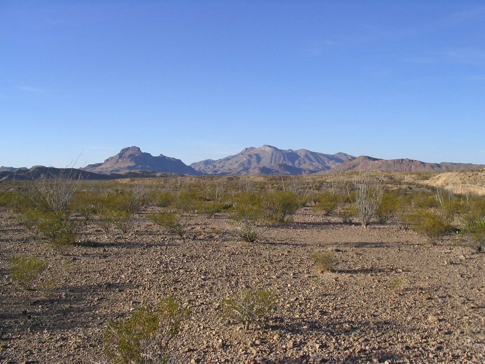 The Christmas Mountains as seen from Big Bend National Park
|
Date: December 19, 2005
• Elevation: 5,728 feet
• Prominence: 2,388 feet
• Distance: 8 miles
• Time: 3 hours
• Gain: 1,800 feet
• Conditions: Cool at first, then nice
Texas
•
PB
The Christmas Mountains are in southern Brewster County in West Texas, north of Big Bend National Park. The range is compact with significant prominence, and for many years was closed to the public. It was privately owned at one time, then purchased by a land conservancy group with the intention that Big Bend National Park might eventually buy the range and absorb it into the park. Something this simple has now dragged on for almost 40 years.
My wife and I were visiting Big Bend, our second time here in a year. We were going to stay at the Terlingua Ranch. However, we assumed it was near Terlingua, the town. We arrived into Terlingua, then realized the turn-off to the Terlingua Ranch was about 25 miles back north. So we back-tracked and arrived in the early evening, but too late to catch the people at the main office. However, they had left our key for us, and we settled the bill the next morning.
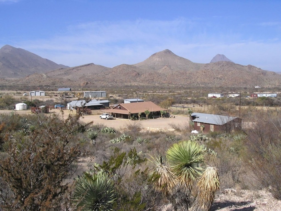
Terlingua Ranch is a big patch of desert roughly bounded by State Route TX-118 on the west, US-285 on the east and the National Park to the south. It is very remote. A few people bought lots and live out here, off the grid. Some lodgings are available for tourists such as ourselves. The main office area has a restaurant and occasional entertainment. The lodgings were basic, but decent. Everything worked, which is all we ask.
The next morning, I walked to the main office to settle our bill. I noticed that Christmas Mountain was nearby. However, I had no idea we'd be staying so close to it, and had done no homework beforehand. Being as close as we were, I could not resist to inquire about it.
The offices have a detailed map room, with topographical maps, plat maps and so on. The man at the office was nice and allowed me to peruse the maps. I noticed that the Christmas Mountains were owned by the Texas General Land Office (GLO), and the entire range was for sale for $450,000. This was a good way to bring up the subject with the proprietor.
The man was personable, but seemed to play his cards close to his chest. He revealed that the Terlingua Ranch does not own nor does it have any purview over the range. He would not (or could not) grant me permission to hike it. I could see a mine road (and it showed on a map, too), and he said it does go to near the top. He never said I could go there, but he never said I couldn't, either.
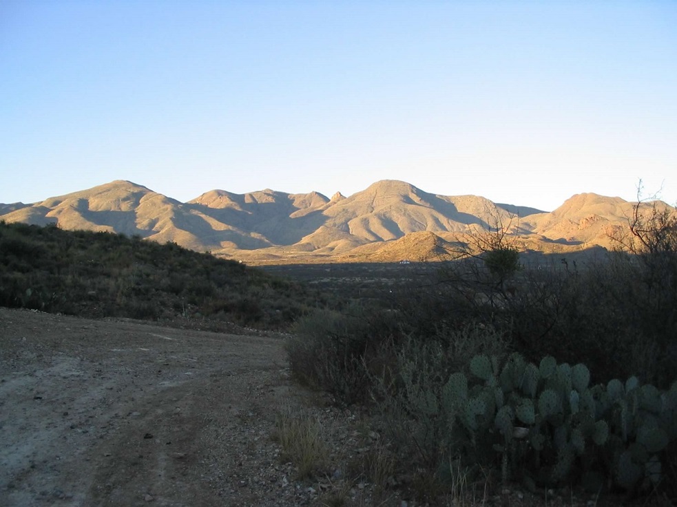
I decided to go check it out. I drove the roads from the office to the base of the mine road, a distance of two miles. The mine road was gated with a light-gauge chain link, a single strand between two metal posts. There were no signs telling me to get lost. I stepped over the chain and started up the road.
I was doing this entirely extemporaneously. I had not told βð what I was up to. I was "pretty sure" I would get in about a mile, see a barrier or sign or whatever, then turn back. So I walked fast. If I was going to be defeated, I wanted to know sooner than later.
The road was my trail. It was heavily eroded, some places so deep that I could have stood within the erosion gullies and still be below road level. There was no way any vehicle could get up this. Once past these gullies, I knew that no one would surprise me by driving up. Soon, I had surmounted a hill, with awesome views of the Chisos Mountains to the south.
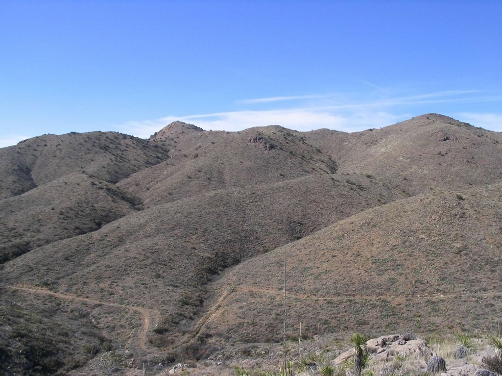
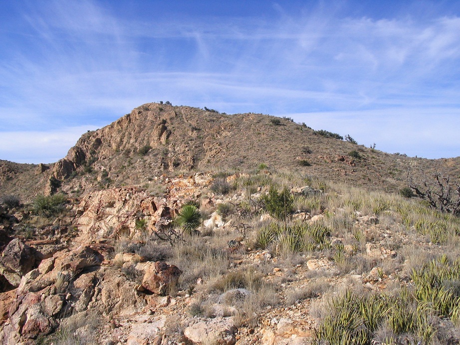
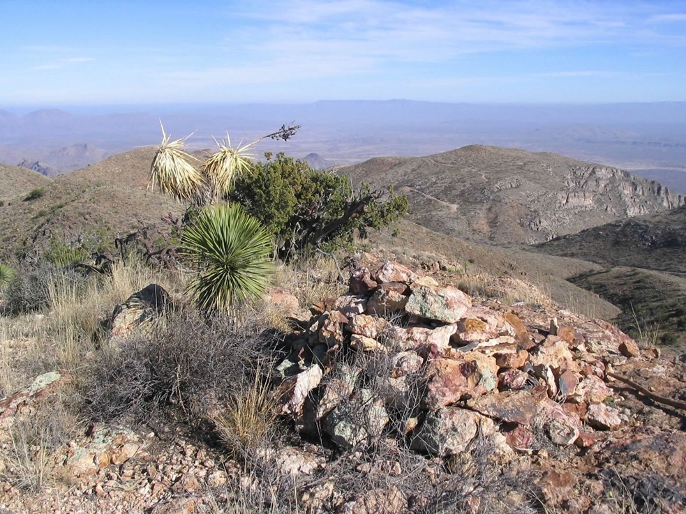
This hill was about 2.5 miles in, and the summit was now visible, about a mile away. The road dropped, then gained up to a saddle south of the summit, and north of a subpeak with towers on it. I jog-walked as best as I could, got to the end of the road, then found a scant path that went up and over ridge bumps to the actual summit, on which sat a big rock cairn. There was a register here, placed by someone I know. He had visited in 2004. I may have been the only visitor for all of 2005.
I snapped photos, took a small break, but then hustled back down, running whenever possible, never stopping. I was back to my truck after a total of 3 hours on the trail, covering 8 miles and 1,800 feet of gain. I was absolutely delighted to have hiked this peak given that I had no idea we'd be so near it, even as late as a day before. This was an entirely unexpected journey. I was back to our cabin by about 3 p.m..
βð and I had a fantastic time here. Two days later, we hiked Emory Peak, visited the Hot Springs along the Rio Grande, checked out Terlingua the town, then drove up FM-170, The River Road, all the way up to Candelaria and the Chinati Hot Springs. This is a magical part of the world, and we love it here. Too bad it's so far from where we live.
. . . . . . . . . . . . . . . . . . . . . . . . .
Here is a little background about the Christmas Mountains that I was able to discover:
A land conservancy group purchased the range in the late 1980s, hoping to unload it to the Big Bend National Park later on. But the park can't just buy land without going through a thousand hoops and getting Congressional approval. The land conservancy group grew tired of holding onto the property, so they sold it to the TX-GLO, but the deed restrictions are so severe that there is literally no development allowed within the range.
It seems the TX-GLO had the same idea as the land conservancy group: that the Big Bend people would swoop in and buy it, but that did not happen. Big Bend National Park is certainly interested, but big land purchases like this are very rare and have to go through a process. So the land stays in limbo. In the meantime, the TX-GLO allowed a group calling itself the Christmas Mountains Association (CMA) to look over the range.
I had not heard of the CMA when we were there, nor beforehand. The Terlingua Ranch guy never said anything about them. There were no signs anywhere saying "Please contact the CMA". So a few months later, I got a letter from them where they called me every name in the book, questioning my honor and decency. Many of the words in the letter were misspelled. A few days later I got another letter from them, in the same general tone and badly-spelled words. I regret not keeping those letters.
Naturally, I wondered who the f the Christmas Mountains Association was. I was able to find just one reference to them, embedded within a PDF from some group down there, the PDF being a newsletter of some sort. I could not find an address for them, nor a phone number.
I am well aware of how Texas law favors landowners, and that essentially any land more than 20 feet from a highway is probably private. The landowner does not need to post very heavily, either. The burden is on the visitor to know what's legal and what's not. But I also know that the CMA does not own the Christmas Mountains and would have limited legal authority to tell me to do anything. In recent years, it appears they have disbanded.
The good news is that the land has slowly been quasi-absorbed into the National Park. The properties share a one-mile border, and hikers can walk in from the Big Bend side with no problem. But that's a very remote boundary. Then, in April 2011, I got an email from the Terlingua Ranch people saying that the public has access up that old mine road, as long as they get a permit. I want to thank Dr. Paul Burger for alerting me of this development.
So, as of 2016, the Christmas Mountains are still not technically a part of the Big Bend National Park, but the locals are growing wise to its potential for a small revenue stream from hikers and visitors (which is better than no revenue stream). Apparently the road has been repaired and vehicles can now drive to where it ends.
|
|