The County Highpoints of Texas
www.surgent.net |
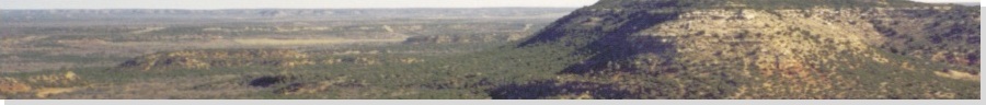
| Border Benchmark & surrounding area |
• Highpoint: Webb County |
 Exciting South Texas scenery |
Date: Novermber 11, 2001
• Elevation: 940 feet
• Prominence: 355 feet
• Distance: 1 mile total walking
• Time: 1 hour
• Gain: 30 feet
• Conditions: Cool, high clouds
Texas
•
PB
•
LoJ
South Texas features almost nothing of any significant topographical prominence. The highpoint of Webb County is an exception: it lies atop a long mesa that has over 350 feet of prominence. In fact, it is the only hill that exceeds 300 feet of prominence in all of South Texas (basically, anything south of San Antonio). I was here on a three-day journey to visit as many county highpoints as I could in the far-south part of the state.
Up to now, I was not having a lot of luck. The land down here is sandy and what's not sand is usually thorny and dense vegetation. And what's not vegetation is often a snake. So even scampering a few hundred feet into a field was perilous. That, and the miles of g-d fencing they string up everywhere down here.
Anyway, I had started today with a successful "ascent" of the highpoint of nearby Zapata County ("Shoe County"). From there, I drove to a small town called Oilton, in the middle of nowhere, about three miles south of the Webb County highpoint area.
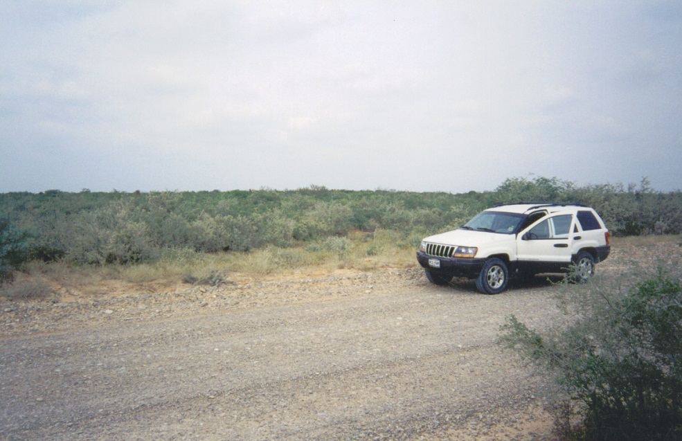
From Oilton, I drove north on Welhousen Road until I was in the middle of the scattered areas that each reach 940 feet elevation. One region has a survey benchmark "Border" on it (says the map), so I hiked to it, but I couldn't find the actual disk. Two other areas nearby the road were quickly visited but probably were not contenders (nor was the Border Benchmark area, in my opinion).
One area, just by its size and by the fact I could even make out its rise above the scrub, stood out as the likeliest highpoint candidate. I breached a fence and walked into the brush about 500 feet, gaining 20 feet. I would put my money on this slight hill being the highest point in Webb County Another tiny region near a gravel pit is probably man-made and so tiny it statistically has probability zero of holding the highpoint, so I ignored it.
The day was highlighted by a visit with a lonely Border Patrol checkpoint fellow just east of Oilton. This isn't a heavily traveled highway so he took longer than usual to wave me through. He asked me of my business so I just told him I'm highpointing, and showed him my maps, too. He seemed surprised anyone would be in this region who didn't have actual business (legal or otherwise) to do. He went through my backpack, peered in the windows, then let me go. An hour later, I went through same routine again near Freer, though this time it went quicker.
I was two for four today, batting five-hundred. I headed north and tried to hike to the Duval County highpoint, but immediately backed off due to substantial fencing and long distances across private lands. That brought me down to a four-hundred batting average. Ted Williams would be proud of that. For me, it was kind of frustrating.
|
|