
Peaks in Tennessee
• www.surgent.net
|
 Haw Knob in Monroe Co.
|
Prologue: I visited Tennessee in May 2000 and tagged its highpoint plus a couple nearby peaks, some on the Tennessee-North Carolina state line. In 2001, I returned to visit a friend of mine, and we hiked a few peaks in and around Knoxville, plus some lame county highpoints near Nashville. I did not return to the state until 2019, with my wife, crossing into Memphis.
Date: May 27, 2000 •
Elevation: 6,643 feet • Prominence: 4,503 feet • Distance: 1 mile • Time: 1 hour • Gain: 200 feet
Main
•
PB
I was in the Appalachian Mountains, visiting various peaks and hilltops. I'd been on the road for three days by now. I stayed the night in Wayneville, North Carolina, scratched and tired from yesterday's series of hikes in North Carolina. I was up early today, with Clingmans Dome first on my agenda. I headed into the Great Smoky Mountains National Park through the town of Cherokee, within the Cherokee Indian Reservation.
Every conceivable space in the town was devoted to advertising, souvenirs, restaurants, and eight-hundred other things. Thankfully, once I entered the National Park, the commercialism stopped, the trees resumed, and I could get back to the task of following slow R.V.s going 10 miles per hour up the slopes toward the high peaks ahead.
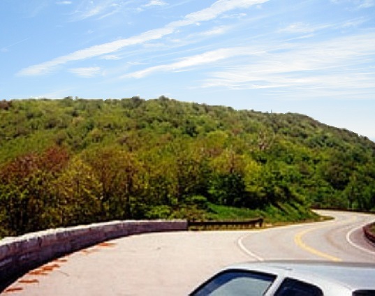
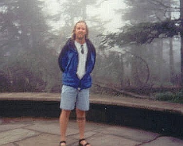
From the main highway, I followed another road south about six miles to a parking area below Clingmans Dome. Up here, the fog was thick, obscuring views. I walked a paved footpath to the top, tagged the top, hung around for a brief while, then returned to my vehicle. Someone took a blurry hotograph of me.
Interestingly, my entire "Tennessee Highpoint" experience was entirely within North Carolina, other than the moment I tagged the presumed top, which momentarily meant I was "in" Tennessee. With the fog, this was not a memorable experience. I'll come back when I am older, then I can be the slowpoke in an R.V.
I then drove toward Robbinsville (N.C.) where I met Fred Lobdell, a county highpointer celebrity. He has hiked many peaks in the region, and it was his notes that I used for my highpoints along the Blue Ridge Parkway. However, we both encountered delays into Robbinsville and didn't meet there. Instead we met at the Nantahala Forest Ranger station up the road, by luck. Together, we convoyed over the Cherohala Scenic Byway across the Unicoi Mountains along the Tennessee and North Carolina border.
Many of the highest peaks in this part of the Appalachian Mountains lie on the Tennessee and North Carolina border. What follows below are some of the bigger ones, but slightly out of order, as I had hiked Roan High Knob first thing yesterday. I spent a half-day in Tennessee today, tagging a couple more easy bumps with Fred Lobdell before heading back to Atlanta for my flight home.
Date: May 26, 2000 •
Elevation: 6,285 feet • Prominence: 3,485 feet • Distance: 4.8 miles • Time: 2 hours • Gain: 700 feet
PB
Roan Mountain is a series of peaks along the Tennessee/North Carolina state line. On the Tennessee side, there is a state park with a Ranger Station, information kiosks and built-up areas for visitors. I drove in from the Tennessee side through the towns of Johnson City and Elizabethton, following the signs to Roan Mountain State Park. The Appalachian Trail is the principal hiking route through the park, and would be the trail I would follow to the summit.
Roan High Knob is the highest of the Roan summits. It lies on the state line and is the highpoint of Mitchell County (North Carolina) and Carter County (Tennessee). I parked at Carver's Gap, north and east of the peaks, and a let-in point for the Appalachian Trail. From the parking area, the trail gains steeply and is eroded in places, then the grade moderates via switchbacks before leveling off. Then the trail bends left and starts a slow descent. The highpoint is here somewhere... umm...
I knew something wasn't right, but I hiked onward anyway, coming to another parking area and a fee station. I asked the ladies in the booth where Roan High Knob was and they pointed it to me: right where I had come from. So I retraced my steps, hiked back the way I came, and found the turn-off to the summit. It's poorly marked and only visible for the northbound hikers, not for southbound hikers like I was. That's my excuse and I'm sticking by it.
It was an easy uphill stroll to the summit, marked by rock outcroppings, dense forest, and a nearby shelter (apparently, the highest one along the Appalachian Trail). In all, I added an extra 1.4 miles to the hike, making a 3.5-miler into a near 5-miler. Overall, the hike involved 700 feet of elevation gain and took me 2 hours. I drove down beautiful local highways and got myself onto the Blue Ridge Parkway, heading toward Mount Mitchell.
Date: May 27, 2000 •
Elevation: 5,472 feet • Prominence: 192 feet • Distance: 0.8 miles • Time: 35 minutes • Gain: 180 feet • Teammate: Fred Lobdell
PB
Haw Knob is a bump with no significance other than it is a county highpoint. Fred and I parked in a pullout along the Cherohala Scenic Byway, on the North Carolina side. We found an overgrown trail on the north-west side of the pullout. This trail gets little use and we had a lot of brush and slippery rocks (I fell once). But it is a short hike, less than half a mile each way, and less than 200 feet of gain, so in 20 minutes, we were at the top, where the trees give way to reasonably nice views. We spent 10 minutes up there, then retreated to our cars.
Date: May 27, 2000 •
Elevation: 1,495 feet • Prominence: 615 feet • Distance: drive-up • Time: 5 minutes on site • Gain: negligible • Teammate: Fred Lobdell
PB
Fred suggested we visit this easy highpoint, not far from Chattanooga. It would place us both convenient to the main interstate when done. The highpoint itself is nothing special, but easy. We left Interstate-75 at exit-20 northeast of Chattanooga. Fred then rode shotgun with me and navigated, while I drove a series of backroads, about five miles worth, roughly paralleling the interstate. I couldn't even begin to recall the names of the roads, except that we were on Owl Hollow Road, then up Firetower Road toward the lookout.
There is an abandoned house on the summit, with the actual highest point located around the back. We found a witness mark but not the actual benchmark. We did not stay long. There was nothing to see. We backtracked back to the main highway, where Fred and I parted ways: he to Chattanooga and me to Atlanta.
I flew back to Arizona the next day. Boy, my arms were tired. In 2001, I returned to Tennessee. My friend V. was here for a couple job interviews. We met and spent a couple days together touring the state, which included a handful of hikes.
I flew into Nashville, and we spent a day visiting some lame county highpoints in the area: Sullivan Ridge in Cheatham County (a grassy rise among homes in the woods), Russell Hill in Macon County (around back of an abandoned home), and Dripping Springs in Putnam County (a small rise in the forest). This put is near Knoxville, where we stayed the night in Farragut.
Date: August 18, 2001 •
Elevation: 2,080 feet • Prominence: 1,085 feet • Distance: 4 miles • Time: 2 hours • Gain: 1,100 feet • Conditions: Heavy humidity • Teammate: V.
PB
House Mountain is located a few miles northeast of Knoxville, in a "range" of hills that tend to be long narrow parallel ridges called the Clinch Mountains. House Mountain is close enough to Knoxville to attract hikers. It has a developed trail that allows for a loop option. We weren't in a hurry, and didn't leave the hotel until 9 a.m. We parked in a small lot in the House Mountain Wildlife Area, southeast of the peak.
We hiked up the West Overlook Trail (this is a few yards past the "Mtn Trail" junctions, see below). The West Overlook gains moderately to a rock outcrop at the west end of the ridge. We saw a few people relaxing here, enjoying the views. We took a break here, too. We then continued on the ridge, hiking east and following the trail up and down a series of bumps. In a half-mile, we came upon a small structure, and past it, in the woods a little bit, the remnants of a lookout tower. This was one candidate for the highpoint.
The second bump is another half-mile east. The trail drops a hundred feet to a junction for the Turkey Trail. We stayed on the main trail (east) and regained our lost elevation, coming to another rock outcrop. The highpoint here is a large rock that presents a challenge to scale. We "summitted" by partially shimmying up the rock to where we could reach out and tag the top. Both V. and I are tall so this was not a problem. We stayed here twenty minutes to enjoy the views.
Coming back, we met up with a couple hikers who mentioned that the Turkey Trail would take us back to the parking lot, so we followed it instead. This trail covers a mile, and re-emerges with our original trail at the aforementioned "Mtn Trail" junction at the bottom. There is a possible point of confusion: there are two "Mtn Trail"s at the bottom, but they meet up together a hundred or so yards into the woods (coming down, we saw this fork which confused us). Coming up this trail, you'd come to the ridge about equidistant between the two highpoint areas.
Our round trip took two hours. The weather was nice, about 70 degrees. But the humidity was almost 95% and the air was still, the dewpoint probably around 70 degrees too. What this meant was that any sweat would not evaporate. We were soaked, but it wasn't uncomfortable.
Date: August 18, 2001 •
Elevation: 3,534 feet • Prominence: 2,074 feet • Distance: 1 mile hike • Time: 1 hour • Gain: 300 feet • Conditions: Humid • Teammate: V.
PB
Cross Mountain lies about 20 miles northwest of Knoxville, and we were in the area about an hour after leaving House Mountain, now in the early afternoon. The day was hazy and humid, but stable. Our goal was the summit of Cross Mountain, knowns as The Flag Pole too. It is a big mountain (over 2,000 feet of prominence), but easy to climb since roads go to the top. V. had the wheel for the time being.
We had some trouble finding the right road, given the many roads that exist here. At some point, I took over the driving and more than once we had to backtrack down to a known location and try again, following other roads. After trial and error, we found the right road.
We drove this road as it switchbacked up the mountainside about three miles. The road leveled and came to a junction. The main road went left down the other side of the mountain, while the road we wanted continued straight. After another quarter-mile, I parked us at a junction with a lesser dirt road, and started in on foot.
The one-way hike was one mile with 300 feet of gain. The road contours around a lesser peak and approaches the main peak. We left the road and followed trails to the top. The top has many buildings, towers and fencing with razor wire. I found a knob of rocks near one fence and stepped on it, as well as circling the fences. I spent ten minutes wandering the top. V. was down below checking out other areas.
The round trip took 40 minutes. We drove to nearby Lake City, had lunch at the Cracker Barrel, then spent the rest of the day at Cumberland Gap National Historic Park. We hiked the trails there, plus visited the museum and all the historical points. Afterwards, the day running out, we emerged back into Tennessee and stayed in Cumberland.
Date: August 19, 2001 •
Elevation: 1,400 feet • Prominence: 460 feet • Distance: 1.5 miles • Time: 45 minutes • Gain: 300 feet • Conditions: Humid • Teammate: V.
PB
We were now on our return drive to Nashville, but we detoured for one last hike: Pilot Knob, the highpoint of Clay County, via Livingston and Celina. From Celina, we went northeast on TN-53 for 5 miles, then left onto Old Highway 53, heading west for 1.5 miles, then turned left again onto Pea Ridge Tower Road, which meanders mostly south for another two miles through pretty farms and countryside. A sign on the road pointed to the Pilot Knob lookout tower. We drove on this gravel road to a gate and parked.
Past the gate, we hiked the dirt road for 0.75 mile to the top, taking 20 minutes. The summit contains a lookout tower and an apparently abandoned house, plus other small buildings. We found the benchmark embedded in the rocks just a few inches from the highpoint.
We stuck around for about 10 minutes, then started back down. It was warm and humid, and we were both soaked with sweat despite the short hike. We backtracked through Celina, then headed west through Red Boiling Springs and into Carthage, where we checked out the "Gore-Lieberman" shop downtown and the Gore Ranch on the outskirts of town (a friendly gas station owner told us where to go). From here, we returned to Nashville.
I cleaned up at the hotel and we had a late meal and parted ways here. I have not been back to Tennessee since.
|

|
(c) 2000, 2020 Scott Surgent. For entertainment purposes only. This report is not meant to replace maps, compass, gps and other common sense hiking/navigation items. Neither I nor the webhost can be held responsible for unfortunate situations that may arise based on these trip reports. Conditions (physical and legal) change over time! Some of these hikes are major mountaineering or backpacking endeavors that require skill, proper gear, proper fitness and general experience. |