
The Mountains of Oregon
• www.surgent.net
|
| Steens Mountain |
• Highpoint: Steens Mountain • Highpoint: Oregon Public Lands (BLM) • Highpoint: Harney County |
|
Date: July 30, 2004
• Elevation: 9,733 feet
• Prominence: 4,370 feet
• Distance: 1 mile hiking
• Time: 4 hours total
• Gain: 180 feet
• Conditions: Awesome
Main
•
PB
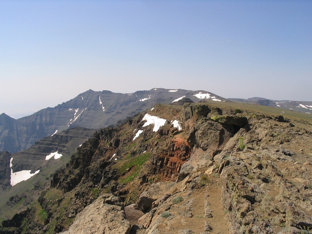
Steens Mountain is a unique mountain located in the deserts of southern Oregon. It is an uplift. On the west side, the land slopes up so imperceptibly that you barely sense any rise at all. Meanwhile, to the east, the mountain drops off over 4,000 vertical feet in a sequence of massive cliffs, overlooking the Alvord Desert below. There are two points along the cliff rim that reach above 9,730 feet.
Climbing Steens Mountain is not a challenge since good roads get near both of the highpoints. Very little hiking is necessary, assuming dry conditions. However, the country is extremely scenic out this way. We were on the tail-end of a two-week tour of the Northwest, and were now driving south through Oregon. Steens Mountain would be the last of our significant peaks visited, but would require the least amount of effort ... and we were okay with that.
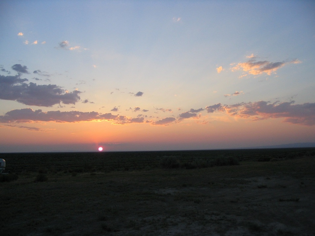
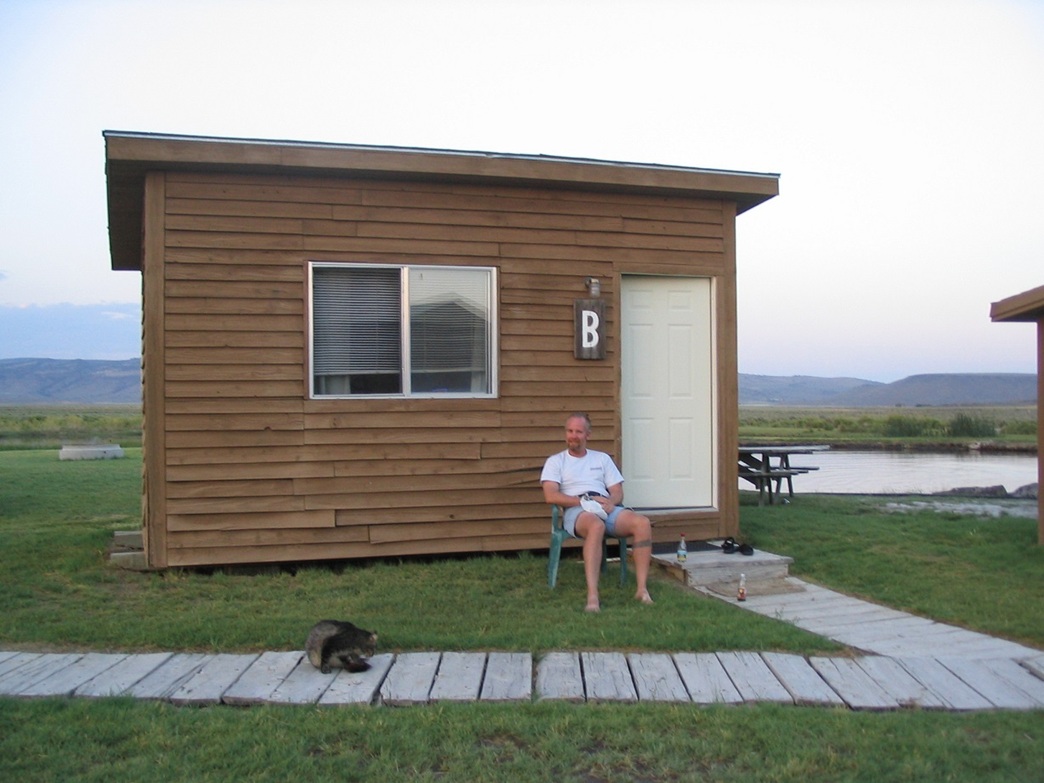
We stayed last night at the Crystal Crane Hot Springs, about 30 miles southeast of the town of Burns. This little establishment features cabins surrounding natural spring-fed pools and hot springs, and included (at the time) a friendly kitty who hung out with us during our stay. This part of Oregon is remote and lightly populated. We learned that the town of Crane features the only (?) public high school with dormitories, since it serves an enormous area such that is not practical for the kids to be driven to and from school every day given the distances.
This morning, we got rolling early, aiming for Steens Mountain and the town of Frenchglen, the let-in point west of the mountain where the road to the top starts. Along the way, we let ourselves get sidetracked with a visit to the Peter French Round Barn near the town of Diamond. Peter French was the son-in-law of William Glenn, a wealthy California-based wheat farmer. Together, they founded the French-Glen Ranch and of course, the town of Frenchglen is named for them. Interestingly, Glenn County, California, is named for William Glenn.
After our visit to the Round Barn, we drove state route OR-205 to the village of Frenchglen, which is just a couple of buildings and a mercantile. Some of the town looks preserved from the olden days, and I doubt more than 20 people live there. We turned east onto the Steens Mountain Backcountry Byway, a 60-mile loop that re-emerges with OR-205 about 10 miles south of Frenchglen. Thus, our plan was to enjoy the long leisurely drive, and only hike the little bits necessary to tag the highest points.
Driving on the Steens Mountain Byway, we kept a steady pace and enjoyed the rolling foothills, stands of trees and open meadows, and the slow change from lower semi-desert scrubland to higher semi-alpine terrain. There were runners, bicyclists and a few other vehicles on the road. We didn't rush things, and in a little over an hour, had arrived to near one of the two summit points. The change in elevation was so gentle that even we were caught off guard, getting out and immediately feeling short of breath when we started to walk around.
We came to a three-pronged intersection, the left leading to one of the 9,730-foot bumps along the cliffs. The walk was short and easy, just following the road, but we definitely felt the effects of the elevation change. The views east into the Alvord Desert, nearly a full vertical mile below us, were outstanding.
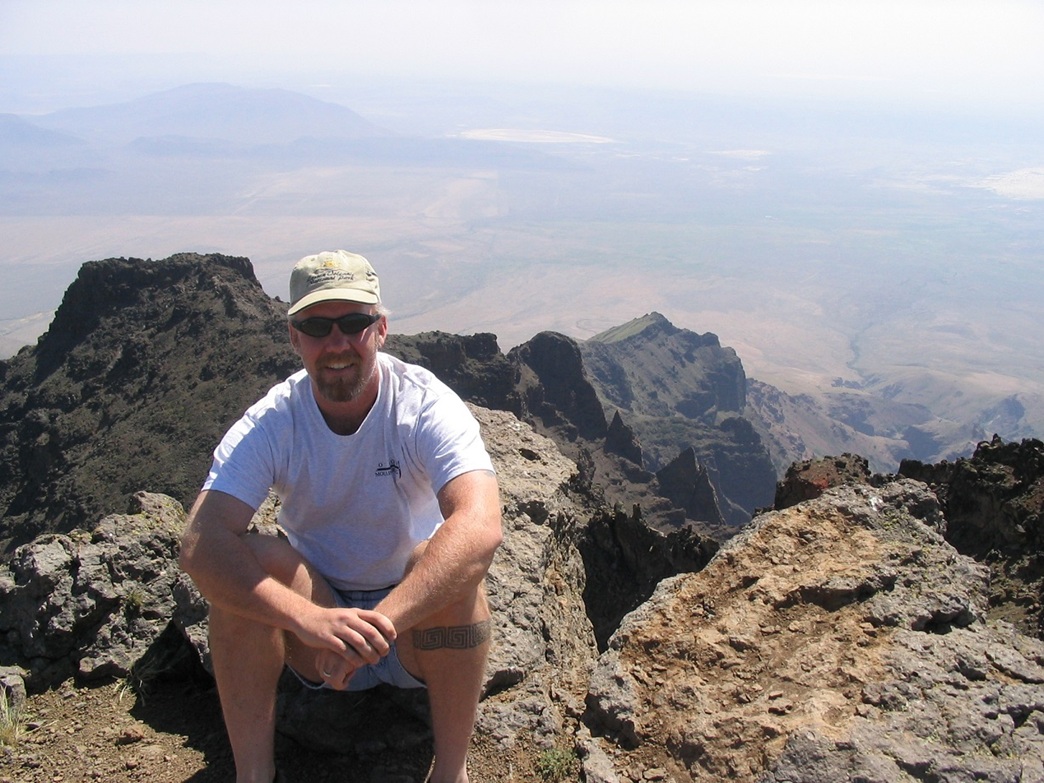
Back to the main road, we followed the middle prong and went south about 1.5 miles. This road ends at a small parking area, a half-mile walk from the second summit point, this one marked at 9,733 feet elevation. We walked around a gate and followed a service road to a set of buildings, solar cells and towers, where we paced the grounds. Of the 5 or 6 cars in the lot, no one was up here with us. It seemed everyone else was hiking down to Wildhorse Lake, a neat glacial remnant a thousand feet below. We could see the lake and make out some of the people. After taking photos, we hiked back out and started our drive out.
We had driven nearly 30 miles from Frenchglen, and the roads to here had been fantastic. Our little passenger vehicle with weenie little tires and no clearance had handled the road well. We assumed that the remaining 30 miles of the Backcountry Byway was of the same quality. We continued on the remaining loop. For a few more miles, the road was well-tended gravel, but then, bam, the gravel ended and the road became rough dirt.
We should have turned around right there. A normal high clearance vehicle would be fine, and the roads did not need 4-wheel drive. But we had a delicate passenger vehicle. We soldiered on, thinking that the road would improve. It never really did. In parts, it was a narrow shelf road etched into the cliffs, and under normal circumstances, I would never take such a small vehicle on a road like this. But there was no place to turn around, so we were committed to this road.
As the road descended, it improved by degrees. We were off the harrowing cliff segments, now just meandering through mid-elevation desert rangeland. I was concerned that the smallest arroyo or sandy spot would stop us. But ... the roads faithfully fed us back to the main highway without any trouble. We enjoyed the adventure, but had we known the condition of the latter half of this road, we would not have driven it.
In any case, we were back on the main highway (OR-205). We drove south through more desert and rangeland, then rested in the tiny village of Fields (population 11, said a sign), and had milkshakes. We spent the night in Winnemucca, Nevada, and flew home the next day.
|
|