The Mountains of Nevada
• www.surgent.net
|
| Tortoise Shell Peak |
• Sloan Canyon National Conservation Area • McCullough Mountains • Clark County |
|
Date: May 21, 2021
• Elevation: 3,753 feet
• Prominence: 633 feet
• Distance: 4 miles
• Time: 2 hours
• Gain: 1,250 feet
• Conditions: Cold and very windy
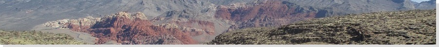
I woke up today in the Elvis room at the Canyon Lodge retro hotel in Seligman, Arizona. By day's end I'd be at my dad's home in Henderson, Nevada. In between, I had a lot of driving to do, with time for diversions. From Seligman, I followed the old Route-66 alignment through Peach Springs. I've driven this route now about ten times, and always enjoy it. It's never crowded, and the way the cliffs line the distant horizons, you can see where the creators of Coyote and Roadrunner got their inspiration. Plus, you can see the Grand Canyon itself when topping out at a rise just before entering Peach Springs.
Today was chilly, with temperatures in the 50s and 60s and an aggressive wind, with gusts above 50 miles per hour. In Kingman, I topped the gas, then drove up US-93. I took a detour to drive down to the Willow Beach Marina not for any boating, but to check out Willow Beach Peak. I had no maps with me, but given the cool conditions, I thought about hiking it. I hoped that the route would be obvious and a map not necessary. However, that was not the case. I drove up a couple washes to investigate possible routes, but know I'd be way in over my head without some actual information to go by. I drove back to US-93 and entered into Nevada. In time, I was in Henderson. It was not yet noon, and even now, the outside temperature was roughly 60 degrees.
I had planned to hike Tortoise Shell Peak at some point this week, and I assumed I'd have to start at dawn to beat the daytime heat that is usually in place at this time of year. But given the cool conditions, I decided to hike it right now. I located myself onto Mission Drive and drove it to its end, where there is a parking lot for a trailhead for the Sloan Canyon National Conservation Area. Being a Friday, the lot was nearly vacant, just a couple cars. I got my hiking boots on and drinks into my pack, and started hiking at noon.
The online maps I printed showed a number of trails in the area, so many that I was concerned I'd get onto a wrong one. In such cases, I revert to my philosophy from 20 years ago: show up, follow my instincts and hope for the best. I knew I needed to be on Trail 601. I walked past the trailhead signs and found a good-looking trail that went south, so I followed it. Was this Trail 601? No clue. No markers to say yea or nay. After a few minutes, I did see a marker, and got myself onto the proper Trail 601.
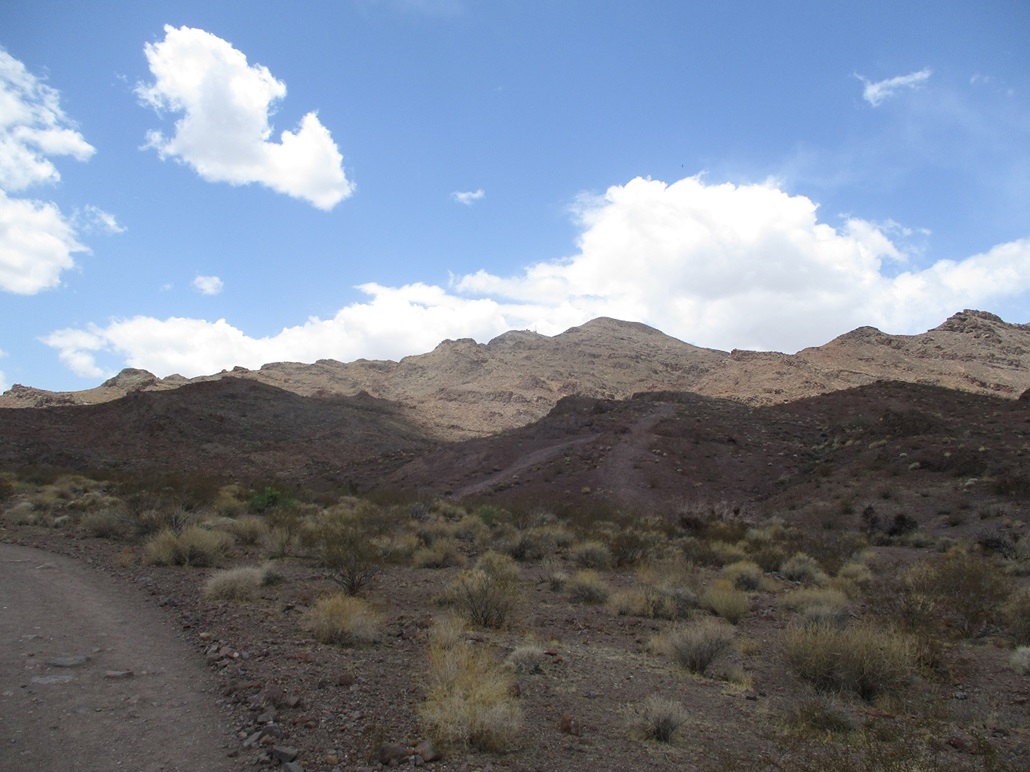
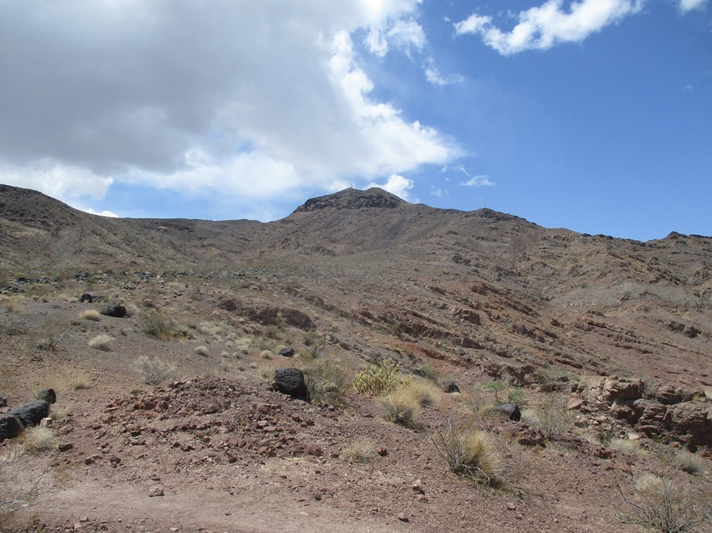
I followed the trail about a mile southbound. It wiggles with the contours of the land and drainages. It then gains a ridge, abeam of the summit, which stood above about another thousand vertical feet. The day was cool and windy and at times I'd have to hunker down to offset the effects of the wind. I even jammed a couple small rocks into my ears to keep the dang wind from blowing into them, causing discomfort. On top this ridge, Trail 601 comes to a Y, where a left continues southbound downhill, and a straight goes uphill and angles left. This was clearly the spur to Tortoise Shell Peak, so I followed it.
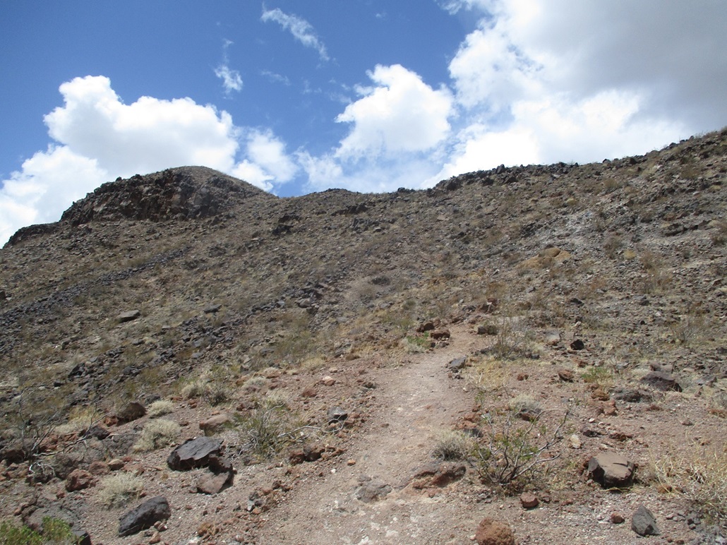
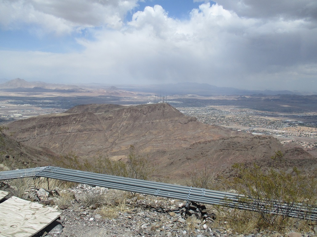
The trail was in great shape, and kept a consistent grade. It worked up some lower slopes and soft cliffs, then emerged onto a "bajada" of volcanic rock. Whenever there was a junction, I always took the branch that went up. The trail steadily approaches a steeper segment, this being the slopes that gain the high ridge. Here, the trail narrows, gets steeper and sometimes sloppier in spots. I took these parts carefully and had no problems. Soon, I was on the highest ridge, which extends east from the summit. I could see a couple antennae rising behind a foregorund hill.
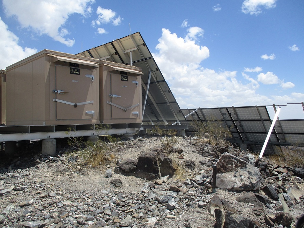
The trail lead all the way to the summit and does a fine job of staying distinct even as it crosses a few rock outcrops. The rock here was all the same basaltic volcanic rock. After gaining another 200 feet, I was appraoching the top, which hosts a small building, a couple large solar panels, and a couple small towers. The very top is tucked between the solar panels and the shed, forming a tunnel. I squeezed through the tunnel, and took a few photos, including Black Mountain, and nearby Henderson Benchmark, which has a lot more towers on it. This particular hill is visible from just about everywhere in Henderson.
The wind was strong, so I took shelter in the little tunnel and had a snack. Moving down, I just needed to be careful on the steep loose parts of the trail, and once down past the steepest parts, made excellent time down the better trails, almost jog-walking. I was back to my car by 2 p.m., a two-hour hike covering 4 miles and with 1,250 feet of elevation gain. I was pleased to get the hike done today taking advantage of the cooler temperatures, but the wind was quite intense at times. And my fears of getting lost or confused on the myriad of trails was unfounded. The way is obvious and I never once got off track or down a dead end.
From here, I drove to my father's place, about 10 miles away, and settled in for a week. We went for a bite later in the afternoon. Tomorrow, I hiked Blue Diamond Hill, a long hike that I moved up to take advantage of the cooler temperatures, which were expected to linger for another day.
|


|