The Mountains of Nevada
• www.surgent.net
|
| River Mountain |
• Highpoint: River Mountains • Lake Mead National Recreation Area • Clark County |
|
Date: December 25, 2019
• Elevation: 3,789 feet
• Prominence: 1,389 feet
• Distance: 6.5 miles
• Time: 3 hours
• Gain: 1,030 feet (net), 1,490 feet (gross)
• Conditions: Cold and heavily overcast
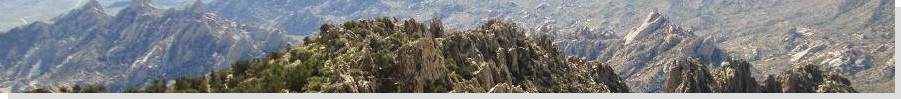
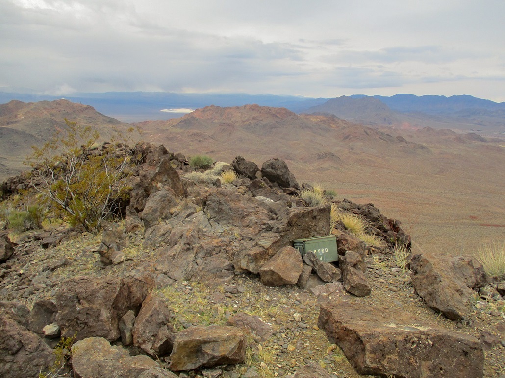
River Mountain tops the River Mountains that lie north of Boulder City, east of Henderson and west of Lake Mead. The peak is also known as River Mountain Benchmark, for the USGS benchmark placed at its summit. It is a popular hike with more than one way to access the top, and to form loop options with other peaks and trails. However, my goal today was strictly the summit, and I did not want to be too clever how I got there, so I went with the bomb-proof route: a sequence of service roads, plus a beaten path from the high saddle to the top.
I drove to Henderson the day before to visit my parents for Christmas. The southwest was being hit by two cold and wet Pacific storms, the first one having moved through central Arizona on the evening of the 23rd, and most of the 24th. I had steady rain for the first hundred miles west of Phoenix. By the time I stopped in Quartzsite for gas, the rain had ceased but the clouds hung low and dark, looking like it could rain again at any time.
I avoided the most direct route, US-93, between Phoenix and Las Vegas. It would be crowded (being the day before Christmas), there was a chance for snow and ice in parts, and despite being the shortest distance, it is not necessarily the shortest in terms of time. I often take the "low" route between Phoenix and Vegas: Interstate-10 to Quartzsite, then AZ-95 through Parker, CA-62 to Vidal Junction, and US-95 into Needles and up to Boulder City and Henderson. This route is about 40 miles longer but almost always light on traffic. The only people on US-95 between Vidal and Needles are truckers.
The weather was calling for about a 24-hour break in the rain, from about mid-day the 24th to sometime in the day of the 25th. We also had plans for later that morning, so I needed to be back in time for those plans. Thus, I got up very early with plans to be at the trailhead as close to sun-up as possible. I elected to start at the Bootleg Canyon trailhead, coming up from the south via Boulder City.
I rolled in about 6:35 a.m., the only one here and the sky a pre-dawn luminescence, light enough to see by, but dark, and moreso with the very heavy cloud cover. It was cold (about 35 degrees), damp but not rainy, gray and gloomy. I got my pack organized, locked up the car and started walking. At least that would warm me up.
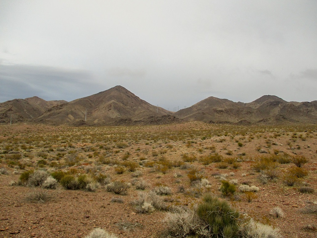
I walked north along the graded dirt road that heads into the canyon. This road wiggles and bends for about two miles, topping out on Red Mountain, which features a number of towers and a peculiar "flying saucer" structure. I stayed on the road for about a mile and a half, gaining abour 370 feet. I was moving quickly and so far, no rain had fallen. The cloud line looked to be about 4,000 feet, high enough to not shroud the surrounding peaks, but low enough to look like it wanted to.
I had come to a saddle, where the good road bends sharply to the right. About this time, I heard a high-pitched buzz and saw a guy riding up on his little dirtbike. He was the first guy I saw so far. He was aiming for the top of Red Mountain. Me, I bailed off ths good road and took a left (north) down a scragglier jeep track, losing 230 feet in about a mile. This segment went through a small canyon, then opened up into the gently-sloping rocky alluvium that emanates west off the main peaks of the River Mountains. I could see River Mountain now, and some transmission lines that run below it and up a side canyon of the peak.
All the while, I was a little concerned about rain. I was wearing jeans and a fleece jacket plus some underlayers, so I was warm, but if it rained, I could get wet fast, and that would not be good. Even now, as the sun was rising, the air temperature still felt like the low 40s at best. I was wearing ideal clothing for a dry sunny day amid the cactus, not for a cold and blustery morning.
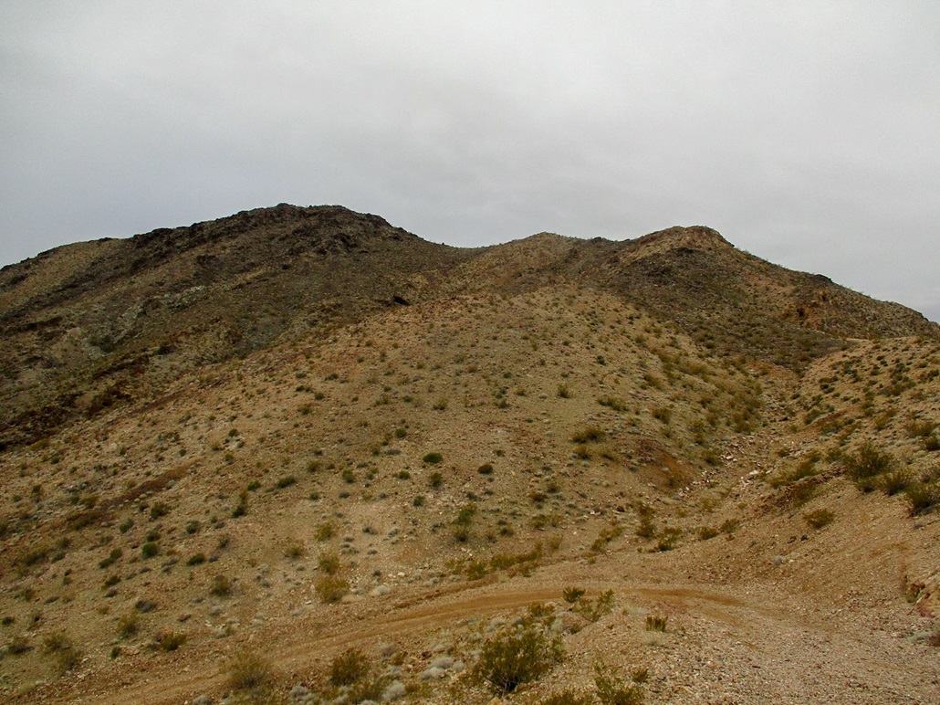
Anyway, I followed a couple tracks that meandered and soon, just hiked cross-country, aiming for the canyon to the south (right) of River Mountain. I came upon the service road that parallels the power lines, then followed this road up and into the canyon, gaining about 400 feet. The road reaches a high saddle southeast of the summit. Here, there is a massive stanchion, and the power lines drop suddenly off the much-steeper east face, down to the next stanchion about 500 feet below. That's some mean engineering right there.
I never really stopped. I went left and followed what looked like a road cut, which ended on a ridge about 75 feet higher. Beyond this, I found beaten paths in the volcanic rock. By now, I was high enough to glean the logical route to the summit, which stood to the left of the summit ridge above me. I kept to this path, which was scant but discernible if I paid attention.
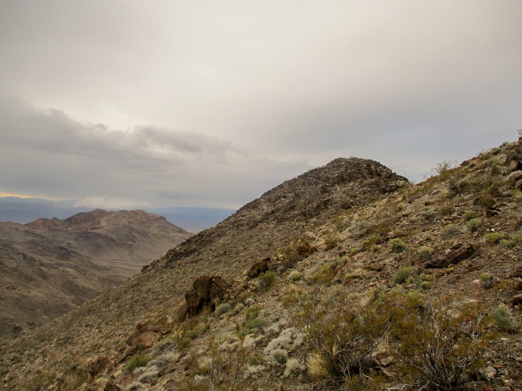
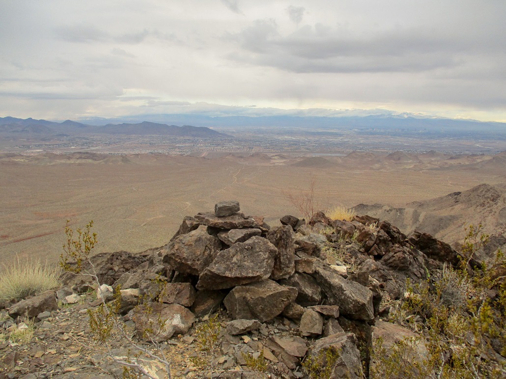
The path went where I expected (and hoped) it would. It generally kept to a ridge, then angled below the eastern-most summit bump to gain the small summit ridge. The top was another fifty feet higher, a crown of volcanic rock, mostly solid but some loose. I stashed the poles and clambered up the rocks to the summit.
Up here, the breeze was more pronounced and the weather was still cold and gray. I could see veils of virga to the south and west, the direction the clouds were coming from. I stuck around just long enough to snap a few images and sign into the summit log in the strongbox. I did not take off my pack or have a summit snack. It was cold and uncomfortable up here in these conditions.
For the hike down, I followed the beaten paths and the access roads exactly as I had coming up. Once on the roads, I fast-walked much of the downhills, made good time across the alluvium, and kept a decent pace as I gained up that 230-foot segment to get me back onto the good road from Bootleg Canyon. By now, people were on this road, a few having driven up but most of the rest riding their bikes.
I just wanted back to my car. I never once stopped and was back to my car at 9:45 a.m., a three-hour round trip hike. I was quite cold, so I hustled in and turned over the ignition, then cranked the heater. I was pleased to be successful on this peak but wish I had better conditions. But I take what I can get and appreciate the extra challenges that get thrown at me sometimes. I was fortunate it did not rain.
I drove back to Henderson, a 20-minute drive. I could see the peak from points along Race Track Road, and for a few minutes the summit was socked in by clouds. Back to my parents' place, I showered and got prettied up for our planned lunch with a family friend. I did not climb any other peaks on my visit as the weather never improved. The second wave of the storm was due that evening, and it came as expected, persisting into the next day as I drove home to Arizona.
|


|