The Mountains of Nevada
• www.surgent.net
|
| Potosi Mountain |
• Spring Mountains • Humboldt-Toiyabe National Forest • Spring Mountains Nat'l Rec. Area • Clark County |
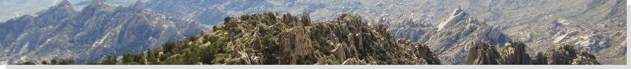
 Potosi Mountain from Goodsprings
|
Date: April 5, 2008
• Elevation: 8,514 feet
• Prominence: 3,012 feet
• Distance: 9 miles
• Time: 5 hours and 15 minutes
• Gain: 3,150 feet
• Conditions: Perfect Spring (no pun intended) conditions
Nevada
•
PB
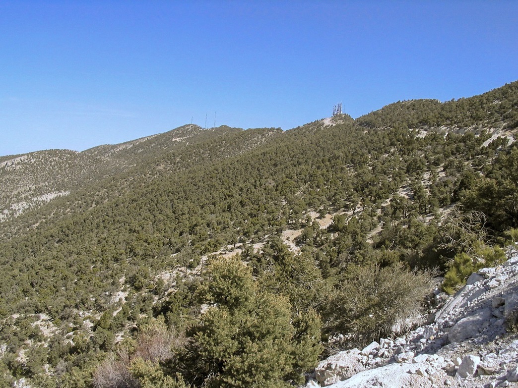
The Spring Mountains form the western backdrop to the Las Vegas metro area. Mount Charleston is the range's highest point, located northwest of Las Vegas and clearly higher than anything around for hundreds of miles. Potosi Mountain is the major peak located about 20 miles south, or to the southwest as seen from most places in Las Vegas. The peak has a noticeable skew shape, with long slopes to the south and steeper slopes and cliffs to the north and east.
Potosi Mountain is famous as the mountain into which a DC-3 airplane crashed in 1942, killing actress Carole Lombard, among many others. The site of the crash site is not meant to be revealed, although dedicated (and sometimes lucky) searchers have found the site, at which scant remains of the plane can be found. At the time, most of the plane was salvaged for its metals, so no big pieces remain. I had no interest in seeking out the site. It seems wrong to pick around an area where many people perished.
The common way to hike to the summit is an off-trail route from the west, but the parking situation from the side is sometimes uncertain. The other way to the top is to follow an access road from the south, the road built to service the towers located on the summit. This route is a no-brainer but dull, being just a long road walk. However, I was fine with that. I was looking for the exercise and did not mind walking the road. It was going to be a long walk with a lot of elevation gain, so I would be getting a good work out.
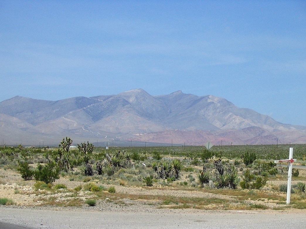
I planned a weekend visit to my folks in Henderson with plans to hike up Potosi Mountain on one of the days. I drove to Henderson on Friday afternoon after work, covering 310 miles in just over five hours, which is pretty good considering it was a Friday with lots of Phoenix-to-Vegas traffic, and that I went via Laughlin to avoid the back-ups at Hoover Dam (the new bridge was not quite ready just yet).
I woke early on Saturday and drove to Potosi Mountain, planning to show up just as the sun was rising. I got onto Interstate-15 south to Jean, then west on NV-160 toward the town of Goodsprings. From here, I followed local roads north about 4.5 miles to a Y-junction, going left, now following a dirt road that went another 1.8 miles into the foothills before coming to a locked gate. It was just after 6 a.m. when I arrived and backed into one of the pullouts. I got dressed into my hiking clothes and was on the move by 6:20, the sky alight with the new day but the sun still behind the eastern ranges.
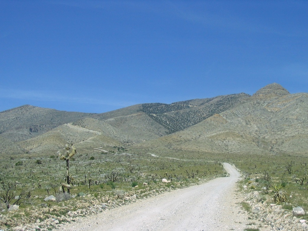
Comment on the drive: I missed the bypass road that leads off NV-160 before Goodsprings (didn't see it in the dark, I guess), and went into Goodsprings itself. This wasn't too much trouble. If this happens to you, I suggest taking Esmeralda Road north to Pacific, then hang a right, go past Revere, then take a dirt road on the left that connects to the paved bypass. This road is paved but torn up with big potholes. It leads to a gate (right at the aforementioned Y-junction) at a quarry. The road's name, as I learned while driving out, is "Goodsprings something something gravel bypass something" Road. You can't miss it. I did.
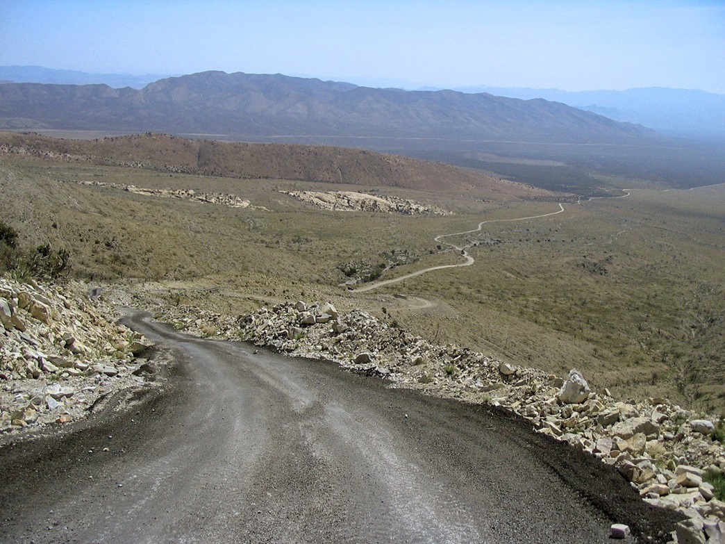
Past the gate, the road hangs a left and then becomes extremely steep. Then it's paved again. I think they may have just put it in since there was a pile of unused asphalt nearby. Going by the map, the road gains about 500 feet in a third of a mile, and doing the math, this is about a 25-30% gradient. Given that vehicles need access up here, the asphalt seems like a good idea to combat erosion and perhaps, downhill skidding. Even walking it was a grind. But it went fast and within minutes I had passed the asphalt section back onto hardpack dirt.
After passing a small knob, I saw the remaining road as it gains up onto the main range crest way up ahead. From where I parked to where the road gains the main range crest is about 1,800 feet in about 1.8 miles. I stopped and changed into long pants when the breezes chilled me, now higher up but with the sun still low. Sometimes, the air was still and other times it would blow fast (maybe 25 m.p.h.).
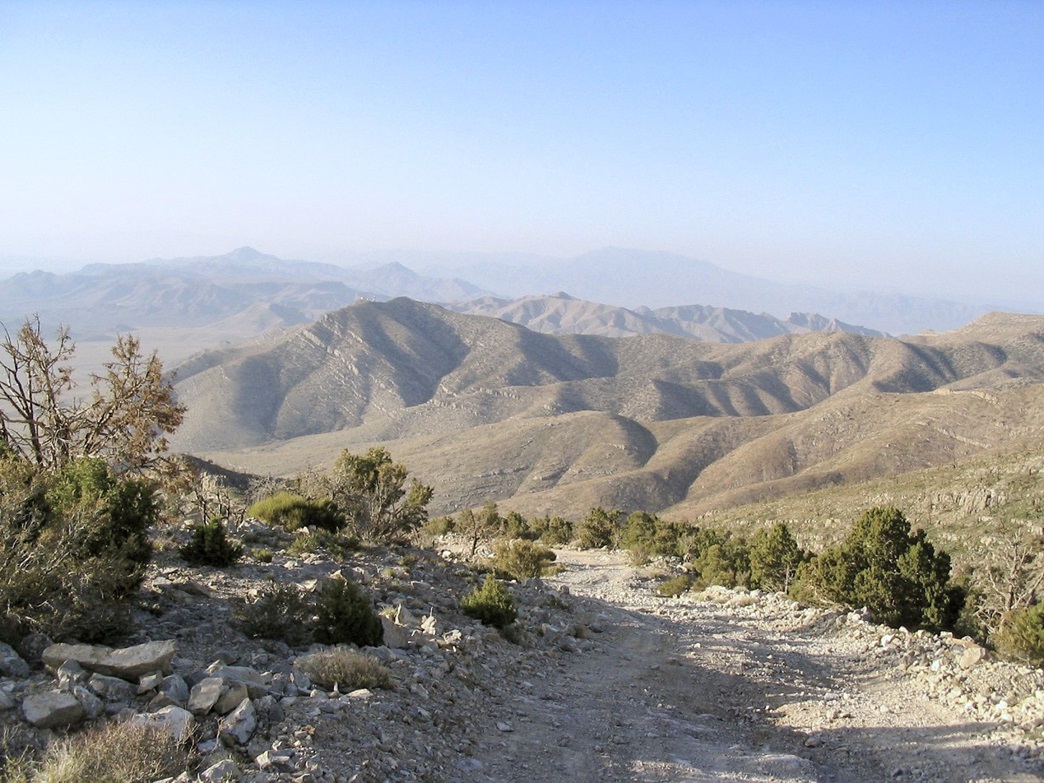
Around the bend, I was treated to a great view of the first of the main Potosi summits. A fire from 2005 scorched this particular section of mountain, leaving nothing in its wake, no trees or grasses or anything. The hillsides were barren. I could see the road high up on the foreground peak's west flanks ahead of me. The overall effect was like a huge amphitheater. I also had good views west into the Potosi Valley and the peaks and deserts toward Pahrump, but haze and dust blotted the horizons for now. There were even smatterings of snow in the north-facing shaded slopes.
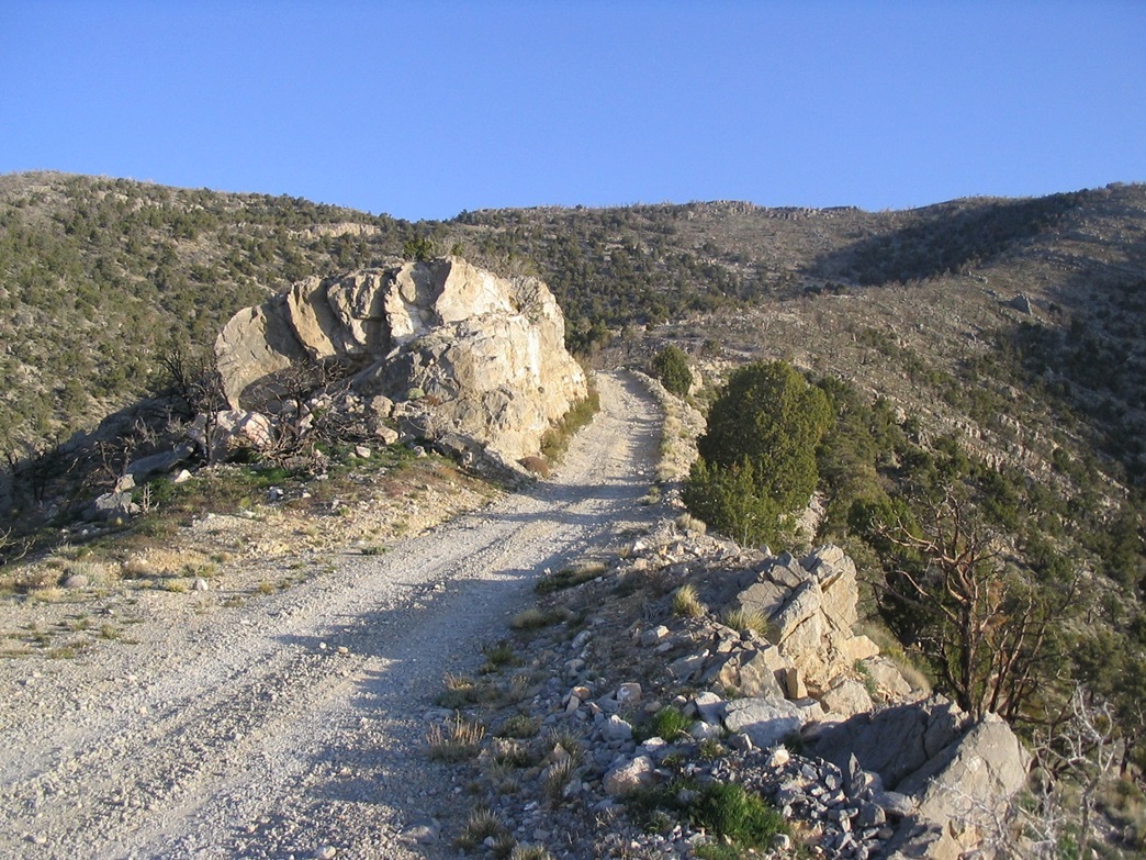
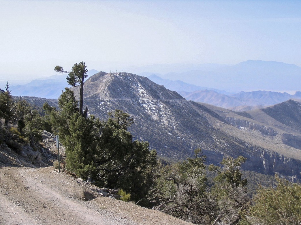
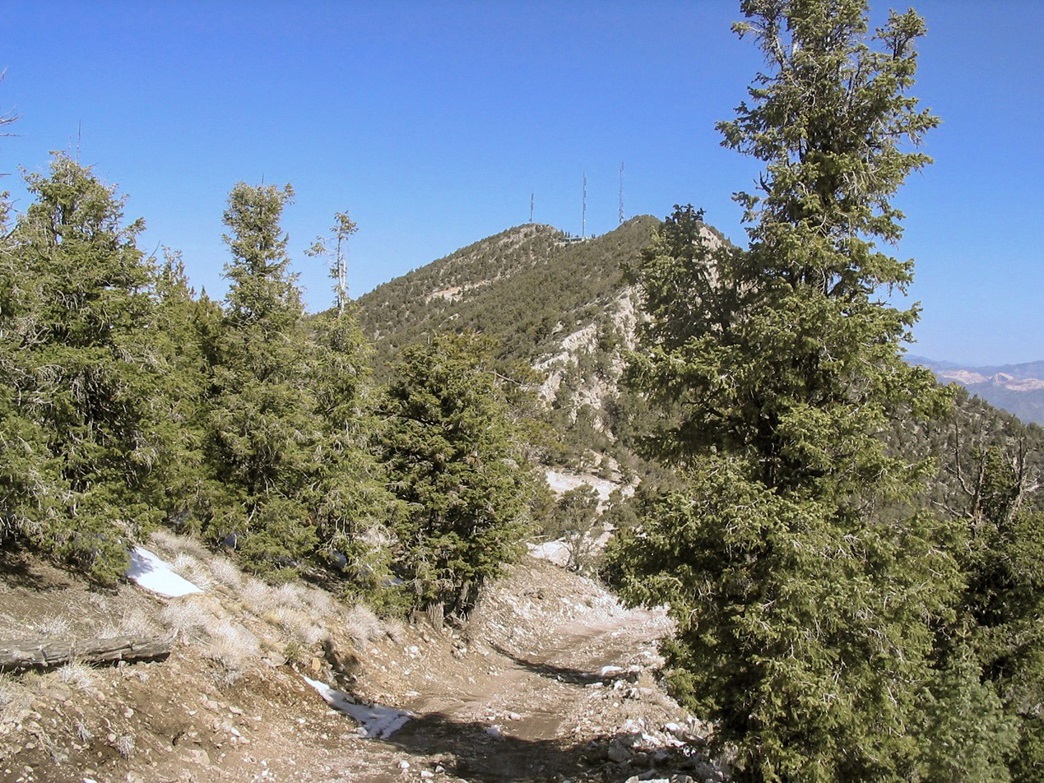
Back on the hike, the road drops slightly, then gains steeply before moderating again. A side-road zooms up to the summit of this foreground peak, but I ignored it. In less than a half-hour, I had hiked north of this first bump to where I could now see the other two tower complexes and the true summit, still about a mile and a half north. The forest here was thicker, in the Nevada sense: smatterings of bristlecone mainly, all sorts of grassy underbrush and tumble-weedy plants (thistles).
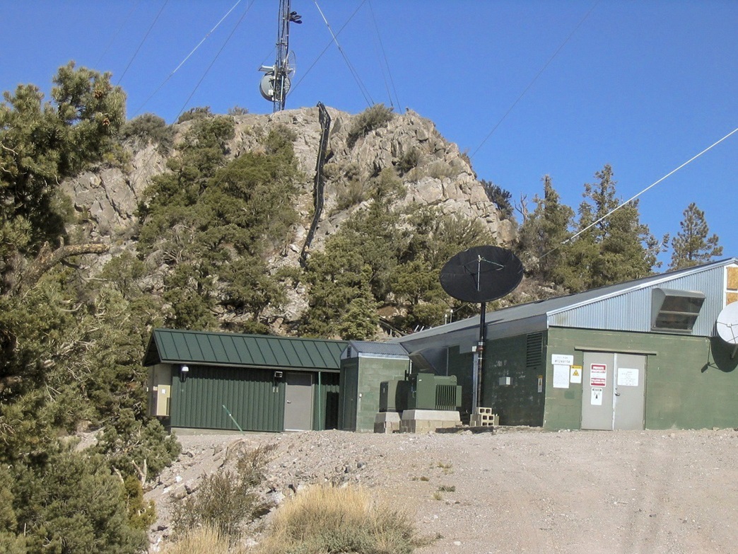
I covered the remaining distance to the summit in 45 minutes, including breaks. The road crested near the second set of towers, then dropped steeply about 100 feet to a saddle before wiggling up to the last complex of towers near a building. The weather was improving nicely, warming up and becoming more still. I walked up to the buildings, dropped my pack and walking stick and scrambled 40 feet up rocks following wiring conduit to the summit.
From the summit, the views were tremendous. Mount Charleston dominated to the north, still capped in snow. Las Vegas, of course, could be seen "everywhere" in the valleys to the east. The nearby Red Rocks could be seen as well. The big peak east was McCullough. I didn't spend long up top, instead walking back down to my pack and having lunch on one of the concrete guy-wiring anchors nearby the road. I had a signal so I called my folks to say hi, and also to call my wife to say hi and tell her I was safe. It was 9:30 a.m., meaning three hours to get here.
I spent 15 minutes at the concrete pad, having an early lunch before starting the walk down. The walk out went fast, going at a steady pace. I took the pace slow to enjoy the views and to take photographs in the less hazy lighting. The steep downhill walk went fast, too, but on the steepest portion I had to go slow lest I slip on the loose rock. Even on the asphalt part, I had to go slow. There was a guy driving up this road, presumably to go check on the towers. He was inching up at what seemed like 1 m.p.h. and it didn't look like fun. His truck was laden with work materials.
I was back to my own truck at 11:40, an exit of just under two hours and a total hike of just over five hours, including rests. I drove out slowly and stopped for more photographs, then stopped in Jean to call my peeps to let them know all was well. Later that day we went out for a buffet meal at one of the casinos. The rest of the weekend was spent relaxing and generally hanging around. I drove back to the Phoenix area early monday morning.
|


|