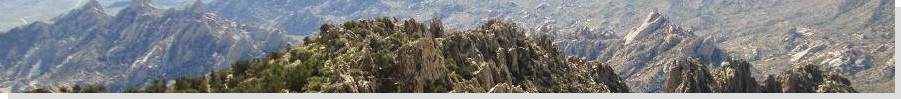
The Mountains of Nevada
• www.surgent.net
|
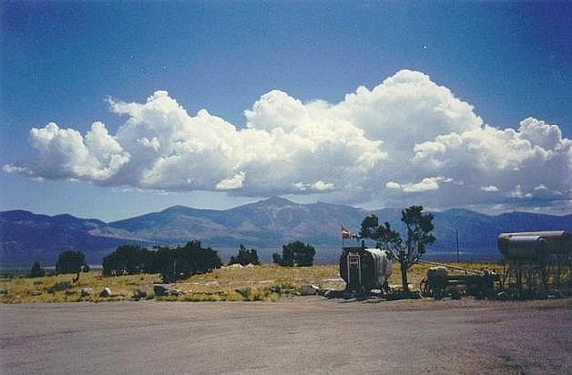
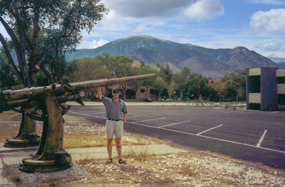 A big gun at the Hawthorne Ordnance Depot. Mt Grant rises in back
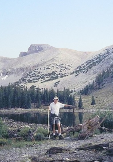 My dad at a glacial lake  At camp, in the rain |
Mount Grant • Wheeler Peak These two peaks lie on opposite sides of the state from one another, so are not naturally grouped as a pair. My father and I were on a four-day drive throughout Nevada, zig-zagging up and down the state, so we were able to visit these two points as part of our bigger journey.
Date: August 7, 2001
• Elevation: 11,280 feet
• Prominence: 3,920 feet
• Distance: 3 miles
• Time: 2 hours
• Gain: 920 feet
• Conditions: Calm and very nice
• Teammate: Joe Surgent
Nevada
•
PB
Mineral County is located in the high desert along the Nevada-California boundary, about 4 hours' drive north of Las Vegas and a couple hours south of Carson City, along US-95. The county has just one city, Hawthorne, and a few scattered towns like Mina and Luning, all strung out along US-95. The county has one main business and employer, the gigantic United States Army Ammunition and Ordnance Depot, which takes up much of the land surrounding Hawthorne. In case you ever wondered where all our wartime playthings are stored, a lot of it is stored here.
The highest point of the county is Mount Grant, which tops the broad Wassuk Mountains, northwest of Hawthorne, and west of Walker Lake, a remnant of ancient Lake Lahontan, which covered this part of Nevada many thousands of years ago. A tolerable dirt road starts at a gate nearby Walker Lake and runs about 17 miles, ending just below the summit. Since some of the range sits within the Ordnance Depot, visitors prior to September 11, 2001, could get a key from the Ordnance people in Hawthorne, sign a few waivers, and drive the road to their heart's delight. After that horrific day in 2001, the Depot clamped down on visitation until very recently. For many years, Mount Grant was essentially closed to the public.
My father and I arrived in Hawthorne after the long drive from Henderson. We detoured through Dyer, following a lesser highway underneath the state highpoint at Boundary Peak. We arrived in Hawthorne in the mid afternoon, enough time to drive onto the main Ordnance Depot "base" and get the key for tomorrow.
At the time, the day-to-day runnings of the base were subcontracted to various civilian companies. The main buildings had that military look to it, and some neat tanks and other items from World War II were erected around the area. However, there were few actual people anywhere to be found. It had a kind of ghost-town feel. We were able to find the office where we signed for the key to the gate. My dad's past military experience (Colonel, retired, U.S. Army) helped a lot of course. He was instantly trustworthy in their eyes.
The next morning, we drove to the gate, unlocked it, and drove up the long road south toward the higher ridges and peaks. We took the drive slowly to enjoy the views, and found the road to be in pretty good shape. The road follows Cottonwood Canyon, and gains about 5,000 feet from the gate, passing through zones of pinon and juniper, poplar, fir, and high-elevation scrub.
In time, the road hugs the slopes a little more severely, and we sensed were were gaining the summit quickly. The road was good enough that we could have driven it, but we opted to park at a wide area near a bend about 900 feet below the top, elevation 10,369 feet, and hike it from there. The one-way hike took about an hour. We arrived to the top, where the road ends in a loop. My dad did well, but I think this was his first time ever at over 11,000 feet elevation. He admitted feeling a little wobbly.
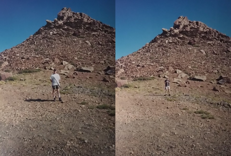
The summit is still a short hike beyond the end of the road. The top is covered in flakey talus, and somehow, a trail was hewn into this mish-mash of rock. In a few minutes I was below the top-most rocks, small cliffs momentarily blocking my way. I was able to find a way up these small barriers, and arrived onto the summit quickly. The views were beautiful, with Walker Lake below, and the grid-work of roads and bunkers of the Ordnance Depot in the surrounding desert flats. I could also see Hawthorne, too, plus many surrounding mountaintops.
Not wanting to keep my dad waiting, I spent just 10 minutes up here before starting down, taking the first few feet down carefully to be sure the loose rocks wouldn't slide from under me. I was back to where my dad was sitting after a few minutes, my whole time gone from him about 40 minutes. He was itching to get back down, so we hiked directly downslope, following natural openings through the brush such as gullies and game paths to shorten our hike. Back at the vehicle, we drove back down carefully, and were out past the gate, our whole time here about 4 hours. We returned the key to the Ordnance people, and continued on our way.
From Hawthorne we took shortcuts through Lander County into the town of Austin, where a friend of my dad's was now employed by the Lander County Sheriff. We caught Interstate-80 at the ugliest city on the planet, Battle Mountain, where we stayed at a hotel.
Our timing for visiting the Depot and Mount Grant was fortuitous. We, of course, had no clue what would happen slightly over a month later in New York, Washington and Pennsylvania. After those events, the Depot essentially shut out all recreational access onto the Wassuk Mountains. Only in recent years have they started allowing one-day visits, a sort of race to the top. It's not cheap and only happens once a year, but for now, access to Mount Grant is extremely limited.
Date: August 10, 2001
• Elevation: 13,063 feet
• Prominence: 7,563 feet
• Distance: 8 miles
• Time: 5 hours
• Gain: 3,100 feet
• Conditions: Pleasant but cloudy with developing storms
• Teammate: Joe Surgent (base-camp manager)
PB
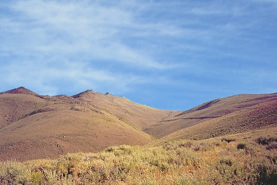
Wheeler Peak is the dominant mountain of eastern Nevada. It rises to 13,063 feet, just 80 feet short of being the state's highest point. It is the highest point of the Snake Mountains and of Great Basin National Park. It also is home to Nevada's only glacier (which may not be there long in this current climate). A good trail leads to the top, and the peak is climbed often.
I intended to hike this peak a year ago, but was stopped by a forest fire. This year, my father and I went on a four-day driving tour of Nevada, going up US-95 to Hawthorne, then across the state and up to the Idaho state line at Jackpot, then back down south, aiming now for the Snake Range. The weather was a mix of sunny weather and rain, not uncommon this time of year. We had more rain than sun as we drove to the Great Basin National Park.
We arrived to the park, paid our fee, and drove to the upper campground, elevation 9,800 feet, arriving at 3 in the afternoon. We sat out a thunderstorm in my dad's big army tent, big enough to set up lawnchairs and stand up without hunching over. In an hour, the storm ended and the sun broke through, and it got lovely all of a sudden. My dad and I decided to hike to a couple of the glacial lakes located in a hanging valley below Wheeler Peak's East face. Both of us could feel the elevation, though. That hike took an hour, and we were back to our tents by 5, where we ate and drank beer.
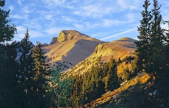
I was up at 4:30 a.m. the next morning, and moving before 5, just as the sun was rising in the east. I walked up the trail, the initial portion being the same as yesterday's hike. At a junction, I went hard-right and up a mix of light forest and meadow, emerging into an open meadow where I had unobstructed views of the magnificent profile of Wheeler Peak, slightly orange now in the early-morning light. The trail bends south and gently ascends toward a saddle north of Wheeler Peak, roughly at tree-line. The saddle is at 10,800 feet and I was here within an hour.
At this elevation, the vegetation is sparse limber pine and gnarled krumholz. The trail is nicely hewn into the rock, so that route finding is easy. Past the saddle, the immediate objective is a ridge bump at 11,500 feet. I reached this bump after another half-hour. The weather was holding steady, but given the activity of yesterday, some cloud build-up was already happening even though it was not yet 7 a.m. At this point I was passed by a family of four, all making excellent time. I even hiked with them for awhile. At this 11,500-foot bump, Wheeler Peak's summit comes into view once again, still about 1,600 feet higher.
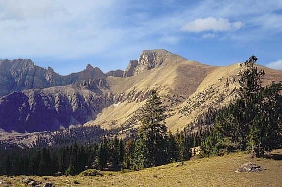
The route reaches another bump at 12,000 feet before making a thousand-foot push to the top. From below it looks like one big rock-hop, but the trail does in fact go all the way up, although it does get steep in places. I was on the summit at 7:15 a.m., roughly a 2.5-hour one-way hike with about 3,100 feet of gain. This was quick for me, the fine trail aiding my ascent time. The weather was holding well and the family of four was already up top. The views are outstanding: sharp abrupt peaks and cliffs forged by glaciers, moraine fields, and thousands of square miles of Great Basin scenery into Nevada and Utah.
I ambled along the elongated summit ridge to the east end to peer down the east slopes and the campground below. The actual highest point is the windbreak on the west end of the ridge. I stayed for about 40 minutes, having it to myself after the family started their descent. However, down below there was this big crowd of boy scouts working their way up, so I decided to get moving so as to avoid the crowd when they arrived.
I caught up to the family again, hiked with them for a ways, then parted ways at the saddle, where I took an extended break to feed and water myself, and change into drier clothes. The subsequent hike down went quickly, and I was back to the campsite just before 10 a.m., surprising my dad who figured I'd be gone for another two hours. He was happy, though, as he was starting to feel discombobulated from the elevation, and it was just as well to get going and down off the mountain as soon as possible.
We stopped at the visitor's center and got a lunch. Driving back to Ely, we stopped at a peculiar "town" called Major's Place, at the junctions of US-93 and US-6/50 in the middle of nowhere, west of Wheeler Peak. It's a bar that sells gas, with a minimum purchase required and at a very high price. By this time (noonish), the storm clouds were amassing again, shrouding Wheeler in white and grey. I was glad to be off the mountain.
After a day and night in Ely, we returned to Las Vegas via US-6 and NV-375, the so-called "Extraterrestrial Highway". NV-375 skirts Nellis Air Force Range and the famous Area-51, and the little town of Rachel makes good money by promoting aliens and UFOs. But the "A-Le-Inn" in Rachel does have some excellent burgers for such an out of the way locale. The walls are covered in photographs that purport to be UFOs. Most (to me) are clearly not UFOs. A lot are clouds, tricks of the light or too fuzzy or suspect to be taken seriously. Some people even confuse their own foggy breath with UFOs. I imagine this place gets a few of the believers, but most people who show up here come for the grub, the isolation and the experience. I recommend it.
|

|