The Mountains of Nevada
• www.surgent.net
|
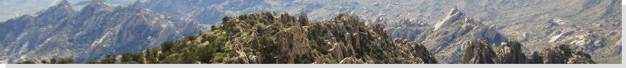
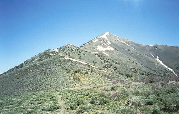
 Bunker Hill from Kingston access road
|
Bunker Hill • Diamond Peak I flew into Reno with intentions to climb two central Nevada county highpoints, Bunker Hill in Lander County, and Diamond Peak in Eureka County. I knew I was taking a bit of a gamble since these peaks could have significant snow even in mid-May. I was fortunate that I was able to climb both peaks, but the snow did pose challenges.
Date: May 15, 2002
• Elevation: 11,474 feet
• Prominence: 2,793 feet
• Distance: 8 miles
• Time: 8 hours
• Gain: 2,800 feet
• Conditions: Pleasant weather, snowy slopes
Nevada
•
PB
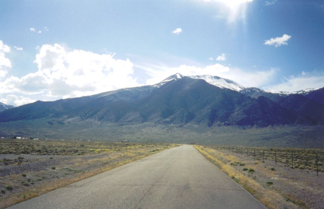
Bunker Hill, despite its name, is a major mountain at over 11,000 feet of elevation. It is in the Toiyabe Mountains, in the southern part of Lander County. The closest town is Austin, which has just 400 people. This part of Nevada is wide-open and vacant, with huge mountains rising above broad sage deserts. It is very pretty.
The flight went well, and I picked up my rental, a Ford Ranger pickup truck with 4-wheel drive, which could prove crucial to my success. I was taking a small gamble by coming here in May, when snowmelt usually makes approach roads muddy. But it had been a dry winter, so I hoped the peaks and routes would be less snowed in than usual.
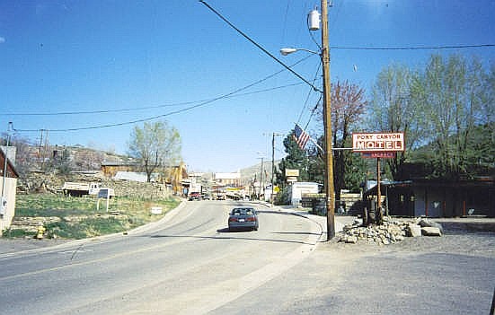
I drove through Fallon and the little mountain town of Austin, then down the east slopes and south to the tinier community of Kingston, following a good road south and west into a canyon, putting me directly below Bunker Hill's summit. I arrived at dusk and was able to score a secluded spot, backing the truck into a thicket of trees and reeds. I slept in the truck's bed, the night being cool but mild.
I woke early the next morning and drove farther in along the main road, now going northbound. Way high above, I could see the main range crest and plenty of snow, but open areas as well. I was debating my options, whether to start low and barge up a canyon and catch a ridge that way, or drive to a saddle farther up and spend more time traversing from that direction. I chose the latter.
I parked in a clearing at a pass, elevation 8,660 feet, and started hiking at 6:15 a.m. An even scanter road leaves the pass and goes uphill toward Bunker Hill, and in dry conditions it is drivable, but my luck with the snow, which had been good so far, ran out, as a big snowbank spread across this secondary road. Instead, I walked it, soon surmounted a small hill, then started down the other side and the long trudge south toward Bunker Hill.
I was aiming for a saddle below the hulk of Bunker Hill's summit, elevation 10,100 feet, about a mile or two away. In dry conditions, it would have been an easy bee-line through sage slopes with sparse pine to get there, but the snow was abundant here, so I had to amend my approach accordingly.
I actually started to climb higher, following a gully upward, eyeballing a safe section of the snow slope where I could traverse across it. I got higher into the trees, and found what I felt was a good spot to start the traverse. I had wisely brought along instep crampons, and they were absolutely vital. The traverse was short and mostly safe, but there were segments, perhaps 30-40 feet in length, where I had steep slopes below me, few trees around me, and no way to stop a slide should I slip. I carefully stepped my way across and in time, had passed these exposed sections.
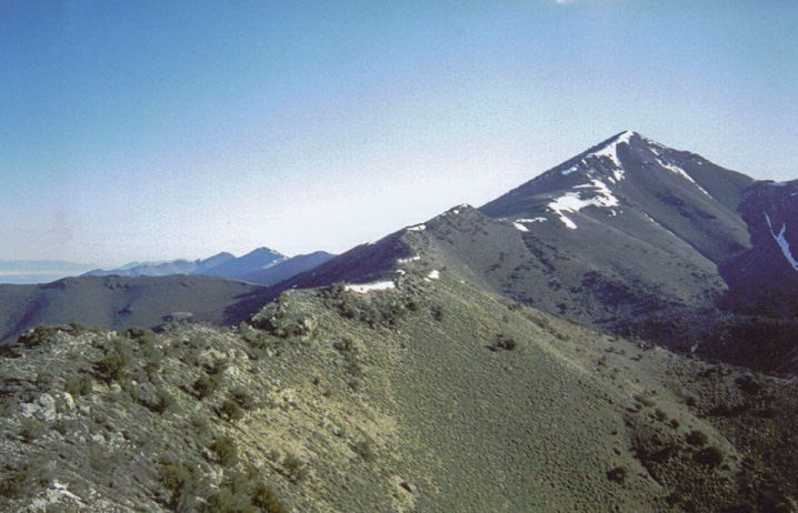
I ended up hiking to almost 10,800 feet elevation, simply to gain the safer, less-steep slopes. This put me well above the 10,100-foot saddle. I found open routes in the rock to descend to the saddle, then looked up at the remaining 1,300 vertical feet I needed to ascend to Bunker Hill's summit. Now on the range crest, I had a mix of snow fields and open paths in the rock. I stuck to the rock whenever possible, but I had to work up one section of soft, steep, gooey snow and mud. Finally, I was on the last summit ridge from which it was an easy walk to the summit, at the south end of this ridge.
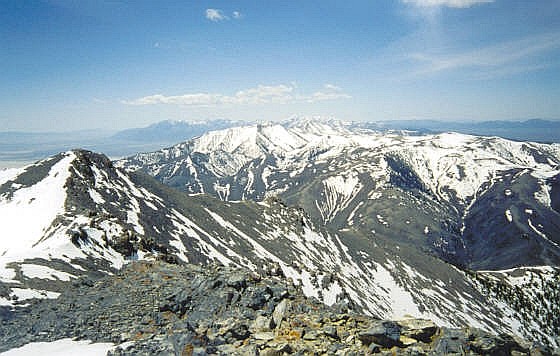
The views from the top are astounding. The snow-covered Toiyabe Range continued north and south, with higher peaks way off to the south such as Arc Dome. Bunker Hill sits like a prow on a ship, anchoring the south end of one section of the Toiyabes, so its south-facing slopes dropped many thousands of feet into the Kingston Canyon below. The log book showed just a handful of visitors in the previous many years. It had taken me 4 hours to get here.
I didn't stay long, though. I wanted to get back down to the saddle and away from the snowy slopes. This I did with no trouble, and at this saddle, I took an extended lunch break. I finally started moving downward, angling northwest down the patchy snow and open slopes. The forest is non-existent up high, so I hiked line-of-sight, aiming for the snowy slopes I had traversed coming up. The hiking through the sage was great: I just took big steps and plowed my way through the knee-high scrub, kicking up the lovely scent the whole way.
Shortly, I was back to the margin of the snowfield that I had traversed coming up. If I could bypass it again, I could then bee-line back to my vehicle, but truthfully, I wanted no part of it, so instead, I continued downward into a side canyon and from there, back out onto the main road. The hike out had been easy and pleasant, if a little brushy within the canyon.
The problem was, I was now 800 vertical feet below my vehicle and about a mile away. I started walking back toward it, hoping someone might drive by and give me a lift. But no one did, of course. I may have been the only person in this part of the range today. I reached my vehicle at 2 p.m., tired but feeling pleased. The hike had been a success. After changing clothes and resting, I started my drive out and east toward tomorrow's objective, Diamond Peak.
Overall, my hike up Bunker Hill had been a success, and I had no troubles other than the snow. There was just enough to slow me down and force me to alter my tack both ways. These various alterations added about 1,200 extra vertical feet of gain, and an extra hour of time, but I had fun and enjoyed the whole journey immensely. I actually drove back into Austin and met with the Forest Service people there before driving east to Eureka.
Date: May 16, 2002
• Elevation: 10,614 feet
• Prominence: 3,574 feet
• Distance: 8 miles
• Time: 6 hours
• Gain: 2,200 feet
• Conditions: Lovely
PB
Diamond Peak is the highest point of Eureka County in central Nevada. It is one of two peaks named Diamond Peak in the Diamond Mountains, whose ridge actually forms the Eureka and White Pine county line. I was spending the weekend in Nevada, and had climbed Bunker Hill in the Toiyabe Range yesterday.
The drive to Eureka along US-50 went well. Eureka County is a large county area-wise, but only has about a thousand people, most congregated in the town of Eureka, the county seat. I planned to camp, but I found a cheap hotel room at an old casino and stayed there for the night. Eureka is a typical Nevada old-time mining town, built into the slopes of a mountain, with a single Main Street, a few side streets, and everything looking like it is from 1900.
Early today, I drove out of town and headed east along Newark Canyon Road a long way to the spine of the range, then north upward along scanter roads. I came upon a snow patch in the road higher up, and was able to get past one 20-foot segment by plowing into it about five times in low 4-wheel drive until I had bashed a path through it. This allowed me to drive another quarter-mile to a small pass, where I parked. The roads from here were too muddy and snowy to bother with. I was near Alpha Peak, elevation 8,400 feet. I started hiking at 7 a.m. in cold, pleasant weather. There were still shadows from the low sun.
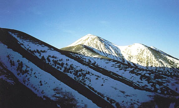
I hiked up the muddy road on Alpha Peak's west slopes, then cut across north to a saddle, actually losing all the elevation I had gained, but placing me at 8,800 feet on another saddle. Diamond Peak was visible to the north, the highpoint hidden by a foreground summit. Snow seemed light except for one large patch on the steep slopes south of the peak. The main ridge seemed mostly snow free.
From the saddle I was on now, I found a path that charged up a slope immediately to the west. Once atop this little hill, I found more good paths that went north. There was no developed trail, but these game paths seemed to work pretty good most of the time. Some have been "human enhanced" and judging by the poop on the ground, popular with horses.
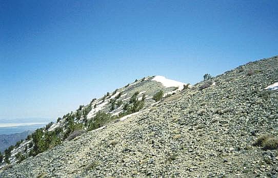
The next two miles is along the spine of the range, following a series of paths and some cross-country up and over, and sometimes around, the intervening ridge points. Overall, it seemed easiest to stay high whenever possible, as the side-hilling could be ugly at times. This went on for an hour until I reached an open saddle at about 8,820 feet. The next segment was a short but steep grunt up open slopes, gaining about 500 feet to a rock knob at 9,320 feet. After dodging this rock obstacle, I had another steep 600 feet of easy hiking to the big snowbank. Now for the fun part.
If the snowbank was not here, the path would just go up this slope to the main summit ridge, and would be cake. However, the snow was sloppy enough that hiking through it was not an option. So I went right and worked my way up through the rocks, at worst requiring scrambling and all fours. This worked and shortly I was above the snowbank. Not much longer afterward I was now on the main summit ridge, with Diamond Peak's summit now visible a quarter-mile away.
The final walk was easy, skirting other snow patches whenever I could. I arrived at the top a little after 10 a.m., taking time to tag the large summit cairn. The weather was lovely, and I felt like the only person in the world up here, in the middle of nowhere Nevada. There was one downside: I mushed my finger in the rocks trying to locate the register. I never did find it, and thus did not sign myself in.
The hike down went well. The snowbank still motivated me to find ways around it, so this time I skirted it on its steep downrange slopes, which was slow and messy, but effective. I retraced my steps, and was back to my truck in less than two hours. The weather had warmed nicely, and I took a break here to change into dry clothes and relax. I slowly drove down the icky roads onto the firmer dirt roads below, then out to Eureka. The rest of the day was spent leisurely driving back toward Reno. However, I decided to stay the night in Fallon, then get to Reno the next morning for my flight home. This had been a successful two-highpoint trip, and I was especially pleased to get these two peaks into the record.
|


|