The Mountains of New Mexico
www.surgent.net |
| Whitewater Baldy |
• Highpoint: Mogollon Mountains • Highpoint: Catron County • Gila National Forest |
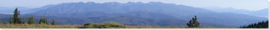
 Whitewater Baldy from the halfway point on the hike
|
Date: September 23, 2000
• Elevation: 10,895 feet
• Prominence: 3,535 feet
• Distance: 10 miles
• Time: 3 hours and 30 minutes
• Gain: 1,800 feet
• Conditions: Autumnal
New Mexico
•
PB
Whitewater Baldy is the highest peak of the Mogollon Mountains in Catron County, and is the county's highest point. I had intended to climb it earlier in the year but a month-long fire restriction forced closure of the lands and I didn't get a chance until now. For some reason, I aimed to visit this peak from my home and back all in one long day. I awoke at 1:30 a.m. and was on the road by 2.
This being early Saturday morning, most people on the road were late-night revelers just getting home, and cops. I headed east through Globe and Safford in darkness, and then through Greenlee County and the New Mexico border as the sun was rising. I came to US-180 around 6:30 a.m., headed north through the towns of Pleasonton and Glenwood, then to the junction with NM-159, the access point to the Mogollon Range.
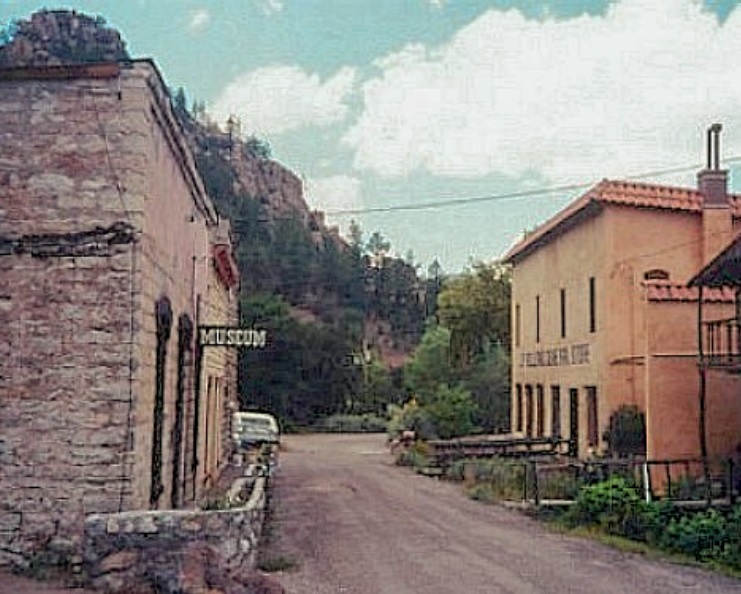
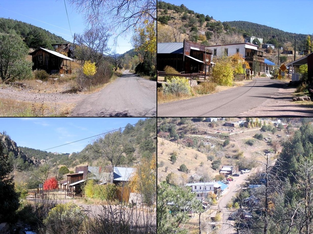
Highway NM-159 winds its way up into the mountains, becoming a one-lane road after 5 miles (it's wide enough to allow two cars side-by-side but just barely). It curves and snakes over a ridge, then descends into a canyon and into the ghost town of Mogollon at milepost 9. Mogollon sits tight in a canyon barely a quarter-mile wide and old buildings from its heyday (the 1900-1940s) still stand. These days, Mogollon's full-time population is about a dozen, and they do a fine job of keeping up the place. It is a popular tourist draw during summer weekends.
After Mogollon, the pavement ends and it's another 8 miles up a winding gravel road to the Sandy Point parking area and the trailhead. It took me 45 minutes to get to Sandy Point from US-180, arriving at 7:45 am. Sandy Point's elevation is 9,132 feet.
At the parking area, I met with a pair of hikers from Tucson who were going in for a backpack. The weather was clear, pleasantly cool (50s), moderately breezy and absolutely beautiful. Looking up, the trees were starting to turn color in preparation for fall and I could see bands of yellow and orange mixed with the green.
I began hiking at 8:15 a.m.. The trail ascends at an easy grade for the first mile, gaining about 600 feet, as it contours up and around the east of Willow Mountain. Soon, I came upon the Gila Wilderness Boundary sign, at which time the trail flattened out. The next two miles were mostly level with about an overall 400 foot gain, and I made good time. The trail comes to a saddle, but the views below are obscured by the forest for the most part.
After this first saddle, the trail stays high on the ridge, gains moderately, then goes up and down and getting as high as 10,500 feet. Whitewater Baldy came into view across occasional meadows. The trail then re-enters the trees, loses about 200 feet, and comes to Hummingbird Saddle, which is directly below the peak. Forest Service literature says it's 4.75 miles to Hummingbird Saddle from Sandy Point.
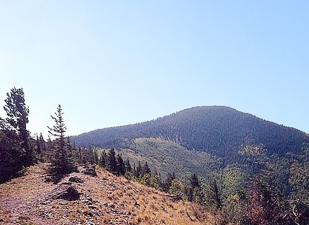
From Hummingbird Saddle, I left the trail and followed a path directly up Whitewater Baldy's north ridge. The trail, such as it is, is faint and in some places non-existent. Small cairns help but mostly, the hiking is common sense: go up whenever in doubt. It's also steep, gaining about 700 feet in a half-mile. I came to the summit and walked over to the big cairn sitting at the edge of the cliffs. It had taken me exactly 2 hours to get here. It's hardly a "Baldy": the summit is (was ... see below) heavily tree covered, although views to the south toward Mogollon Baldy are very nice. I stayed at the top for about a half-hour and ate lunch. The wind was blowing hard so I sat in the lee of the cairn. But soon I started to chill so I started down.
Coming down, I missed the "trail" and actually took a bearing that was slightly off to where I needed to be. The result was I had to bushwhack a short ways back toward Hummingbird Saddle, which added about 20 minutes. The hike out went quick. I met with the Tucson duo again and talked with them for awhile about half way down. I came back to the trailhead at 12:30 p.m., for an overall hike of 4 hours and 15 minutes, including the two stops.
I drove back into Mogollon and walked around the place. I visited a museum and talked with the woman that runs it. Surprisingly, this out-of-the-way ghost town sees lots of visitors, and there were a handful around when I was there. I highly recommend a visit, the town is "open" on weekends.
From Mogollon, I drove home to Chandler. The driving for the day was a total of 510 miles. I arrived home at 6 p.m. and still had enough energy to go have some beer with friends, who all thought I was nuts to have done all this in one day.
Addendum: A massive fire tore through the region a few years after I was here. Since that time, the peak is mostly a scape of burned trees and open areas. I have not been back but I would expect there to be new growth, too.
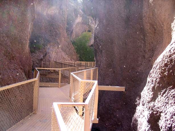
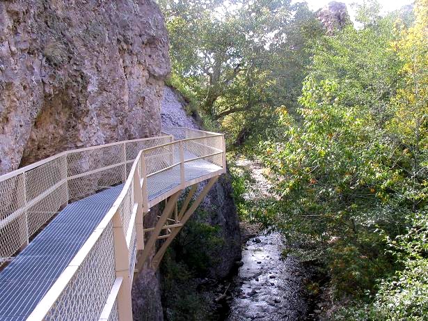
In 2007, we both returned and stayed a couple nights in a cabin in Glenwood. We visited Mogollon ghost town again, while I took a couple hours to hike the Catwalk, an elevated set of walkways through large rocks that ends at a lovely pond with a waterfall.
|

|