The Mountains of New Mexico
www.surgent.net |
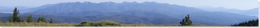
| Wheeler Peak |
• Highpoint: State of New Mexico • Highpoint: Taos County • Highpoint: Taos Mountains • Carson National Forest • Wheeler Peak Wilderness |
 Wheeler Peak from the Taos Ski Valley
|
Date: August 14 & 15, 1994
• Elevation: 13,161 feet
• Prominence: 3,409 feet
• Distance: 14 miles
• Time: 4 hours (high camp to summit and back), 24 hours total
• Gain: 4,700 feet
• Conditions: Pleasant but with some storms
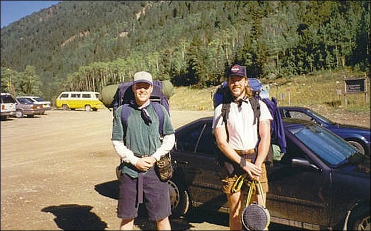
• Teammate: Chris
New Mexico
•
PB
Wheeler Peak is the highest point in New Mexico, rising above the Taos Ski Valley. The climb is usually done via the Bull-Of-The-Woods route as a one-night overnighter with a high camp at La Cal Basin, or a long day hike directly from the ski valley area. I was still new to long-distance hiking in general, so I hedged my bets and went with the overnighter. I was joined by my brother Chris.
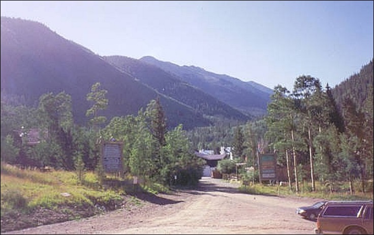
Chris drove from California to my apartment in Tempe, stayed a night, then we drove to Albuquerque, then up to Taos, arriving late in the day. Giant thunderstorms had developed and we had periods of heavy rain, and the Taos Mountains were socked in under the dark clouds. We stayed in a hotel in Taos.
The next day dawned bright and clear, yesterday's storms just "gone". We did not get moving until almost 9 a.m., with big packs on, planning to hike the high ridges and camp the night at La Cal Basin. Clearly, a dawn start would have been preferable, but I did not know that at the time.
The hike starts in the forest, then opens up in the Bull Of The Woods Meadow. We then marched up a scant service road that encircles Bull Of The Woods Mountain, coming to a fence that marks the Carson National Forest boundary. We took a break here, having hiked for three miles and gained about 2,100 feet.
Having gained most of the elevation for the day, the remaining two miles to high camp was relatively easy, along the high ridge connecting Bull Of The Woods Mountain to Frazier Mountain, then down into La Cal Basin. The route gains about 500 feet to top out near Frazier Mountain's 12,163-foot summit, then drops about 300 feet into the trees at La Cal Basin. We arrived in the early afternoon, having hiked five miles.
We set up the tent then got in for a rest. The day was pleasant but the clouds started to build and by 4 p.m., we had a couple showers, but nothing intense like yesterday's big storms. There were a couple other campers up here and a few day hikers. We took cover in the tent when it was raining, and explored the area when not raining. Fortunately, the rains lasted just a couple hours and never got worse than a steady drizzle.
We got up early the next morning and continued the hike to the summit, following the same trail as we had been on. The trail makes a couple long switchbacks up the grassy slopes, gaining about a thousand feet to place us again on the highest ridges.
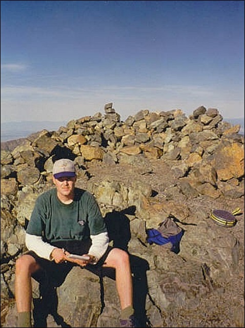
We then continued southbound up a couple sub-peaks, including named Mount Walter, elevation 13,133 feet, which featured a plaque that jokingly reminded hikers that no, we're not at the highest point yet. The remaining walk was easy, and we were on top of Wheeler Peak by about 8 a.m., a two-hour hike from our high camp.
For me, this was my fourth state highpoint. For my brother, his first. I think this was his first big mountain hike overall. We were both feeling good, the sky bright blue with no clouds, and awesome views in every direction. The two or three pikas who live on the summit pestered us incessantly for treats.
We spent twenty minutes on top, then hiked down, taking an hour to get back to high camp. We took down camp and were moving again after just another hour, hiking out to Chris' truck by 1 p.m.. The last couple miles went slow. Me, I was out of liquids and desperately needed some when back at the truck.
The hike covered about 14 miles round trip, and with nearly 4,700 feet of elevation gain when all the ups and downs were figured in. The hike went fast and easy, with no undue challenges. We were fortunate to have good weather while on the mountain, and I appreciated Chris' companionship and am happy he got to hike a big 13er.
We drove to Pagosa Springs in Colorado and stayed in a hotel, then visited Mesa Verde National Park the next day. We then drove through the Navajo Nation back to my place in Tempe, driving through some stupendous thunderstorms while on the Nation. Chris stayed the night then drove back to California the next day.
We had actually rolled in to my place about 10 p.m.. My roommate at the time told me some guy had been calling me non-stop for like two days about a job offer, and to call him back "immediately". I said I'd call back first thing tomorrow, but my roommate said that the caller insisted "immediately". I felt odd calling so late, but he was gracious and the next day, I went in for a cursory interview and that is how I got hired on at Arizona State University!
|

|