The Mountains of New Mexico
• www.surgent.net
|
| Mount Riley |
• Organ Mountains-Desert Peaks National Monument • Mount Riley Wilderness Area • Doña Ana County |
|
Date: December 27, 2023
• Elevation: 5,905 feet
• Prominence: 1,113 feet
• Distance: 4.2 miles
• Time: 2 hours, 50 minutes
• Gain: 1,515 feet
• Conditions: Sunny and quite cold
• Wildlife: Javelina
New Mexico
•
Main
•
PB
•
LoJ
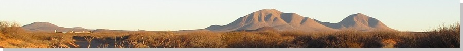
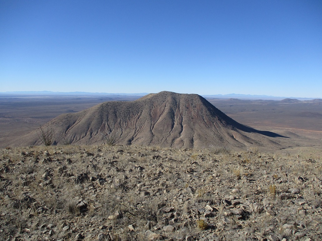
Mount Riley rises suddenly above the desert floor southwest of Las Cruces. From other elevated positions in and around Las Cruces, it and nearby Cox Peak stand out conspicuously, obviously the largest "things" out that way, far enough away to be in silhouette and prompting me to think about climbing one or both peaks. I knew nothing about either peak until recently, other than they exist. The two peaks are part of the Potrillo Volcanic Field, which features a smattering of smaller cone-shaped mounds and notably, one of the largest maar craters in the country, Kilbourne Hole, attesting to the area's volcanic history. From a distance looking that way, you see a whole bunch of low mounds and cones and ridges, then these two big humps of peaks standing above it all.
Driving along state route NM-9 toward Sunland Park/El Paso two days ago, I caught a glance of the peaks from the south. Suddenly, I remembered them. I had not worked either peak into my plans for this short journey. I had done no homework. I had no idea of what the road access was like, what kind of terrain I'd be dealing with, and so on.
Last night at the hotel, I studied up on the peaks and found an interesting report with photos of Mount Riley, so I decided I would try that one. I had no plans to hike both, and would scout ways up the other one while here. I learned the roads toward the peaks are pretty good, which is about 80% of the battle.
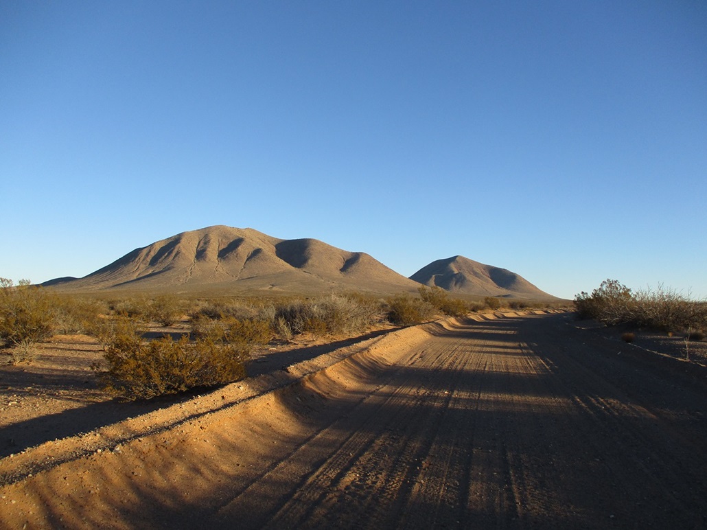
Mount Riley has two principal summits, a western one about 150 feet lower, and the main summit, on the east half of the massif. Cox Peak lies just south of Mount Riley. The topographical maps show dense contours, suggesting steep slopes, and no one obvious "easy" ridge by which to approach the summit. Since one of the roads passes to the east, I chose to approach the mountain from that direction, and thus, selected its southeastern ridge as the default ridge I would follow.
I had achieved what I set out to achieve in and around Las Cruces, and today would be heading back to Arizona. I was up before dawn and on the road, south toward El Paso where I stopped for gas, then back into New Mexico following the highway toward the Santa Teresa Port of Entry at the Mexican border. Just before then, I turned right onto Doña Ana County Road 3, which is really just the continuation of NM-9 (the state designation is dropped when the road is in Doña Ana County). About 24 miles later, I turned right onto CR-5, signed for the Potrillo Ranch.
(The highway CR-3/NM-9 is remote with no development, with long straightaways with good lines of sight, and almost no patrol units on it (none that I saw). It is lightly travelled, so you might go ten minutes at normal highway speeds and not see another vehicle in either direction. You probably see where this is headed. I was motoring along at 75 miles per hour and whoosh, got passed by someone doing easily over a hundred. The speed limit is 60.)
On CR-5, I went north about two miles to the main ranch buildings, then passed through a tiny pasture with a couple cows, opening and closing the gates as I passed through. The sun was up by now but it was still early. It was clear and sunny, not a cloud in sight, and calm with at worst a light breeze. However, it was very cold. My car's outside temperature gauge read as low as 21° F. I stayed on CR-5 for a few miles, passing through one sandy stretch. I then went right on CR-7, and followed that east and northeast until abeam of the saddle connecting Cox Peak and Mount Riley. I parked along the road in a clearing so that it would be visible as I hiked out in a few hours.
I got bundled up. The temperature had risen to about 25° so I put on my polypro then two layers of fleece, my cap, a buff for my neck and ears, and long pants. As long as the wind stayed calm, it was merely cold but not uncomfortable. I started walking at 8 a.m. sharp.
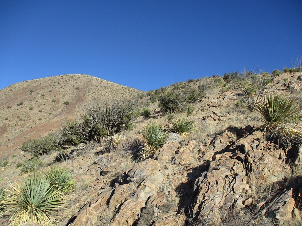
Mount Riley rises very abruptly and even up close, looks intimidatingly steep. Here's what I saw: from the summit, two ridges come down, the southeastern one and one a little west of it. These two ridges curl in toward one another like arms cradling a baby. From the desert flats, a long bajada slopes up to where the two ridges appear to meet. My thinking was that I would hike up the bajada to the base of the ridges, which should take care of a few hundred feet of elevation gain and cut off some of the steep ridge slopes I'd need to do. Maybe I'd see something I couldn't see from afar.
From my car, I followed a haggard track west. This is part of the Mount Riley Wilderness (and the Organ Mountains-Desert Peaks National Monument), so these side tracks are not allowed to be driven on. Even so, they were narrow and unkempt, easier to be walked on than driven. I followed this track about a half mile until I was close to the base of the bajada.
Next, I just walked up the bajada slope. The gradient was lenient, but the slope was covered in ocotillo (and other plants). I had to weave to find ways through the ocotillo stalks. I spooked a band of javelina. I was downwind of them so they could not smell me. They heard me, then as they typically do, they run twenty feet then stop. I yelled and clapped my poles to make noise but that didn't do much. One even started to walk toward me. I then walked laterally, and they just ambled downslope the other way. That was it for the wildlife.
The bajada slope worked well. As it enters the tiny "cirque" created by the two ridges, it gets a little messy and steeper but never too bad. I angled toward the southeastern ridge as was my original plan and from here, saw that it lay back very nicely, and would only entail about 300 feet of elevation gain to get onto the higher ridge, which then just curls around to the top
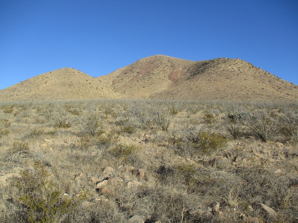
Now on the steeper slope, I just walked upward, going slow and testing each foot placement. The slope was open with spotty plants such as agave, mesquite, creosote and ocotillo, and covered in flat shale-like scree that slide easily upon one another. Most of the time my footing was solid, but there were a few spots where I had to move carefully and find some detours. In about fifteen minutes, I had gained this slope to place me on the upper ridge.
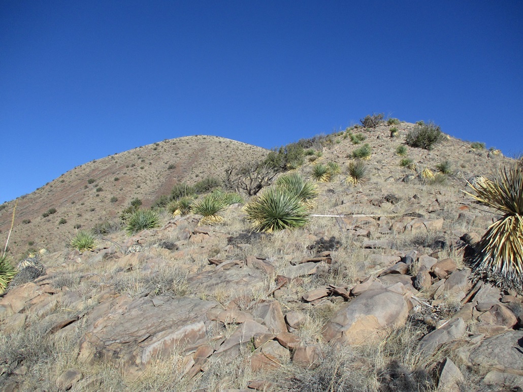
Now on the upper ridge, I still had about 700 vertical feet to gain but the ridge was not as steep. The flora was the same, and the rocks formed random outcrops and small 3-foot cliffs and tiers. I was able to march upward just using my feet and poles, no need for using the hands. I tied some orange ribbon at a strategic ocotillo to know where I need to descend back down.
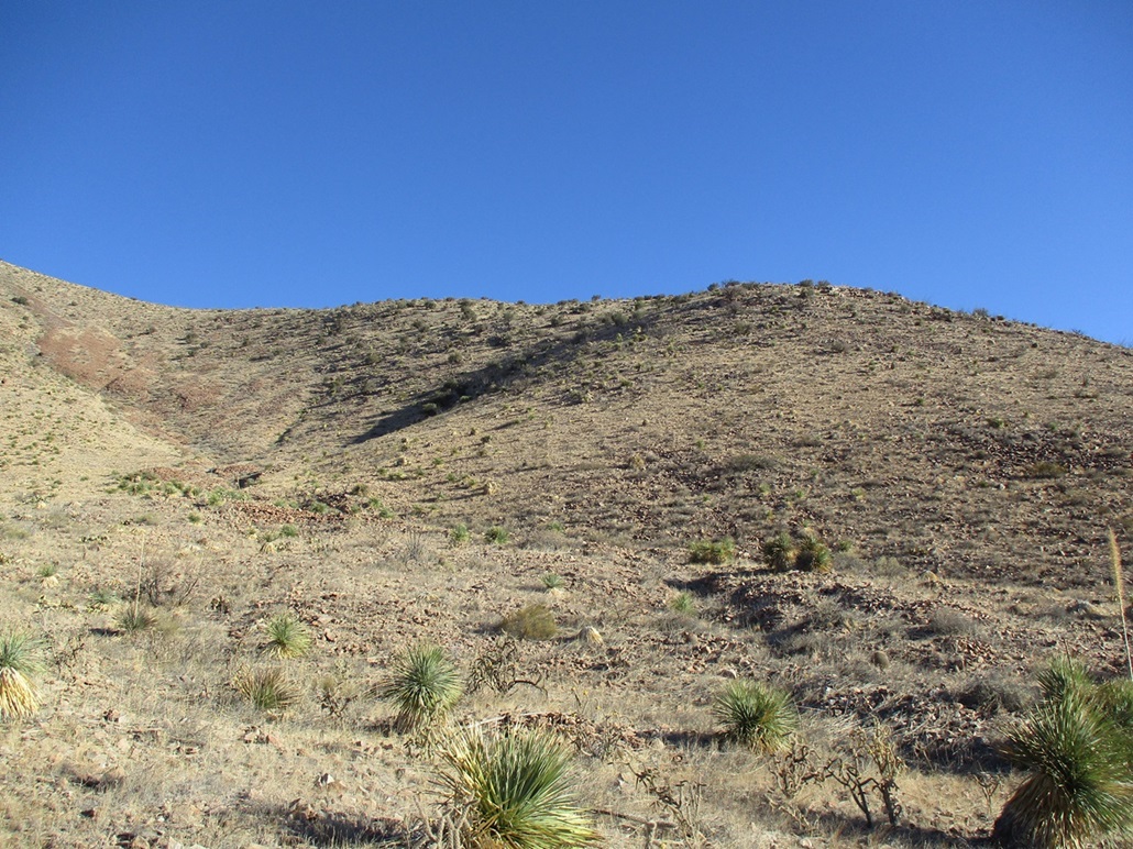
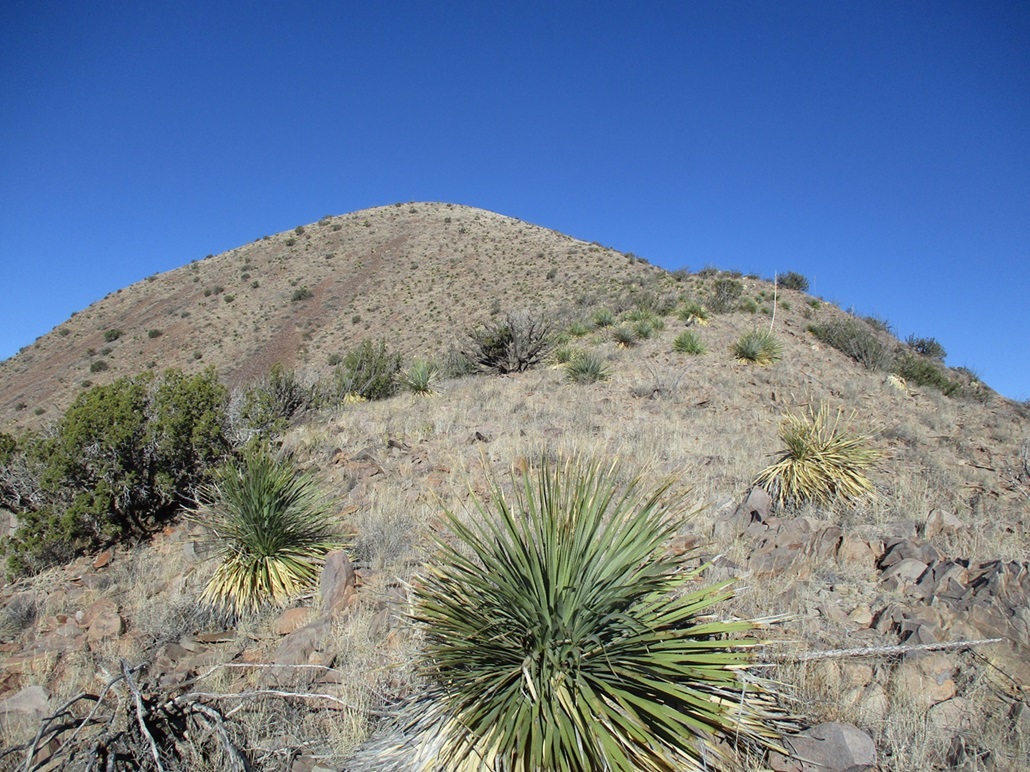
This went well. Other than being moderately steep, it was easy and I never felt in danger of exposure to a fall. The ridge flattens briefly before the last steep push to the summit. This final segment was a little looser but went well too. It was breezier up here, and while the temperatures felt like they had risen ten degrees, it was still quite cold and brisk.
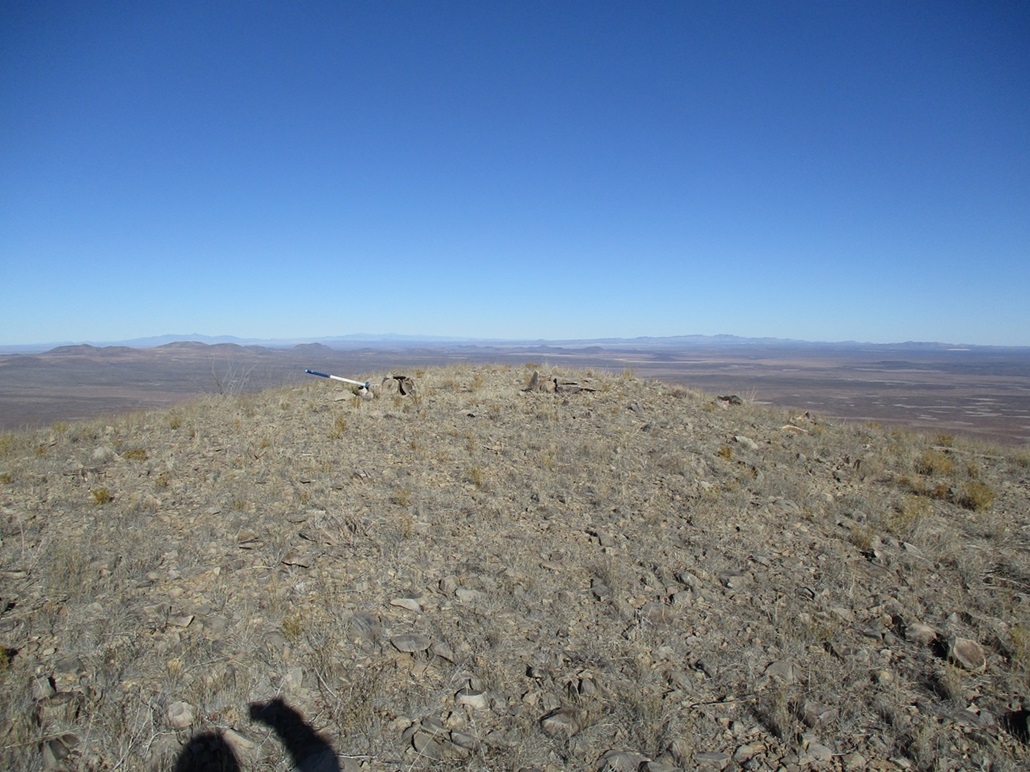
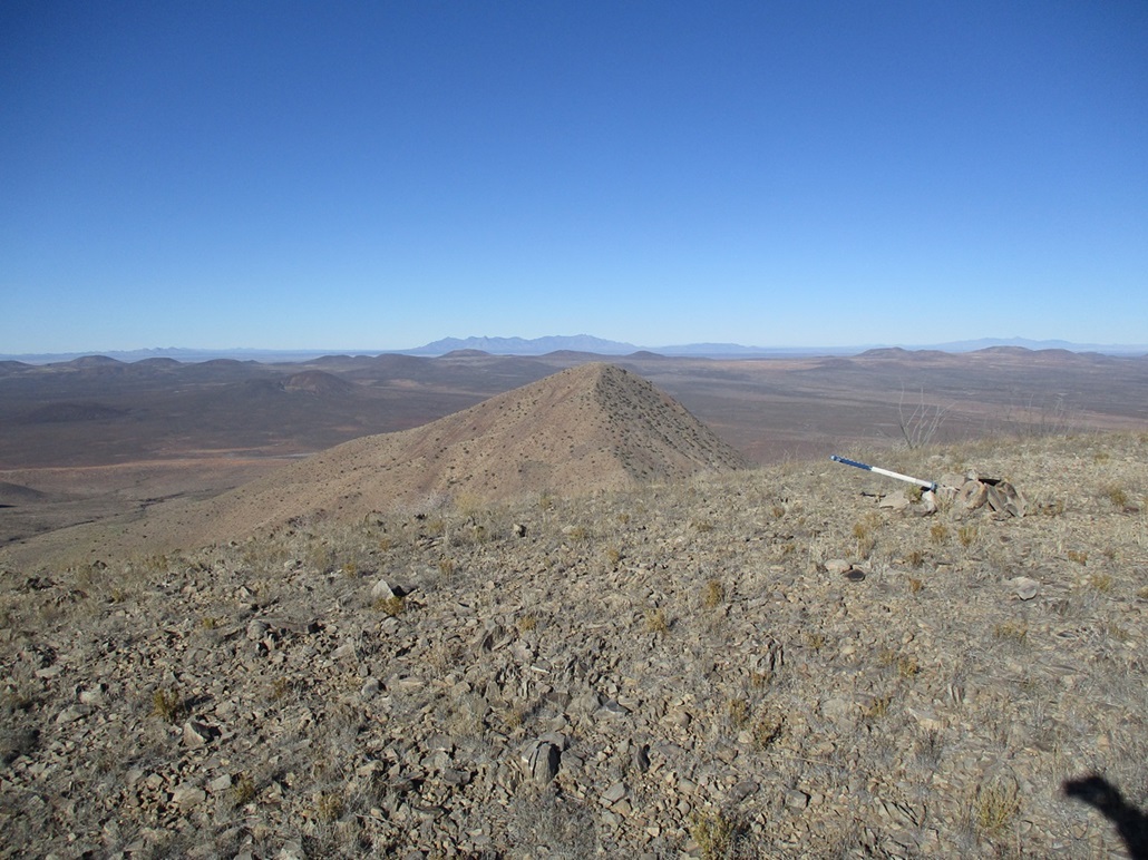
The summit is just a bland bare hump of small rock and two cairns, one holding a register and another propping up a pogo stick, which I'm sure there's a good story behind it. I stopped to sign in the register, the first one here in 9 months, and snap a few images. But it was uncomfortable if I stopped due to the cold chill, so I basically turned right around and started down.
I kept to the ridge and progressed downward. When I found myself within one little clump of trees and shielded from the wind, I stopped for a drink and snack break, plus to change the battery in my camera. I also stopped to really look around. Cox Peak is slightly higher and much more block-shaped. Its eastern ridge and slope looks like a good approach for a later visit. To the east were the lower East Potrillo Mountains, and farther back the peaks by El Paso. I could not see much to the west or north where I sat.
I was back to my ribbon where I knew now to descend that steep slope, which went fine. The sliding rocks were a chore and I took one "CBL" (controlled butt landing) spill when one such rock just scooted out from under me. I was soon down off them and back onto the bajada, which I followed downhill, catching the track then back to my car.
I don't wear a watch and my phone usually stays in my pack, so I like to guess the time when I return, so I guessed 10:50 a.m., and was amused when the phone showed 10:51 a.m.. Off by one minute! I'd been hiking just under three hours.
I changed into a drier shirt and got things packed for the drive out. As I drove, I studied Cox Peak some more and feel I have a good route in mind for when I return. I also took a look at East Potrillo Mountain. It's not as blocky and steep as the Riley and Cox pair and looks like a fun hike too. (I came back a year later and visited both Cox Peak and East Potrillo Mountain.)
The drive out went fine. I actually met two guys on a road maintenance crew from the county coming in to do some grading. They were cool. From here, I got back on the highway and aimed west, arriving in Bisbee about four hours later.
I was very pleased to be successful on Mount Riley especially since I had not planned hiking it until last night. Everything worked out in my favor, and I came away now knowing more about these back roads and other attractions out this way. Reading up on it some more, it seems people approach this peak from other directions too, suggesting no one way is best. My route worked well but I only chose it because it was closest to the road. Many people hike this peak along with its western subpeak and Cox Peak to make it a threesome. If so, plan on a full day.
|


|