The Mountains of New Mexico
www.surgent.net |
|
Picacho Mountain • Peak 4815 (Goat Mountain) I was spending a day hiking a few of the popular peaks in and around Las Cruces. Earlier, I had hiked Magdalena Peak and Aden Hills Highpoint. Those are west of the city, out in the desert. Once done with the Aden Hills hike, I located myself to the Bowlin's gas station at the Corralitos Exit off Interstate-10. They sell all sorts of souvenirs and fireworks. I just wanted to relax a little and get a snack. The nice woman there confirmed that the frontage road would take me back to Las Cruces, so I could skip the interstate.
Date: December 26, 2023
• Elevation: 4,959 feet
• Prominence: 679 feet
• Distance: 2.4 mile
• Time: 90 minutes
• Gain: 829 feet
• Conditions: Clear, cool and very nice
• Wildlife: Eight dogs!
New Mexico
•
Main
•
PB
•
LoJ
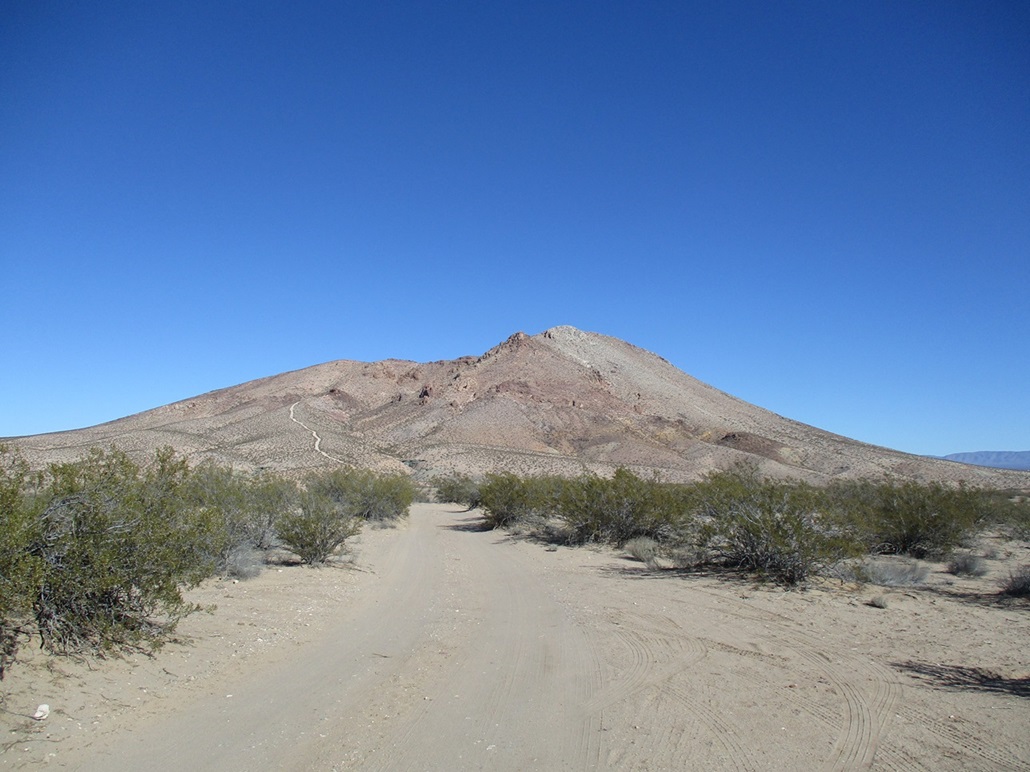
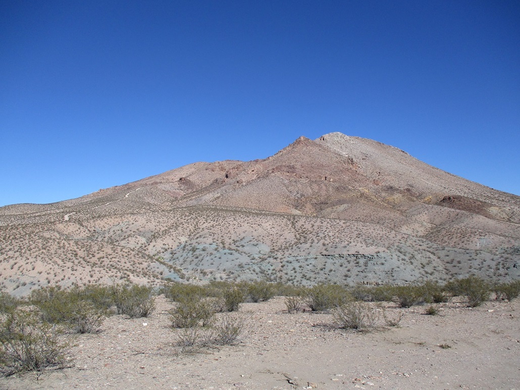
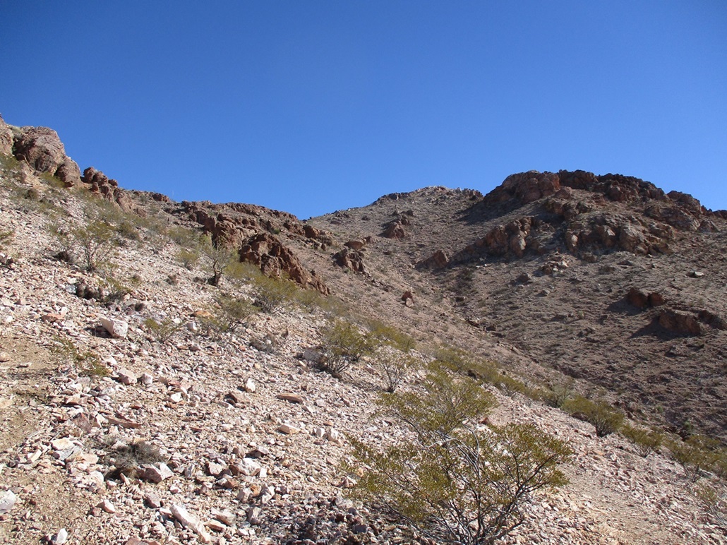
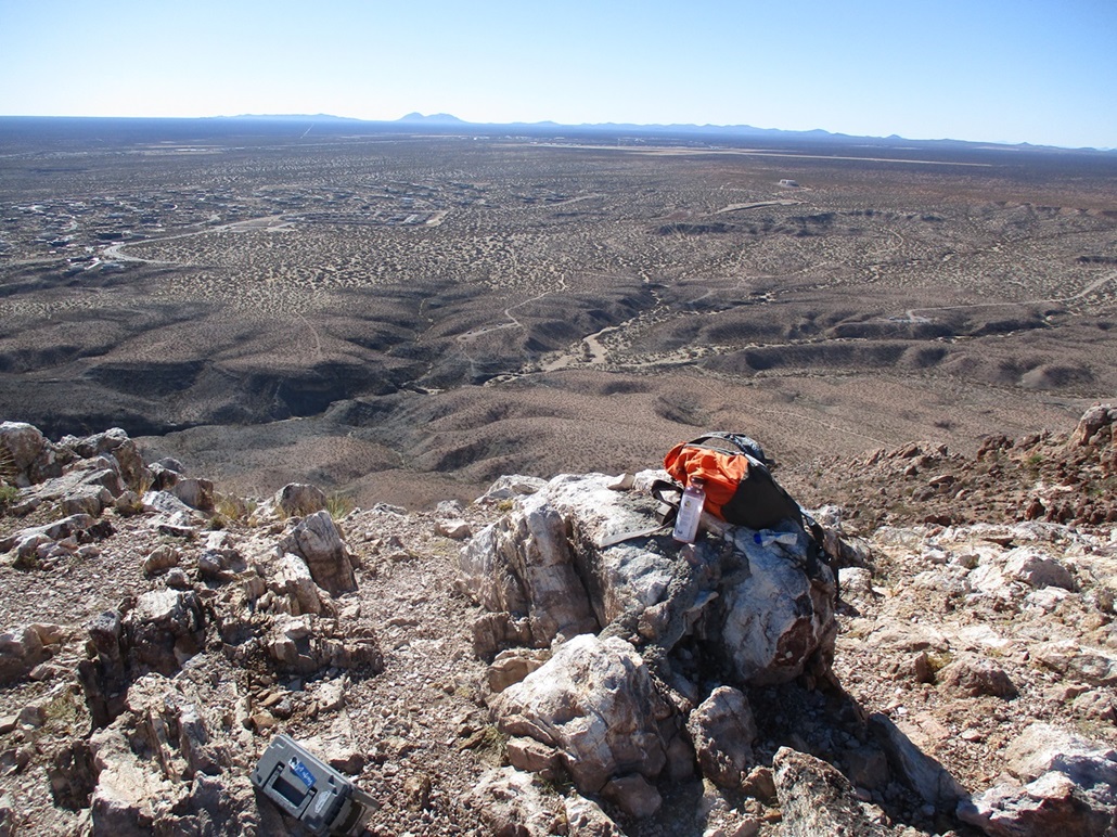
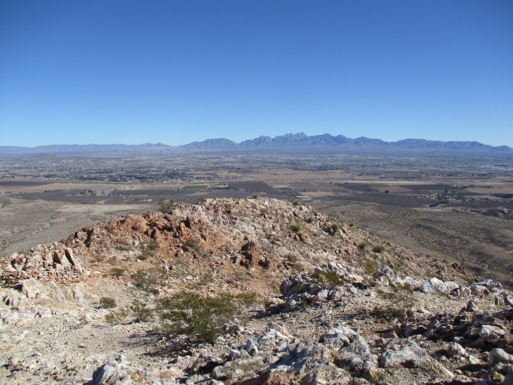
Picacho Mountain ("Peak Mountain") rises suddenly over the desert flats and arroyos on the west edge of the city. It is a volcanic mountain, and an impressive one to look at. It has a nice shape with some rocky outcrops and cliff bands, and some variety in its colors. The peak lies outside the city limits, barely inside the boundaries of the Organ Mountains-Desert Peaks National Monument. A high-end home development takes up much of the land south and east of the peak.
I stayed on the frontage for about 8 miles. It then connects to US-70, signed as "Picacho Avenue". I followed this to Picacho Hills Drive northbound, then west on Barcelona Ridge, then right (north) on Anthem, and followed that north and west to a T, going right (north again) on Picacho Loop Road.
The pavement ends quickly, and a smoothish desert track continues generally westward. Most cars would probably be fine on it, but it's a desert track with sections of sand and some arroyo crossings. It seems peculiar that the pavement ended like it did. I bet they'll build this out in the near future.
The main trailhead lies southwest of the peak, but an unofficial trailhead is at the end of a road that branches north off the Loop road. This road was narrower but in good shape. I parked at the road's end, the second car there. I was suited up fairly quickly and on the move.
I found a path that drops off the bluff that overlooks a drainage crossing below the mountain. I dropped about 50 feet and then followed footprints west then north, catching the summit trail quickly. Another group from the other trailhead were converging onto the summit trail and I hustled to get ahead of them a little.
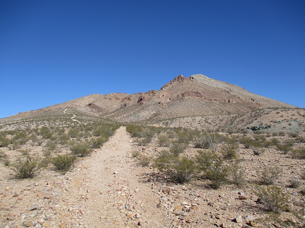
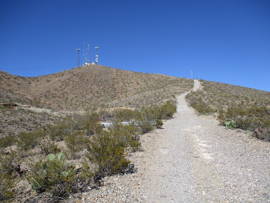
The summit trail at first is an ATV track that goes up the lower slope, aiming for a reddish-brown rock outcrop up ahead, about 300 feet higher up. Actually, no signs said this was the summit trail, but it's where all the footprints led to and it seemed like the best bet.
I got up to this outcrop, and the road ended below it. A narrower trail branched left and up a slope to get behind and above this outcrop. The next segment was a slightly-steeper hike up more trails to gain the upper ridge.
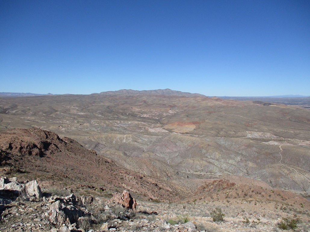
In this segment, the trails branch and braid often. At first, I was unsure which way to go, so I always went up, or chose the better-looking trail. It turns out any branches invariably re-meet the main trail. I generally tried to stay high on the sloping ridge, whereas some of the branches led to trails tucked into a drainage, which looked messy. I was quickly above this segment too, the summit not to far off.
The trail here gets much better defined. It aims east, works through one easy rocky segment, then comes to the base of the final slope to the top. My eyes played tricks on me. I thought the top was higher up, but when I saw some people near the skyline, that gave me a sense of scale, suggesting the top was probably just 150 feet or less. Either that, or these people are fifteen feet tall.
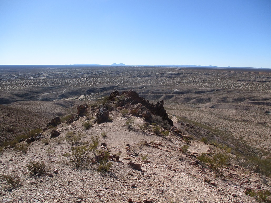
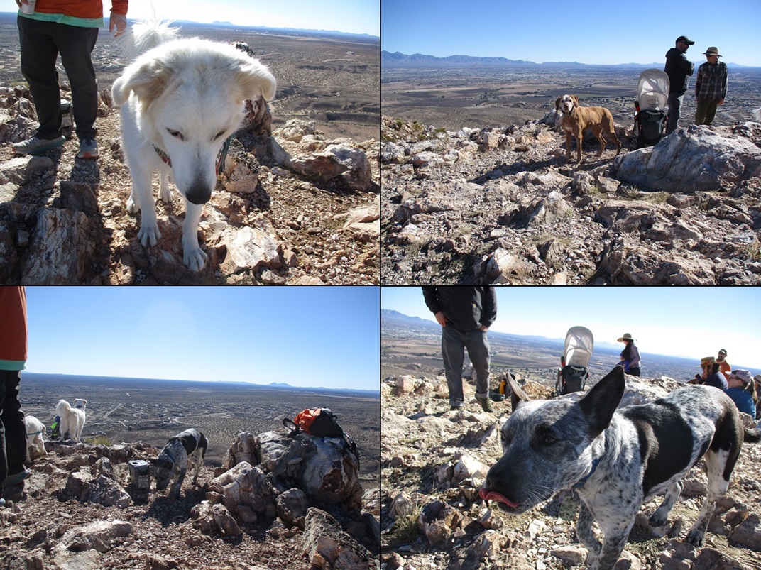
I slowed down a little to allow one woman and her young child to work up the last few feet, and soon, I was on top, taking a seat to the side. The top is rocky with a lot of good sitting rocks. There was a group of about six adults and two children. One, I mentioned. The other was a baby who got carried up in one of those backpack carriers. And they brought their dogs with them, four of them!
The people were real cool and I chatted with them. The dogs naturally sniffed everything, including me. The top is big enough so that accidentally falling off a cliff is unlikely. As I sat, each dog would eyeball me, then come and sniff me and say hi. I stayed up top about fifteen minutes, enjoying the views, the vibe and the doggies.
When I sensed that the group was starting to head down, I got up and bid them goodbye. And one of their dogs started to walk with me! His master called him back, but it just goes to show how fast a dog will change allegiances. Nice dog, too. I would have been glad to have him.
As I hiked down, I passed a group going up about every three or four minutes. Everyone was friendly. And I met up with more dogs, four more total, including one old girl who was blind, her human mommy guiding her with a short lease. And each wanted to sniff me, some even straining at the leash to do so. I enjoyed meeting so many friendly dogs! In case you're wondering how I was able to determine so quickly it was eight dogs total I saw, I just counted how many legs then divided by 4.
I was back to my car in not too long. I had been gone 90 minutes, which seemed shorter because it felt like two hours minimum. This was my fifth peak climbed in my day and a half here so far and it was my favorite, because of its nice trails, cool people, and so many funny dogs!
Back on US-70, it was about 1 p.m. now and I had no desire to go back to the hotel and do nothing. I had hiked the peaks I intended to hike, so I reconsidered Peak 4815 over on the east side of town, which I had to bail on yesterday due to a couple fools shooting guns carelessly.
Elevation: 4,815 feet
• Prominence: 455 feet
• Distance: 2 miles
• Time: 50 minutes
• Gain: 515 feet
• Conditions: Cool and clear
PB
•
LoJ
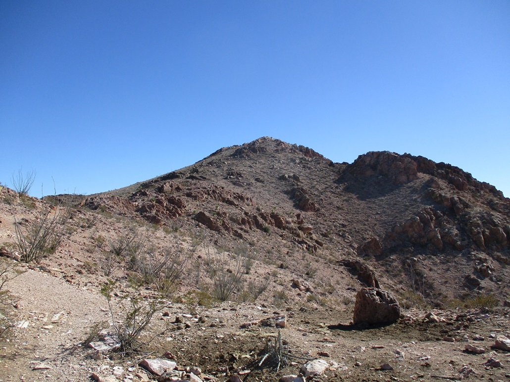
Getting here wasn't a problem except for a couple slightly wrong turns on the city streets of Las Cruces which were easily corrected. US-70 makes a couple turns at intersections and I should have been paying closer attention. In any case, it was an easy 20-minute drive to situate me below Peak 4815, or Goat Mountain as it is locally known.
I chose instead to take the slightly-longer way up, a dirt and concrete road that comes up from the southeast. I passed through a tract of homes, going north on Mount Baldy Road past its pavement, then parking where a dirt track veers west off the main road. There are tracks everywhere but I was pretty sure this was the right one.
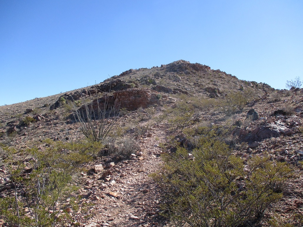
I started walking the track, which was sandy. It split often and I took the route that looked most travelled and/or the one that aimed toward the peak. Slightly higher, the track comes to a gate at a junction. This was obviously the right road, so I followed it up.
ABout halfway up, the track steepens and becomes covered in a layer of rough concrete. The grade was very steep, probably 20% or greater. Walking it was easy but tiresome, but it was short. I was on top the peak in about 20 minutes after starting.
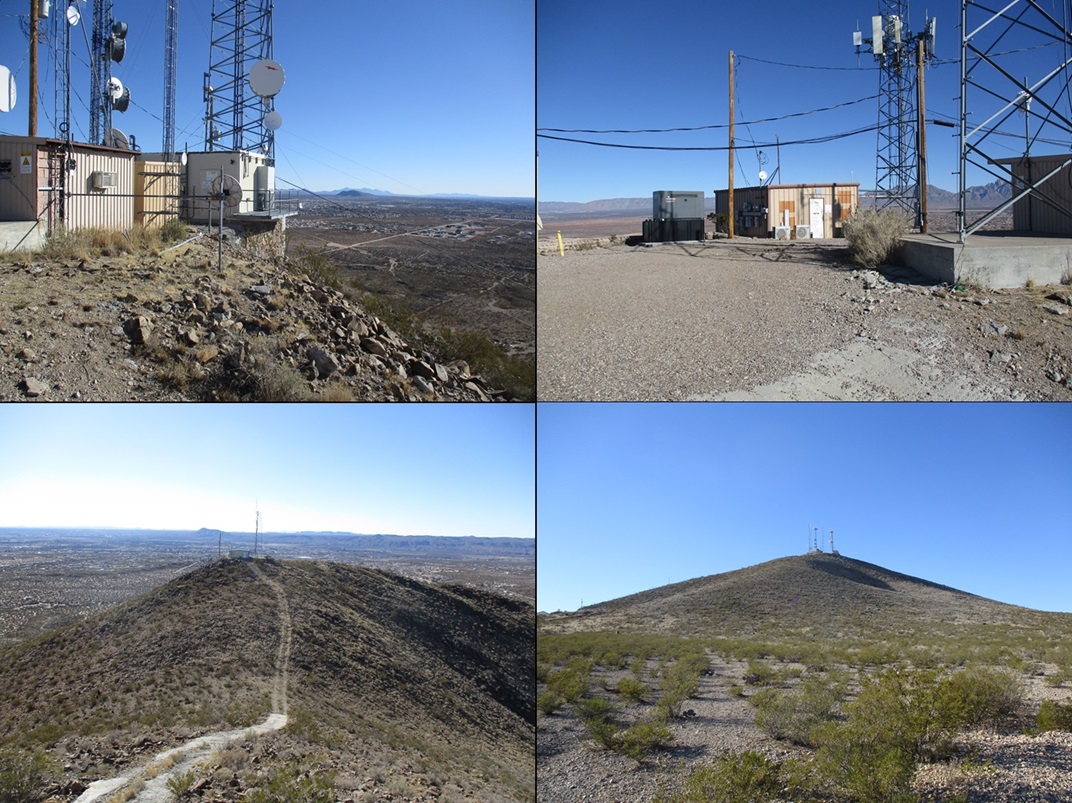
The top hosts a few communications buildings and towers. A lower peak to the west hosts a couple more. I walked around and took a few images, trying to avoid the RF radiation. Some shooters were doing their thing down below to the east, but they were in an area clearly meant for shooting, with back berms, not the open-willy-nilly shooting I encountered yesterday.
Going down went well, but on the concrete road, I was careful to remain upright. The irony is that a spill would be hard to arrest. I could literally roll down a ways. I was back to my car in another 20 minutes, following a slightly-shorter route. The round trip had taken less than an hour and I was pleased to tag this peak. It's nothing special but after yesterday's encounter, I felt more motivated to come back and get it.
Now pushing 3 p.m. and having hiked 4 peaks already today, I was sufficiently tired and smelly, so I returned to my hotel room, showered, napped, and later, went out for a meal at the nearby Cracker Barrell. The next day I headed home to Arizona, but I would hike one more peak, Mount Riley, on the way back.
|


|