The Mountains of New Mexico
www.surgent.net |
| Oso Ridge Lookout |
• Zuni Mountains • Cibola National Forest • Continental Divide • Cibola County |
 The lookout can be seen early on
|
Date: July 11, 2020
• Elevation: 8,713 feet
• Prominence: 353 feet
• Distance: 2.5 miles
• Time: 1 hour and 20 minutes
• Gain: 475 feet
• Conditions: Sunny and quite warm
New Mexico
•
PB
βð and I were nearing the end of our cross-country drive from Maryland back to Arizona. We had slowed our pace, building in a couple "no-drive" days to rest and recuperate. We spent a full day and two nights in Pueblo, Colorado, then from there drove to Las Vegas, New Mexico, for a night. Yesterday morning, we drove from there to Grants, about 80 miles west of Albuquerque, arriving about 2 p.m.. The day was hot, pushing 100 degrees F, so we got into our hotel room and spaced, with occasional vegging to break up the routine.
We did not plan to stay here another day, but we felt another rest day would do us well. We were on schedule anyway, so getting home a day early would not really do much for us. Besides, I saw this as a chance to explore a little around the area. I've only stayed in Grants once before, back in 2000 when I hiked Mount Taylor.
With a day open now, I got on the web and looked around for a hike to do. It was already getting hot, so a long hike would not be possible. I only had my hiking shoes, so I wanted something short, nearby and on a road or trail. I zeroed in on this hike, as it fit all my criteria. It was also close to the Ice Caves, a privately-owned attraction, which I wanted to explore. The area around the mountains is part of the El Malpais National Monument, dozens of square miles of lava beds, some looking like they flowed last week. The peak also lies smack on the Continental Divide, too.
From Grants, I took the exit off the interstate to state route NM-53, which heads south and southwest, first along the flats below the peaks, then curling west into the mountains. I covered about 18 mile, then turning north onto Cibola Forest Road 50, going another couple miles to FR-187, signed for the Oso Lookout (2 miles, says the sign). I parked in a small open clearing at the corner, opposite a residence. It was about 9:30 a.m., sunny and warm, about 85 degrees.
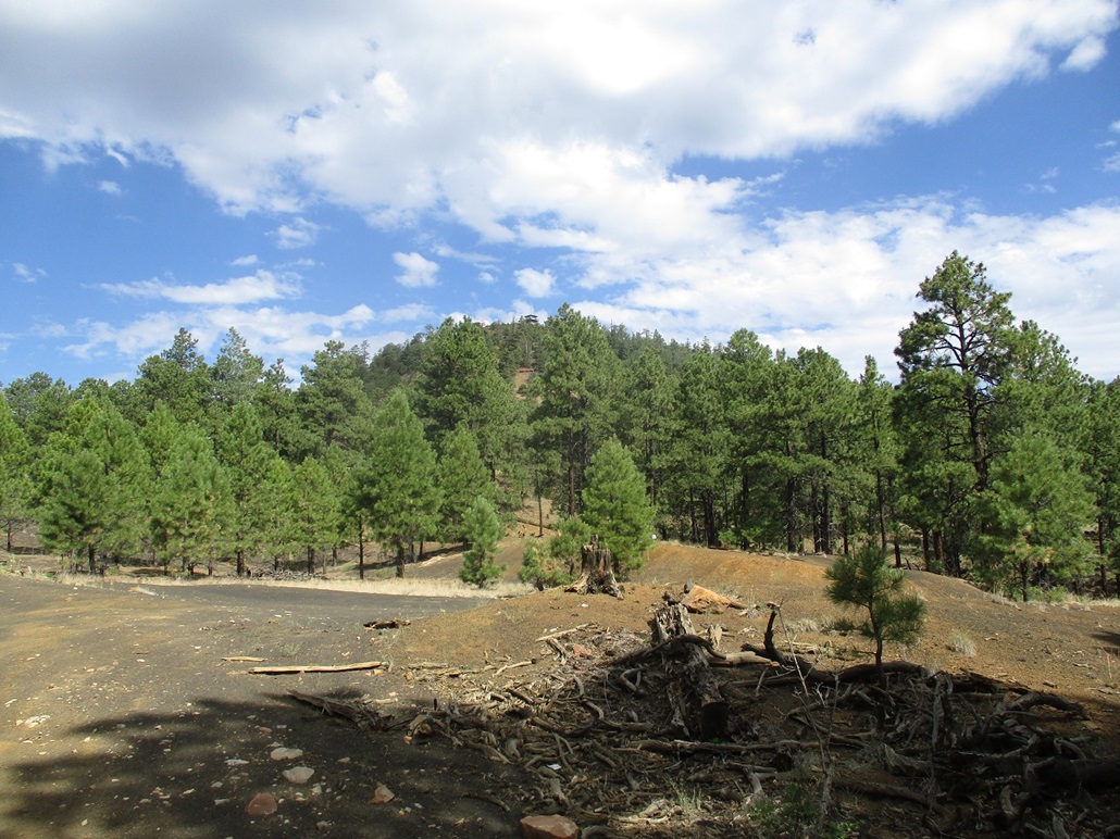
I packed light, just a couple drinks, my camera and personal items. I walked FR-187 west, gaining gently. At a break in the trees, I could see the top and its lookout and a small structure that presumably was an old beacon (going by the map). I had shade at first, which helped. Then I had a stretch in the open. Clouds helped mute the sun and temperature. When the sun was on me, it was quite warm.
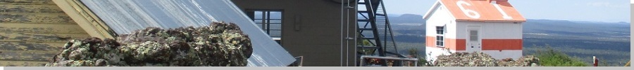
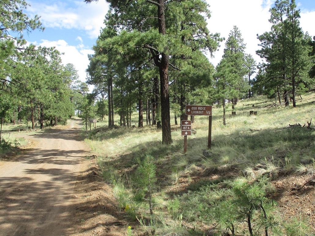
The road re-enters the trees, then leaves the main road at a Y, the sign saying the top is 1/2 mile distant. It was a tad steeper here, and a little more exposed and in the open, with direct sun. At the top, the road curls around a rock agglutinate, and comes to the tower. It was manned today, and I could hear the guy on the phone. I looked at the orange and white "house" which held a beacon, said a sign affixed to it (see image at left). I did not hail the lookout man since he seemed busy.
The highpoint is on this fin of welded rock, and I eased around the lookout and another small shed to get onto the rock, tagging the top. It was very hot now, about 95 degrees. The bugs were heavy and many zinging into my ear and face. I snapped a couple quick shots but scooted down quickly. At this time, the lookout man came out and greeted me from his ledge. He said it was okay if I came up, but I was already on my way down and thanked him. He seemed friendly. I asked if he gets visitors and he said not very many.
I walked down the same way, back to my car quickly. Back in the shade, the temperature was tolerable. In the sun it was hot and tiring. But the hike was fast and easy. I gauged I covered about 2.5 miles, not the 4 miles going by the sign back on the road.
I knew this hike would go fast, so I had one, possibly two, more hills on the agenda. They were the two humps of the old Bandera Volcano, the location of the aforementioned Ice Caves. I drove in to the small facility and talked to the lady that runs the place. For $12, I could hike a trail to an observation deck up high, but hiking to either summit was forbidden. I could also hike into the ice cave itself, but only to an observation deck. I opted to not pay for the priviledge. However, I did buy some crafts from the small store.
It is possible to hike the north hill since it's right along the highway. It would be a steep bust up rubbly slope. Given it was hot, and the peak was on private land, I chose not to go outlaw. It was not that important to me anyway. I had fun on my one hike and had got some conditioning in after ten days of driving.
I was back to Grants by noon, the day very hot now. Back in town, I drove up highway NM-547 from Grants toward Mount Taylor for some sight-seeing and photos. I had driven this twenty years ago but remembered little of it, other than I missed some turns my first time here. I actually want to reclimb Taylor, but another time, when it's not so hot.
Very early the next morning, we left Grants and drove the last 260 miles to Payson, the end of our wonderful journey. I had a wonderful time on the drive, my first true cross-country drive ever, at the tender young age of 53. This is one huge country and a drive such as we did is a great way to appreciate the size, scope and variety of the land forms and the people that live here.
|


|