
The Mountains of New Mexico
www.surgent.net |
| Organ Needle |
• Highpoint: Organ Mountains • Highpoint: Doña Ana County • Organ Mountains & Desert Peaks National Monument |
 The final push to the summit
|
Date: March 31, 2001
• Elevation: 9,012 feet
• Prominence: 3,700+ feet
• Distance: 8 miles
• Time: 10 hours
• Gain: 4,100 feet
• Conditions: Marvelous
• Teammates: Scott Holzhauser (leader), Scott Casterlin, Ken Akerman, and about 8 others
New Mexico
•
PB
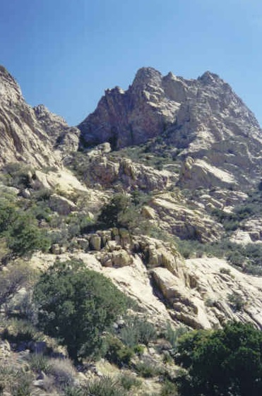
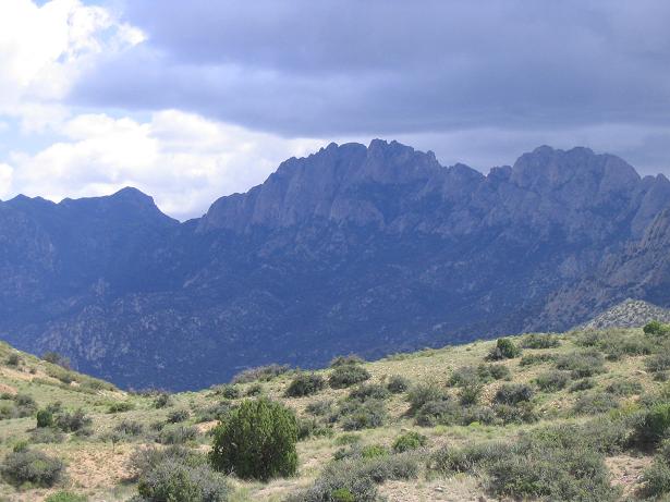
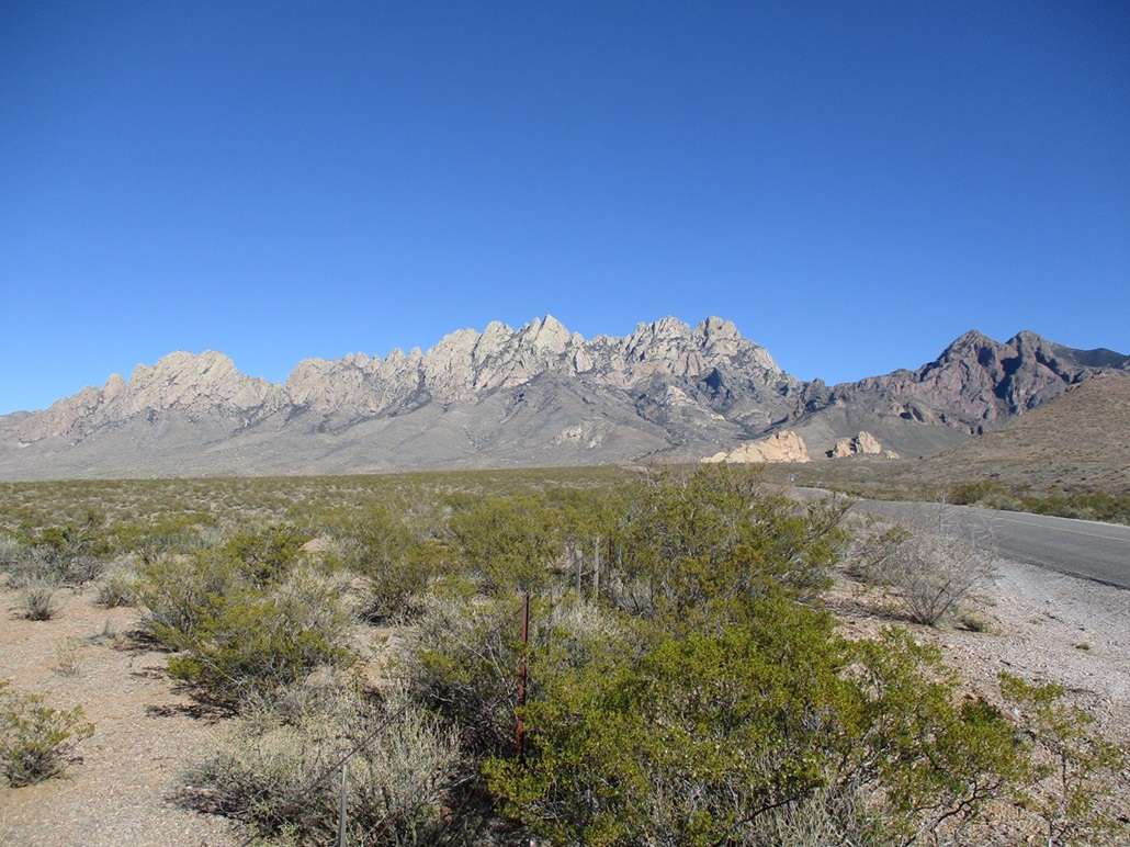
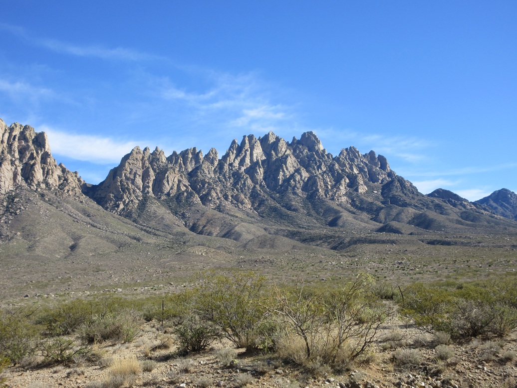
The Organ Mountains lie in southern New Mexico, with Las Cruces to the west and the White Sands Missile Range to the east. The range is noted for its multitude of needle-like rocky summits, akin to the many pipes of a church organ. Not surprisingly, the highest point is named Organ Needle. The current topographical maps do not specify an elevation for the top, other than an 8,980-foot contour. However, Herbert Ungnade's Mountains of New Mexico cites the peak as 9,012 feet.
As a small boy (age 2), I lived at the White Sands base ("Wismer") where my dad was stationed in the Army. My memories of the place are very limited, but in 1993 as a young adult, driving through the area for the first time since I was a little kid, I remember having a strong "deja vu" feeling when I saw the range again. Of course, I knew I had been here before. It was an interesting experience. The range had made an imprint on my psyche, even at that young age.
Organ Needle is the highest point in Doña Ana County, and as I progressed through the list of county highpoints in New Mexico, I knew I would have to face up to mighty Organ Needle at some point. It is well known to be a tough climb, featuring tricky navigation, sloppy tracks, thick brush, and near the top, a small yet exposed class-4 wall. An opportunity came when a number of New Mexico-based climbers were planning a trip to Organ Needle. A couple of us Arizonans caught wind of this scheme, and we joined in with the gang. It was a solid group led by Scott Holzhauser. Eventually, our group would number 11, a mix of men and women, ages from 30s to 70s.
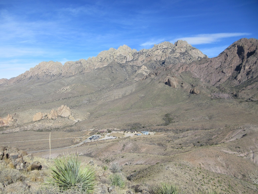
I left Arizona after work on Friday, and made the long drive into Las Cruces, arriving relatively late. Although there was a pre-climb gathering at Scott's place in town, I arrived too late to join in, so I stayed at a hotel and met the group early the next morning. Our convoy consisted of about six vehicles, Scott leading the way. From Interstate-25, we followed University Avenue past "A" Mountain, entered into the desert, followed a good dirt road called Dripping Springs Road, then another road whose name I forgot, then finally a much scanter road west of Modoc Mine. We all parked in a clearing below the summit.
From below, it is impossible to identify the exact needle that is the highpoint. The range is absolutely packed with these rock spires and looks very intimidating from below. We had over 4,000 feet of elevation to gain and it was clearly going to be a long day. Along with my usual stash of drinks and goodies in my pack, I also stuffed in my 100-foot climbing rope and a seat harness, plus a couple carabiners and prusiks and some general webbing. I didn't want to get that far up the mountain only to chicken out at the upper wall for lack of proper gear. However, these items added weight to my pack.
From the cars, we walked the remainder of the road up a ridge then down the other side into a valley, then up again to another ridge, then down again. The road starts to meander, but cross-country hiking here meant doing battle with thickets of cactus. Our immediate goal was Fillmore Canyon and a saddle at its headwall, nearby Peak 7778. We passed by the unique "Yellow Rocks", then started up the slopes inside Fillmore Canyon.
Enough climbers have trudged up this route to have beaten in a footpath, but we were all over the place at first, hiking and side-hilling the slopes through rocks, brush and cactus. It was slow, tedious and unenjoyable, but finally, we came upon this path. The path itself was steep, loose and scant, but at least it was something to follow. The path barrelled directly upslope, and we strung out here. In time, we had all climbed to the saddle nearby Peak 7778, and we took an extended breather here. We had hiked 3 miles with 2,700 feet of gain. One of the hikers bailed here due to other commitments.
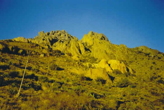
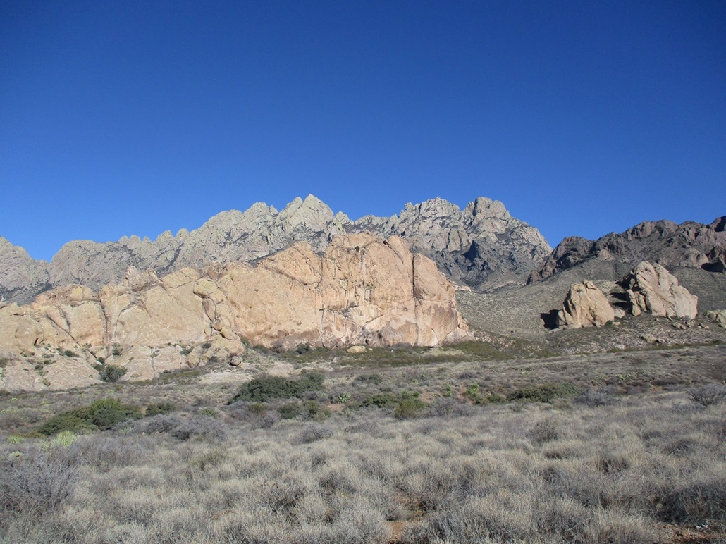
Looking up, the imposing wall of needles stood high, the summit, wherever it was, still 1,400 vertical feet above us. We had two choices here: angle right and follow a steep path through brushy slopes, or angle left and hike through a series of rocky tiers, which was shorter but brushier. Our big group (now 10) split into two, some going right, others (including me) going left. It was a grind and extremely tiring, but in time, our groups had reconvened at the base of the top-most cliffs.
We could now look up a very narrow defile called Dark Canyon, which was completely invisible to us from below. The defile was no more than a couple dozen feet wide, with heavy brush and stands of trees, including Maple, interestingly. However, there was a narrow opening where the slope met the cliffs, and this opening allowed us to scamper upwards. It was steep and loose, but the climbing was no worse than easy Class 2. Shortly, we had convened again at the tiny saddle at the top of this defile. We were now exactly on the range crest. On the east slope, there were still patches of remnant snow. The defile is so narrow that it does not get direct sunlight for months at a time.
We descended about 100 vertical feet, then angled left (north) to walk along the base of the cliffs, keeping to a narrow band of dirt and rock that made travel relatively easy. A number of gullies branch off, and any one supposedly could lead to the top. One such gully even had a small concrete pad with a message written on it, something like Not this one, next one over . I was told it was placed here by the family of a climber who met grief (death?) going up this wrong gully. It was a stark reminder of the demands this peak has on climbers.
Finally, we were in the correct gully, having to get past one inconveniently-placed rock directly in our path. The gully is very short, and within feet, we were below the crux, the 40-foot wall. There is a diagonal crack running up this wall. However, there is no room for mistakes. A fall would be fatal. One of the better climbers free-climbed the wall, then a few others climbed part-way, and the rest of us, one at a time, free climbed the wall, with those stationed halfway helping others with holds, foot placement, things like that. It took about 20 minutes to get everyone up.
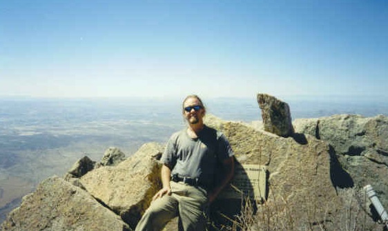
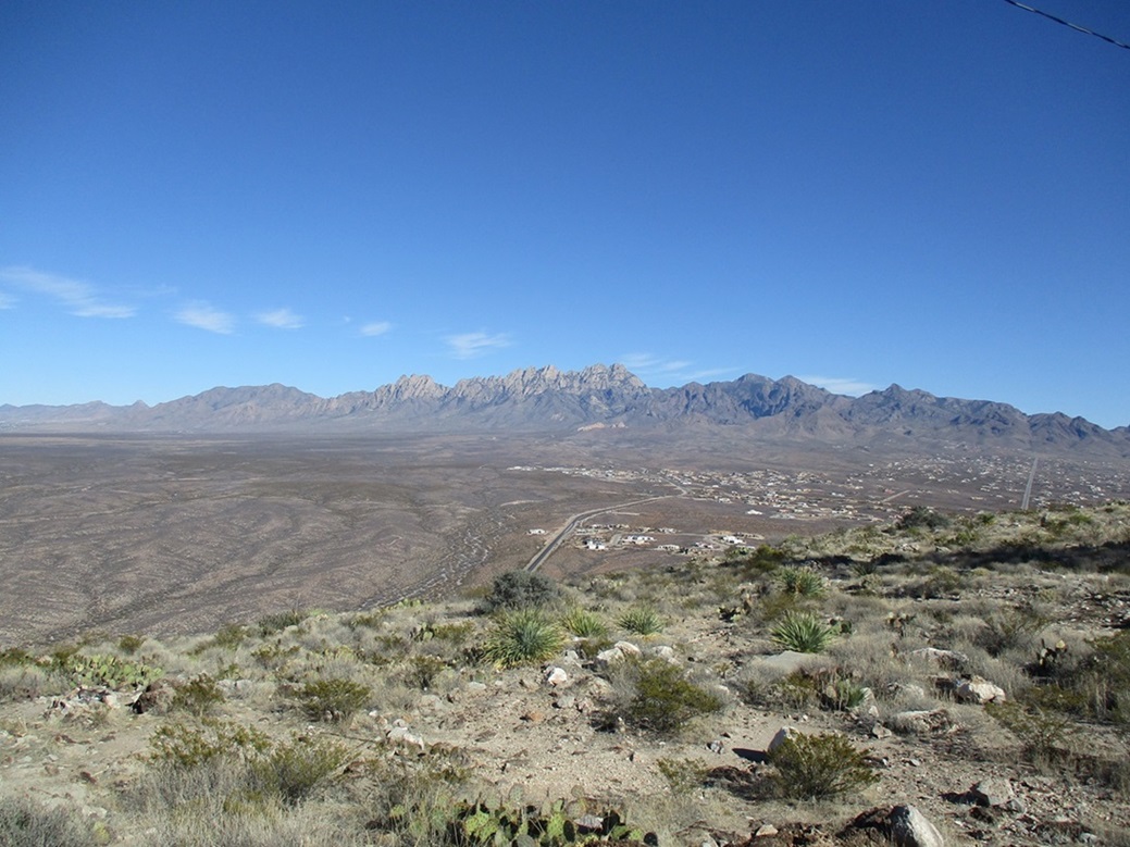
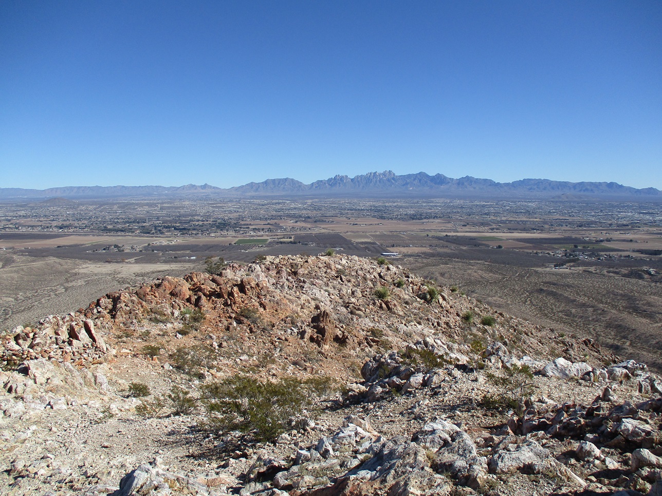
After that, the summit was close by, an easy five-minute walk amid a jumble of spires, talus blocks and smaller rocks, with brush growing in the cracks. I went ahead and tagged the top, got some amazing views of the land in all directions and enjoyed my lunch. The whole gang of us spread out over the various rocky slabs strewn about the summit region. The views were tremendous, and the weather was blue, dry and spectacular. We had a great day for our climb, fortunately.
For the descent, we hiked back to the top of the wall. At this point, I pulled out my rope, harness and trinkets, and immediately I was the hero of the village. I guess a lot of people were not too cheery about descending the wall unaided, but no one knew I had brought along the rope. Conversely, I was surprised no one else had brought along any cimbing items, and that I was the only one who had. A couple climbers downclimbed the wall without the rope, and again, positioned themselves at strategic points to talk others through the moves. One of the guys (named Chip, I think) was belaymaster while I stayed up top and made sure the harness was on properly for those of us who wanted its protection. Each downclimb took a few minutes at most. I went second-to-last, then Chip brought the whole apparatus down with him. Scott Holzhauser was happy I had brought the gear with me, and as thanks, offered to carry it out in his pack, relieving me of the extra weight. I accepted his offer.
We retraced our route going down. Each segment went slow, the steepness and terrain naturally limiting our speed. Below Dark Canyon and still above Peak 7778, we strung out again, forming into two groups, a fast one and a slow one (two guesses which one I was in). We reconvened at the saddle below Peak 7778, and it was agreed that those who egressed early could go on and leave. There was enough of us to ensure one another's safety.
The hike down Fillmore Canyon went slow and methodical. I was beat and a slipped often on the loose soil. We reached the base of Fillmore Canyon nearing sunset, made our way past the Yellow Rocks, poked through the cactus fields, and came upon the road we had started up earlier this morning. One of the guys from the fast group had stayed behind and driven his Jeep up this road, ferrying the last three or four of us down the last half-mile, which was welcome. My rope was sitting in the bed of my truck (Thanks, Scott), and it was dark by the time we all got situated and ready to depart. I thanked those who were still there, we all shook hands, then went our separate ways.
The climb had been a resounding success, and I am deeply grateful for the camaraderie and assistance of the whole group, with people helping one another up and down this tough customer. I was clearly not the only person who had put off climbing Organ Needle. Some in the group had been waiting for years for a good opportunity. Everyone made it, we had no injuries, and that's all we could ask for. My sincerest thanks to Scott Holzhauser for organizing this event
My drive back to Arizona was quite eventful. I stopped in Las Cruces at a Motel-6 but they were all booked, so I called the Motel-6 ahead in Deming and reserved a room there. So I started driving to Deming, 60 miles away, along Interstate-10. About halfway there, I was tailing a big SUV that was drifting from lane to lane, sometimes onto the shoulder. It would slow down, then speed up. I stayed behind this driver, having no inclination to pass for obvious reasons.
Suddenly, the driver drifted into the center median, over-corrected and barrelled into the right shoulder, then one last correction, jetted back onto the highway and rolled the vehicle four times, the vehicle coming to a stop on its side in the median, which here is about 60 feet wide, but not fenced.
I parked on the right shoulder of the west-bound lanes, called 911 and then ran over to render what assistance I could. At the time, I was a certified EMT, but I had no medical gear with me other than the extreme basics. Another vehicle had stopped on the eastbound lanes and the two men were propping up the driver, a young woman about age 20. She had been ejected from the vehicle. She was standing but in a daze, favoring her side. I identified myself as an EMT, stabilized her neck, and carefully, the three of us gently sat the woman down. She was alert but barely.
Part of the problem was describing to the 911 operator where we were. There are no landmarks out our way, just open desert. A police cruiser rolled up and helped out, and his flashing lights directed the ambulance, which arrived after about 15 minutes.
All the while, we had the young woman in a modified supine position, partly on her side because (a) she was favoring it, and (b) in the event she needed to vomit. We talked with her, keeping her awake, trying to soothe her. She was clearly in shock, and a quick assessment indicated stiffness in her belly, a probable bleed. The two other guys were helpful. One was able to kick in her vehicle's windshield to get in and turn off the engine. We collected her purse and other items for her.
In the few minutes between when the policeman arrived and when the ambulance arrived, a fourth guy comes barrelling up to us, yelling his head off, identifying himself as an EMT, demanding she be placed supine, excoriating us for our amateurishness. I must have identified myself to him three or four times but he wasn't listening. I had my hands on her head holding her spine steady and had no intention to let go until a real ambulance showed up. In those few minutes, that ass and I had a controlled argument, where I was not going to risk injuring this young lady because he was not aware of the entire situation. The cop stood behind me and kind of stared at him.
Finally, the ambulance rolled in, they stabilized her and carted her off to Las Cruces. She had been taking some medication and also had not eaten. She was not wearing a seat belt, either. She did everything wrong. She was a college kid and simply had pushed herself past her breaking point, and was extremely lucky to survive. After that, my stay in Deming and my drive home the next day was comparitively quiet.
Later, I asked one of my colleagues on the Mountain Rescue team I was a member of back then about this situation. He was a paramedic who made a living going on runs like these. I explained everything and wanted his opinion, especially about my decision to allow her to lay in the modified supine, slightly to one side. He told me that is fine, as long as her neck and spine were stabilized, and that in the field, these little modifications to "standard practice" must be considered since each case presents its own challenges.
|

|