The Mountains of New Mexico
www.surgent.net |
| McKnight Mountain |
• Highpoint: Grant & Sierra Counties • Aldo Leopold Wilderness • Gila National Forest • Highpoint: Black Mountains |
 The forest road down low
|
Date: (1) September 4, 2000; (2) September 6, 2004
• Elevation: 10,165 feet
• Prominence: 2,525 feet
• Distance: 5 miles
• Time: 2 hours and 30 minutes
• Gain: 900 feet
• Conditions: Sunny with puffy clouds in 2000, much nicer in 2004
New Mexico
•
PB
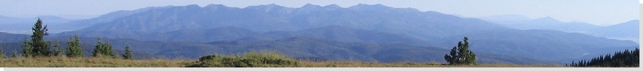
McKnight Mountain is the highest point in the Black Range of southwest New Mexico. The highest point is a tie between two bumps, both 10,165 feet elevation. The eastern point sits on the Grant and Sierra county line, while the western peak (about a quarter mile to the west) is fully inside Grant county. The Aldo Leopold Wilderness Area, the first of its kind in the United States, is located high along the ridges and summits of the Black Range, and includes McKnight Mountain.
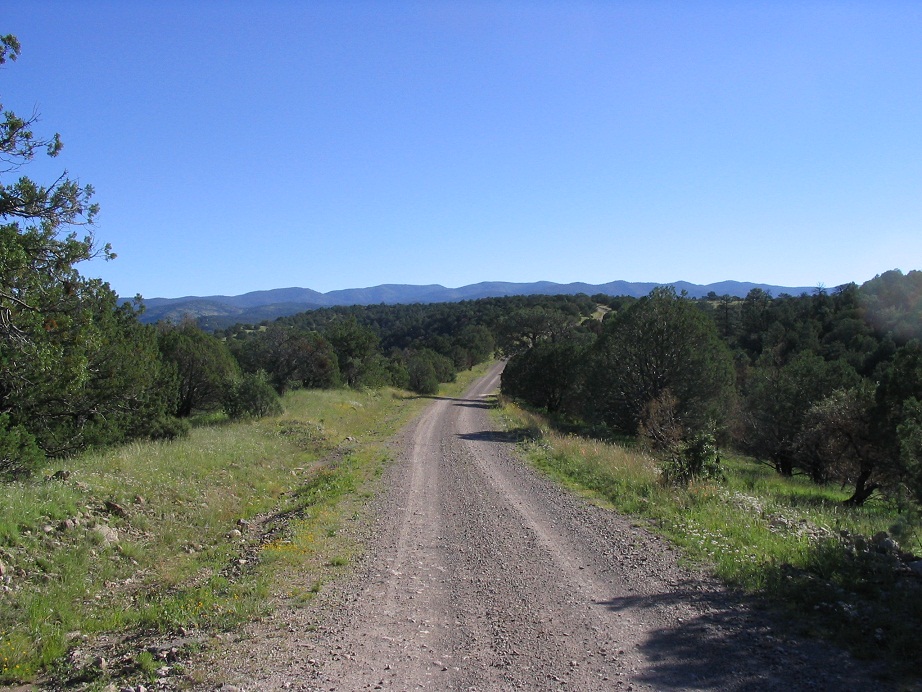
The easiest access to the peak seems to be from the town of Mimbres, where Gila National Forest Road 152 heads east into the range off of highway NM-35 at milepost 12.3, about 5 miles north of the main part of Mimbres. "Easy" is a relative term, as the road is rough and arduous. The road is marked as McKnight Road from the highway, and passes by residences before it passes through a fence grate and onto National Forest land. It gains steeply onto a mesa and for the next six miles is good hardpack. It then drops into a canyon and comes to a junction, roughly eight miles from the highway. McKnight Mountain follows the left fork.
At this point the road becomes rougher, and high clearance 4-wheel drive is highly recommended. For the next four miles, the road is littered with boulders and exposed bedrock forming "steps". While none of it is particularly gruesome, taken as a whole this section goes real slow. Finally, the road tops out at a bend and for the remaining five miles, is in overall better shape, although I kept my truck in 4-wheel drive and never got out of first gear.
The parking area is a cleared section way high up on the main ridge, with positively spectacular views down into the Mimbres Valley below. In many places the road is narrow and frankly, would be impossible for two vehicles to pass, and in many places the drop-offs are nearly a thousand feet down. The drive takes about an hour.
First Visit, September 2000: I was on a three-day circuit of county highpoints in Western New Mexico over the Labor Day weekend. I began the day in Truth or Consequences a day after hiking Mount Taylor and South Baldy Peak. From "Torc", I headed west toward the mountains along highway NM-152, a winding paved route that forced me to go slow. The scenery was quite lovely. I came to the junction with NM-35 and drove through Mimbres and the road to the top. I rolled into the trailhead around 9 a.m. in cool, somewhat unsettled conditions with blue puffy clouds already starting to assemble.
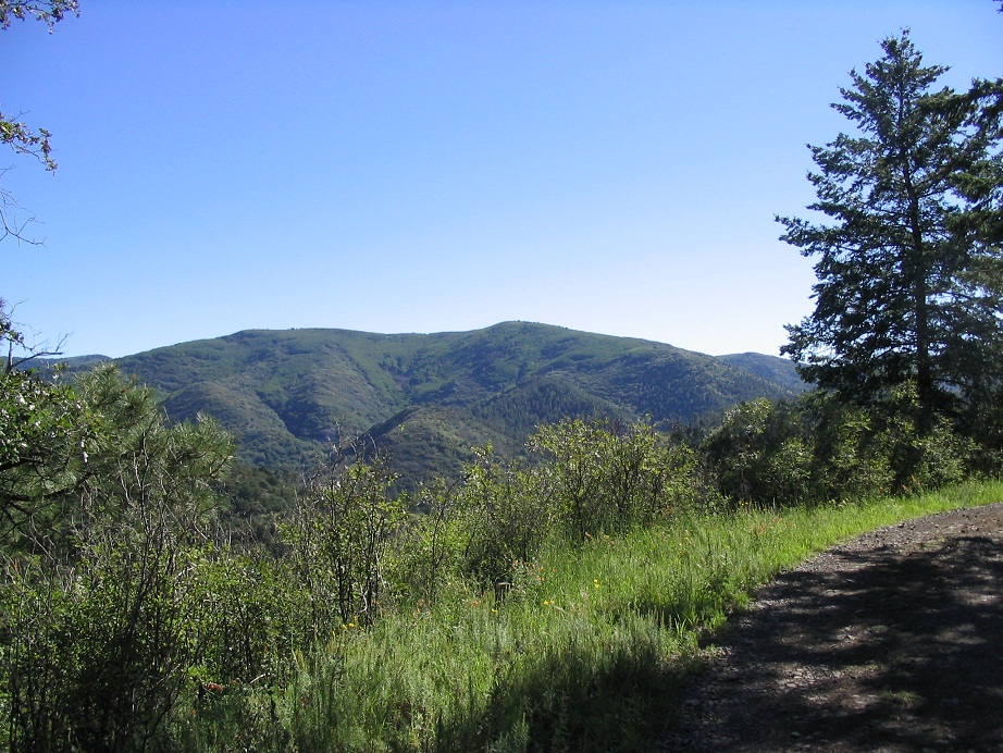
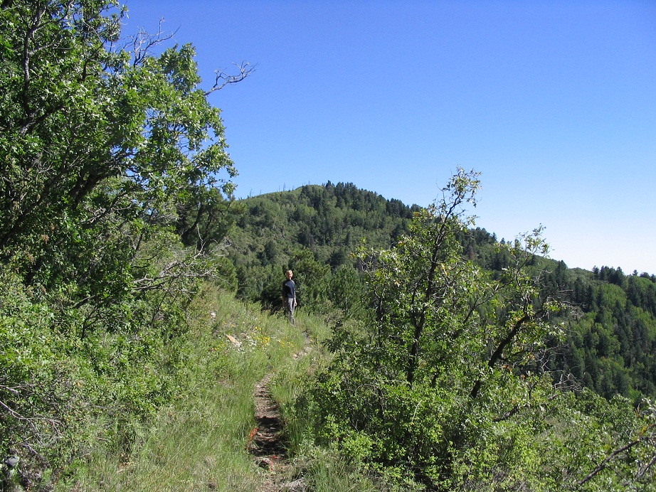
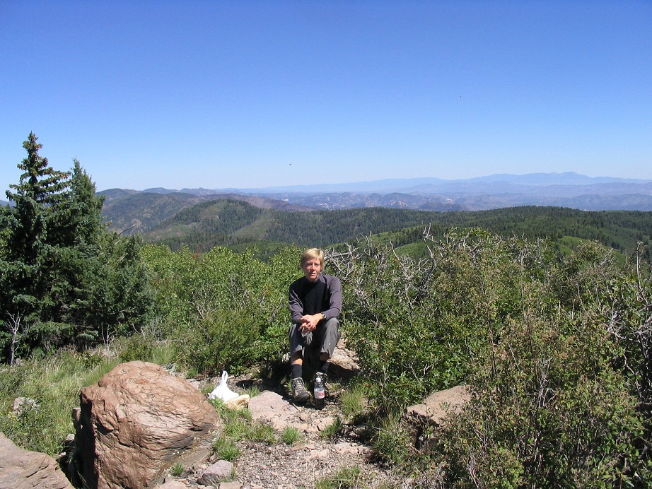
From the parking area, the trail heads north in a glade of aspen and fir. It ascends a small peak (around 9,800 feet elevation), then slowly descends the other side. The trail stays level, contouring around smaller ridge bumps. It's heavily forested and more lush and green, as opposed to the less-dense desert peaks I had been up in the previous days. Soon, the trail gains steeply and then levels off high on McKnight Mountain's west flank. A small marked side trail leads about 100 feet to the rocky eastern summit of McKnight Mountain. The views were nice, mostly to the east. Aspen stands blocked views to the west.
For the western summit bump, I got back on the main trail, went north another few hundred feet to a junction with Trail 82, and turned left. This trail ascended slowly, then leveled. Here, I just started walking up to my right up through the trees along a fence line until I achieved a ridge. Along the ridge, I weaved through the thick trees until I felt I could go no higher. I decided I had "visited" the western bump, and returned to my truck. I had my doubts, though.
Afterwards, I walked out back to my truck and slowly drove out to the main highway. From here, I headed home to Phoenix, but got stopped by The Man near a small town called Buckhorn for speeding. But he was cool and only gave me a warning instead.
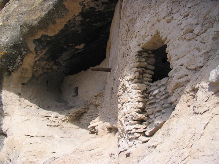
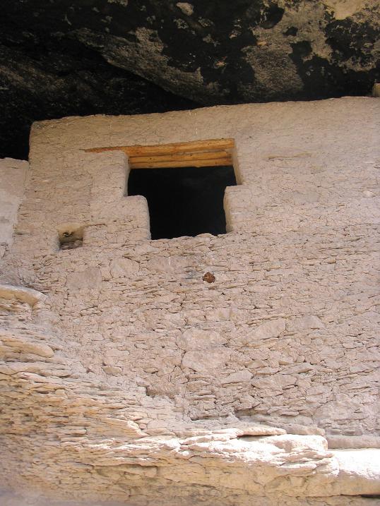
Second Visit, September 2004: When I came through here in 2000 I regretted not staying longer to check out the region. There is much to see in and around Silver City such as the Gila Cliff Dwellings National Monument, plus Silver City, which has a cool downtown area and is home to Western New Mexico State University.
βð and I left home early Saturday morning and followed Interstate-10 to Lordsburg, then NM-90 north about 45 miles to Silver City, arriving about 1 p.m. The weather was unsettled, with heavy clouds the whole way in and rain most of the day in Silver City itself. We did a driving tour of downtown and ate at Jalisco's, a Mexican food place that serves really hot food. By the next morning the storms had moved on and it was starting to be a pretty day, so we got moving and made the 30-mile drive to Mimbres and onto McKnight Road. We went in about 3 miles but the road was extremely slick from yesterday's rains. So we bailed.
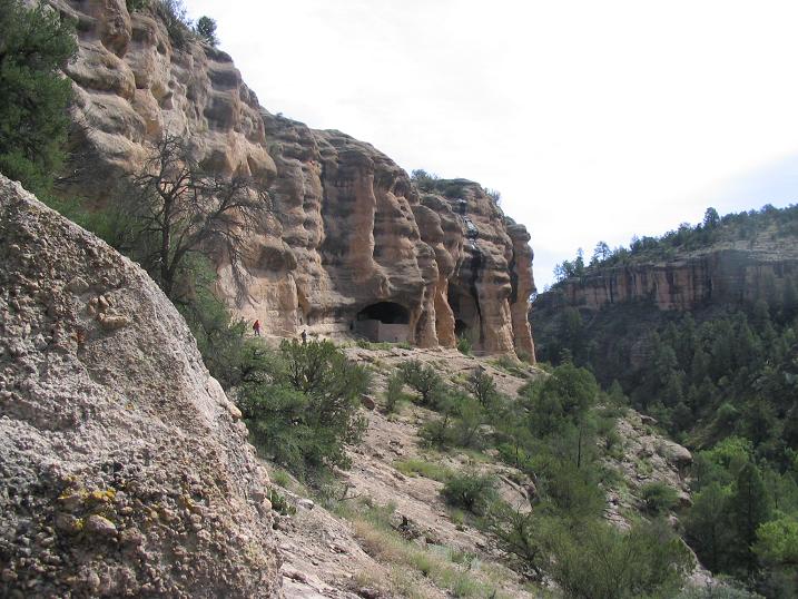
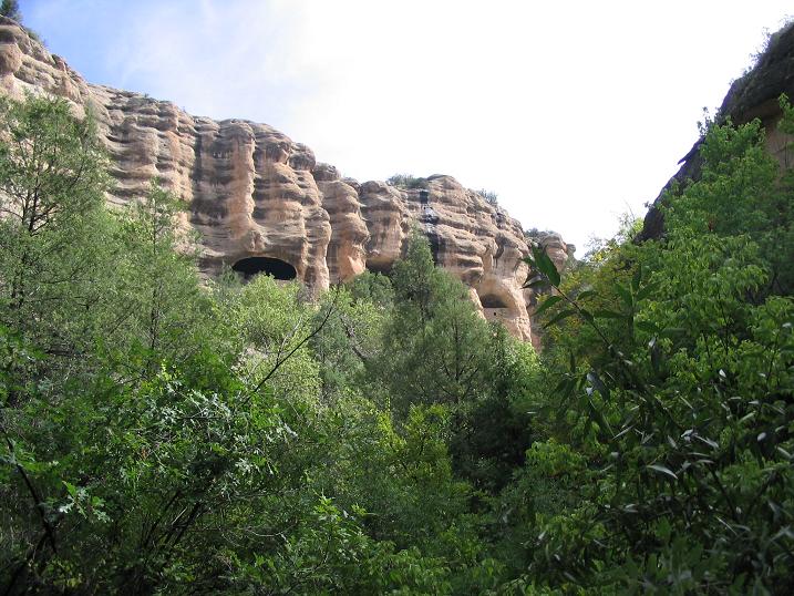
Instead, we drove to the Cliff Dwellings, which were awesome, and also drove up to Signal Peak Lookout, following a forest road to the top where we met with the guy and girl up in the lookout. They were friendly and we talked with them for awhile. There was a "marathon" horse race also going on, and the horseys and their riders were passing through the area as well. We took photos and had an enjoyable visit.
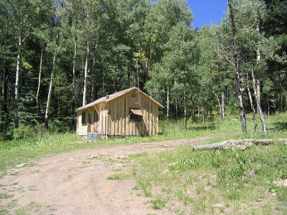
Giving the roads a full day to dry out, we attempted McKnight Mountain on Monday morning, Labor Day. The weather today was clear and dry, and beautiful. The road in was solid and dry, and we bashed 17 miles to the parking area, the uphill journey taking about 70 minutes. We began our hike at 9:30 a.m., and followed the same trail I took in 2000. We reached the first summit in under an hour, and we took a 20-minute snack break here to enjoy the scenery and the millions of lady bugs. Back to the main trail we then set out to locate the second 10,165-foot peak. Instead of following my steps from 2000, we decided to hike a bit farther on Trail 82 to a small rise, then hike due north into the somewhat thick trees. I had my GPS but the tree cover was not likely going to allow it to get a signal. We hiked by reckoning a few hundred yards to the ridge, then west until we topped out on a rounded rise. The trees are thick here and we weren't sure if we were there, or close, the same feeling I had back in 2000. But then we found a rockpile with a register abutting a tree, and figured this must be it. We signed in and started the hike out. The hike out to the truck went quickly, augmented by a side trip to the McKnight Cabin. I felt good knowing that I probably assuredly captured that elusive western summit bump. |
|