The Mountains of New Mexico
www.surgent.net |
| Mangas Mountain |
• Highpoint: Mangas Mountains • Gila National Forest • Catron County |
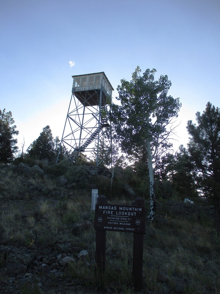 Mangas Mountain Lookout
|
Date: July 31, 2023
• Elevation: 9,695 feet
• Prominence: 1,415 feet
• Distance: 2 miles
• Time: 55 minutes
• Gain: 550 feet
• Conditions: Cool with a clear sky
New Mexico
•
PB
I was returning to Arizona from a few days in Albuquerque. My plan today was to hike a few peaks near Reserve, a little town in Catron County near the western border with Arizona. I already had maps and an itinerary planned.
However, last night, while perusing maps online, I landed on this peak, Mangas Mountain, as a possible destination. Up to that point, I had never heard of it. It had a road to its top, to service a lookout. It was a range highpoint and highly prominent, plus it was on the way to where I was heading anyway. Suddenly, I was interested, so I added it to my agenda.
I left Albuquerque very early, about 2:30 a.m., largely a result of not sleeping well and having an upset stomach. I was up at 2 unable to fall back asleep. Rather than waste time, I packed the car and hit the road. I drove to Socorro, got gas, then to Datil on US-60, then from there followed NM-12 southwest toward Reserve. All this in complete darkness. The barest amount of dawn light began to appear about when I passed through Datil.
On NM-12, I was looking for Mangas Road, which is west of Horse Springs, about twenty-something miles out of Datil. There was more light but it was still very dim, and I really had no clear idea where Mangas Road would be. I just knew it was somewhere west of Horse Springs. At one point, I saw a road and a small road sign so I slowed to read it. It was the Pie Town Road. But slowing down as I did was good because the moment I started up again, about ten elk darted across the road ahead of me.
It was still pre-dawn, where there is just about 20% sunlight. I saw one creature bound across the highway, which prompted me to "suddenly" see about eight more bodies up ahead and off to the side. Then another bounded across. It was essentially invisible until it was directly in front of me. I had the high beams on, but even then, it seems if they are off to the side at an angle, they just appear as a dim black figure, like its hairs deflect the light? Who knows. All I know is that these thousand-pound, eight-foot tall beasts can be so invisible unless a light is shown directly on it. They are remarkable that way. But damn, it makes driving in these pre-dawn hours so nerve-wracking. But on the upside, the adrenaline kept me more awake and alert.
I passed through Horse Springs which is just a couple homes and buildings, then I found Mangas Road, which is dirt, signed for the Valle Tio Vinces campground about 10 miles to the north. The Continental Divide Trail (CDT) passes through here and the Valle Tio Vinces campground is usually occupied by those hiking the trail. It's really the only reason hikers would come here.
The road passed through private rangeland for a couple miles, then onto Gila National Forest land, and for the most part, was a good road. One or two parts, especially near cattle guards, were rough and rocky for some reason. The road gains elevation into the forest, twisting and turning with a canyon then making a couple turns at strategic junctions. I came to the campground after 9.1 miles (by my odometer). About 0.2 mile farther north, I eased right (east) onto Mangas Lookout Road, a sign saying the lookout was 4 miles ahead.
I hoped to drive most of the way up, to get within a mile of the peak, figuring the last portion would be steeper and probably rougher as a result. I drove to a sharp left hairpin turn at 9,300 feet elevation, which was good because this was farther than I expected to get. There is a good pullout here, which I parked in. The road was still a fine road and I could have easily driven farther. But I wanted a sporting hike.
It was just past 6 a.m.., and I was still in the shadows. It was cool but not cold, about 50°. I got a simple pack together and my poles, and started up the rest of the road.
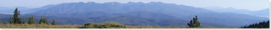
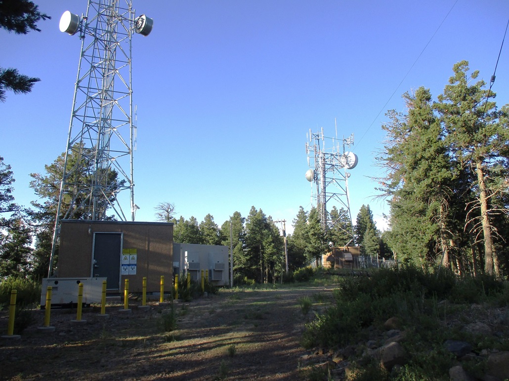
The road makes a northward traverse before bending right (east) and curling around the northern of the two summits of Mangas Mountain. On this northern summit is the Mangas Lookout tower. The road actually makes a long circle around to the east, then south then west again to come to the saddle separating the two summits, which lie about three-quarters of a mile apart.
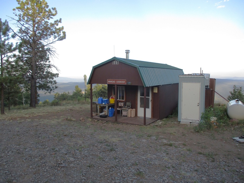
I instead left the road and walked up a steep embankment to a fence, and crossed it, now on an open path to the northern summit and the tower. There's a residence nearby and I said "hellooo" to see if anyone was at home. In moments a guy appeared and he came out to chat with me. I apologized for waking him but he said he was already up. He was fully dressed and was holstering a beefy pistol, a .45 it looked like.
This guy was a real wealth of information. He asked me if I was a CDT hiker since he said he's had about 500 of them pass through this season. I said no, I just like summits and lookouts. He then mentioned that where I came up the road, there's a bear that lives nearby. He also pointed out where there's a mountain lion he sees regularly, then pointing toward the southern summit, a mama bear and a cub who live in a den below the road a little bit. He said he had to hole up in his residence all of one day recently when he saw the cub in a tree nearby. He did not see the mama bear and had no plans to. He said he stayed inside until the cub was gone.
All of this was quite interesting to me. Two grown bears and a cub, plus a mountain lion, all nearby? Oh my. I guess I shouldn't be surprised. I'd seen a bear near Springerville a few days ago and this is bear country. But suddenly, I was on alert again. I had a can of bear spray ... but in my car. I told the guy where I was headed and he said I'd probably be fine if I made noise. He explained that he's had "500" or so CDT hikers come through with no attacks. I had to play the odds. I know that I've probably hiked right by fifty bears in my years and never knew it.
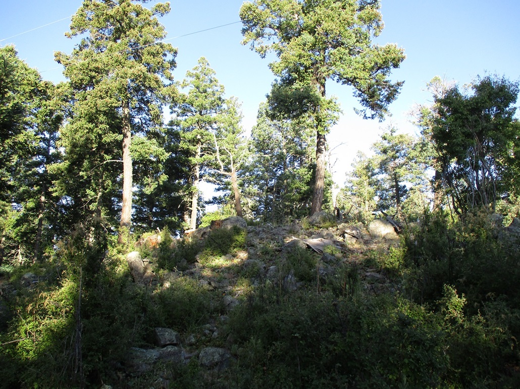
We talked for about ten minutes. I then scampered up the small hill to the tower, then walked up two flights of stairs for an elevated view and a couple of images. The highest rocks lie nearby and are probably piled as the result of the clearance of the pad for the tower. Nevertheless, I tagged the highest one.
I then walked back down and thanked the lookout for being so helpful, and started walking down the road toward the saddle, about a 180-foot drop in a little over a quarter mile. I banged my poles repeatedly together and shouted "hey bear", and moved quickly. I saw no bears and was happy about that.
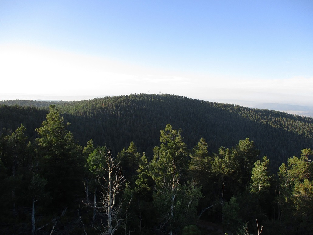
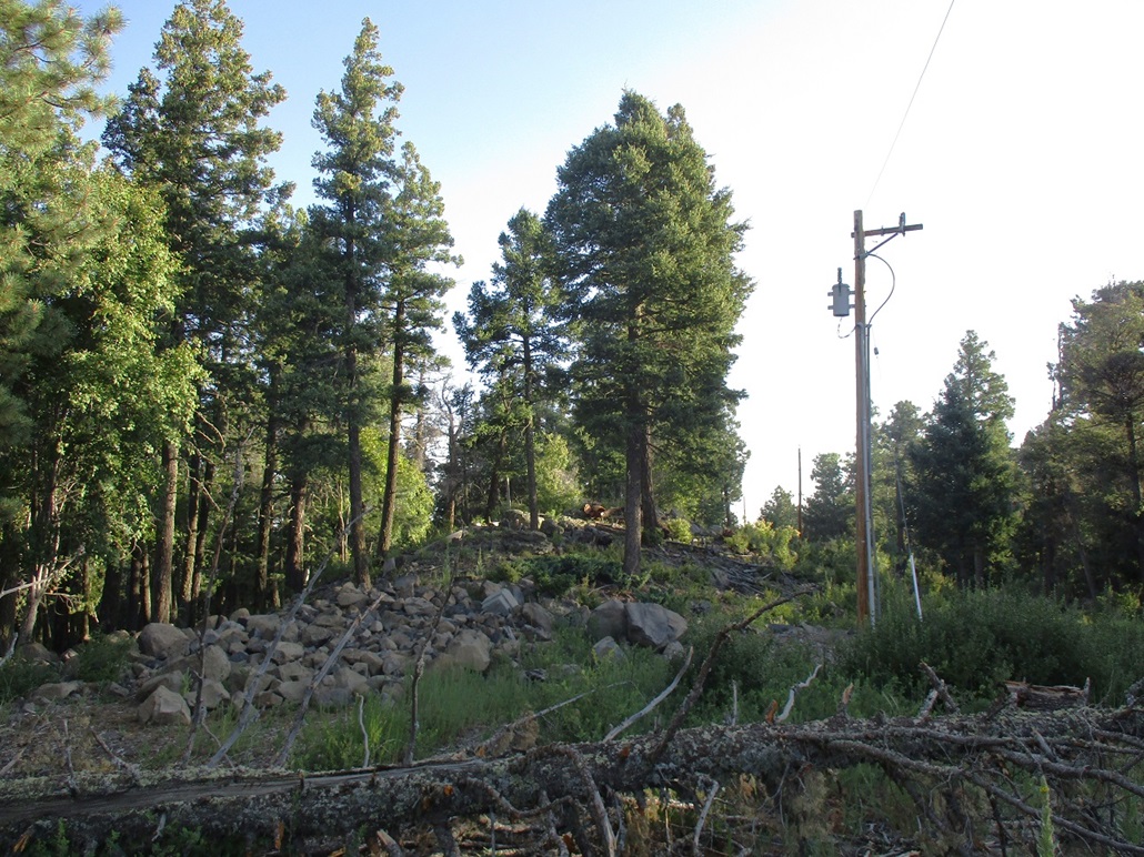
At the saddle, a gated spur road then leads to the top of the southern summit, which for now is the presumptive highpoint. I walked the road to its top, where there are towers. I then walked to some rock outcrops beside the road, which are the highest points, and tagged the contenders. These appeared to be natural heaps, not the result of a bulldozer.
The maps say that the south summit is 4 feet higher than the north, but the north summit's highest rocks are a few feet higher than the benchmark there, so that it's possible the two summits are a dead heat in height. In this case, it's best (and easy) to tag both.
I didn't linger, wanting to be back to my car as soon as possible and avoid any bears. The lookout man said there's a path that starts at the saddle and heads down through the trees back to the road, saving me about a mile of walking. I found what we was talking about, but there was no path. It's been reclaimed by nature. So instead I just busted downslope through the brush, trees and downed logs. This worked very well and I was back to the road quickly, and my car moments later. I had covered about 2 miles total in slightly less than an hour.
I was very pleased to be successful on this peak. Yes, it was an easy peak, but for me, only learning about it about 12 hours earlier, it was a small but sweet victory. I got a range highpoint and a thousand-footer prom peak in the books, all in less than an hour of hiking. I'm glad I took time to peruse maps last night, but truthfully, that's pretty much all I do, when not seeing how the Dodgers are doing.
I did a quick change but did not stick around longer than I had to. I got in the car and started down, retracing the roads back to NM-12. Counting the driving, this side trip took about two hours. It was still early, about 7:30, so I was on schedule. I proceeded west toward Reserve and more peaks west of Reserve in the San Francisco Mountains.
|
|