The Mountains of New Mexico
www.surgent.net |
| Cookes Peak |
• Highpoint: Luna County • Highpoint: Cookes Range |
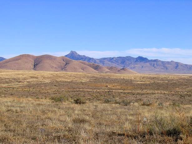 As seen from near City of Rocks (Nov. 2006)
|
Date: April 11, 2004
• Elevation: 8,408 feet
• Prominence: 2,568 feet
• Distance: 5 miles
• Time: 4 hours
• Gain: 2,400 feet
• Conditions: Low clouds, rain, snow and graupel higher up, and lightning. Otherwise, dandy
• Teammates: Edward Earl
New Mexico
•
PB
Cookes Peak lies in southern New Mexico, north of the city of Deming. From a distance, the summit appears as a slightly-skewed pillar of rock, and it would appear that it may require rock-climbing gear and skill to surmount. In reality, the climbing is gentle. The biggest challenge is getting close to the peak because of surrounding private lands, and the brush down low once there.
I have passed through Deming too many times to count, on the way to and from Texas, either alone or with βð, whose paternal side of the family has roots in the area going back to the 1800s. Once, we stayed in town and then visited the Luna County Historical Museum. When she mentioned her last name, they immediately knew of her great-uncle, a long-time publisher of the city's newspaper. Some of her old-time relations still live in the county.
For this trip, it was just me. Adam Helman and a bunch of others were in the area, climbing peaks, all of us with varying agendas. Adam, being the master organizer he is, somehow drew up a schedule so that we could all pair off as needed for peaks of common interest.
I drove to Lordsburg Friday after teaching and met with Adam and one other, as we camped and hiked *Ahem* Peak way south of Lordsburg. The weather was unsettled all over the region, so when I left the area, it was raining. I was to meet Edward Earl and Dave Covill at the Rancher's Grill in Deming, where we'd discuss the climb and make arrangements with the main landowner to allow us past one inholding. Dave had climbed the peak today, and Edward and I would climb it tomorrow. We had a hearty meal and talked about the peak. The plan was that Edward and I would drive somewhere near the base of the mountain and car-camp. However, the rain was so heavy, we decided to get one of those cheap $30-per-night hotels in town instead.
The next morning comes and the rain has stopped, but the cloud ceiling is very low, about 5,000 feet. It is gray, grim and very wet, not inviting at all. Frankly, I would have cancelled the hike on the spot given the conditions, but we had to weigh that against having permission for this one day by the landowner, plus Edward's desire to hike it since he does not live close to the region. So we piled into my truck and drove toward the peak. I was certain we'd get to some point and have to cancel.
From Deming, we went north on US-180 for a mile, then northeast on NM-26 for 14 miles to County Road A29 on our left. The county road was gravel and "grabby", the previous night's rain making the dirt sticky and slick at the same time. The first six miles was solid. We went another six miles up this road, now a notch worse in overall condition, with yesterday's rains not helping much. I skidded and lurched up this road, fishtailing in places, until we reached a gate. Beyond the gate is a small corral used by the local rancher, but beyond this pen, the road continues and is on BLM land again.
The rancher had given us permission to pass through the gate. We were on his property for just 100 feet before passing the second gate back onto public land. The road hereafter was much rockier, necessitating 4-wheel drive, but the rocks were more stable than the slick mud we had coming up. I coaxed my truck up another couple of miles, parking in a clearing near the junction of an old side road that headed west into the range, our elevation 6,000 feet.
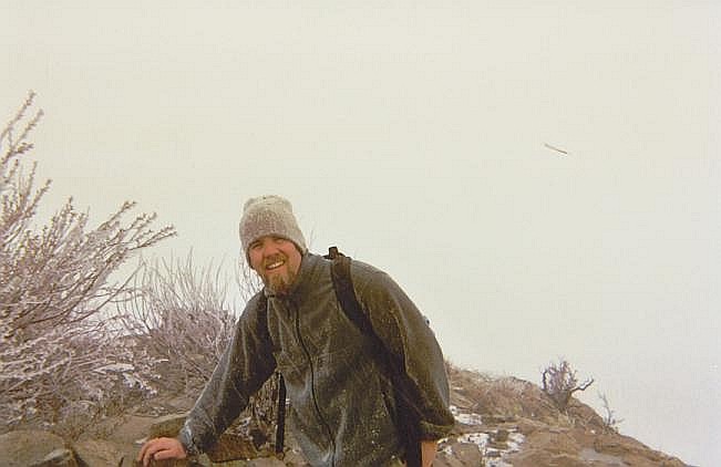
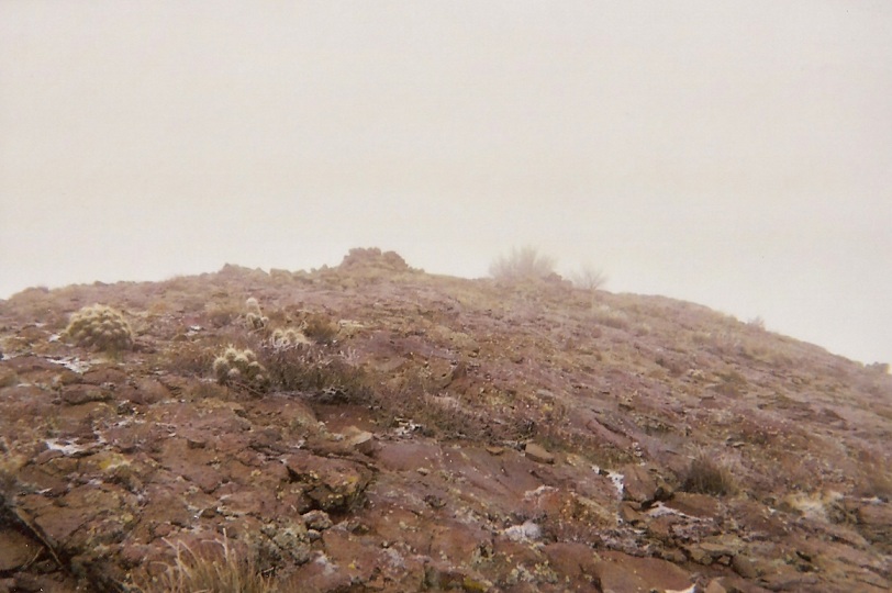
The weather was cool, gray, with low clouds. The whole scene was ominous, but so far, no more rain. Temperatures were in the 40s and there was no breeze. What we could see was gorgeous: high desert scrub and succulents, lots of yucca, canyons and rocky mountainous ridges. An old mining town sits a few miles up the "main" road from here but we did not explore that way. Cookes Peak itself was hidden in the clouds. We started our hike at 8 a.m.. Given the conditions, I held little hope of success.
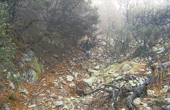
We followed the old road into the canyon, first up the bajada slopes of open rock and low brush, then into the heart of the canyon where the walls grew close and the brush thicker. The road would switch sides, crossing into the drainage periodically. We were on this road for less than a mile to where it comes to a sharp left turn. We knew from previous visitors to leave the road here.
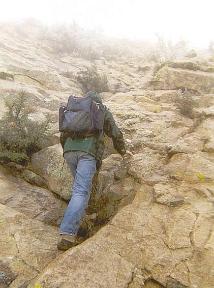
We continued up the steepening canyon in a southwest bearing. The canyon bottom was mostly open and free of the heavy brush, so we made good time. Whenever the canyon would split, we stayed left, and in time, the slope steepened as we approached its headwall. It was now time to venture out of the canyon and onto the the brushy slopes and gain the upper ridges.
Dave Covill had described a set of switchbacks that leave the canyon bottom and ascend the ridge, topping out near the knob shown as elevation 7,402 on the map. Try as we might, we never found these switchbacks. We did, however, find about three or four "trails" that angled up the hillside and that at first seemed solid, but each time they'd degenerate into thick brush. These were game trails, nothing more.
In the process of looking for the alleged switchbacks, we lost time, but not too much. Finally, we gave up on looking for the switchbacks and made our own way up to the ridge, hiking over rock piles and moderate foliage to gain the top of the ridge. A GPS reading put us a bit southwest of Knob 7,402.
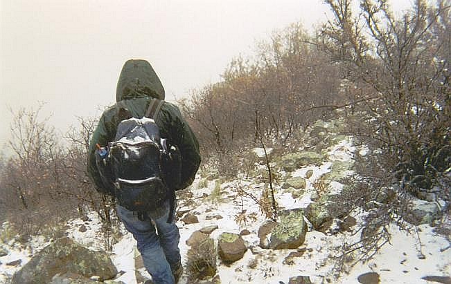
We then hiked southwest along the spine of this ridge, blazing a path through the man-high brush and trees. We made steady uphill progress, then surprise, found an obvious man-made trail which expedited our progress substantially. This trail put us on the principal southeast saddle below the peak. Covill also said we'd find red yarn tied to tree branches and a fence line, which we did, and we followed these. Bear in mind, we still had just about 30 feet of visibility in the thick fog. It was good to know we were in the right place.
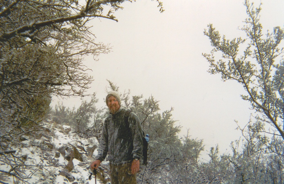
We trudged up the steep slopes, following the yarn bits. Then the weather went to hell. Rain fell, and at this elevation it was cold enough for it to become sleety, or at least a graupel mush. In any case, this motivated us to move quickly. We were soon at the base of the summit rock fin. Fortunately, the rock lies back enough so that the slopes aren't treacherous when wet. Still, we moved with care.
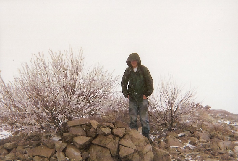
We climbed up a natural line, following clefts and ledges as we found them. We gained about a hundred feet quickly, then were on the last easy slope toward the top, now just a stone's throw away. We couldn't see more than a dozen yards, and the rain fell moderately. Then ... CRACK ... BOOM! Lightning. Sonofabitch. We were exposed on the ridge, sitting ducks. We bolted to the summit rocks, got one or two lousy photographs, then ran our asses back down off the rock and into the relative safety of the brush and trees below.
Fortunately, that was the only lightning strike we saw (or heard). The rain had now turned to snow. We were back on the "good" ridge trail, and when it turned to descend into the canyon we followed it, hoping it would stay good, which it didn't. It just petered out into the brush. We chose to descend directly down the slope, no longer trying to locate paths, the worst obstacles being a few crumbly cliff bands, 6-8 feet high at worst. The snow was sticking but not accumulating in any great quantities.
Actually, the snow was falling slowly, there was no breeze and all things considered, conditions weren't too bad. The snow made our footing a little more surer, as we could usually smoosh our boots into the snow and it would usually hold. Quickly we were in the canyon bottom, which we followed out to the road and back to my truck, arriving at 12:30 p.m. The snow line was at this elevation as we could see a distinct line of snow in the terrain. We didn't waste any time starting the drive out.
Then things got even more interesting...
The rough and rocky mountain track back to the corral was not too bad. I had the truck in 4-wheel drive and just eased over the rocks, which offered solid traction. Back at the corral, we passed through the gates and then back onto the main road again, which was now a wet and messy sand-and-clay slick. I had almost no traction. I would apply a little gas and feel the wheels spin. We might advance a few feet, rotating a little bit along the way.
The only saving grace was that we were off the mountain and on a broad sloping desert plain, so that there was no danger of sliding off the road and down an embankment. But there was a danger of sliding off the road and just getting stuck in a ditch. With a little trial and error, I learned that if I had the truck in 4-wheel low, and let it inch forward, we could keep to a line with minimal yawing. Sometimes, we'd get to a section where we could gain some speed, only to come to a big mudpit, and hope that I had enough momentum to get through it. It was torturous.
I came up with a clever solution. The road grader had pushed up a berm of rocks on one side of the road, so I eased one side of the truck onto this berm, which offered much better traction than the road. I was able to inch us forward at about 5 to 10 miles per hour, all the while at a severe side-ways lean. All of this combined to require an hour to drive out this road, which, under normal circumstances, might take 15 minutes. We were damn happy to be back on the paved highway, and a little amazed we had been successful today.
The drive back to Deming went quickly. Soon, I dropped Edward off at his car, shook hands, and then started my long drive back home. Driving out, the clouds had parted enough to reveal a whole new mantle of snow on the Cookes Range. I still could not believe that we had just been up there not two hours ago. I was not sure if I was brave or stupid. Probably a little of both.
The storms had caused some trouble on the road. A big rig was laying on its side near Willcox, Arizona, and some stretches of highway out this way were covered in hail or snow mix. This surely was the last big storm of Spring as usually by this time of year the temperatures are starting to rise. It can be as high as a hundred degrees this time of year.
For some excellent photographs of Cookes Peak in clear, dry conditions, please check out Gerry Roach's fine report: Cookes Peak. The east face of the peak looks quite intimidating! It also shows the scrambling sections nearer the top. Despite the seemingly severe exposure, the rock is solid, it lays back well and is actually very nice, easy scrambling.
|
|