The Mountains of New Mexico
www.surgent.net |
| Chicoma Mountain |
• Highpoint: Jemez Mountains • Juan Jose Lobato Land Grant • Rio Arriba County |
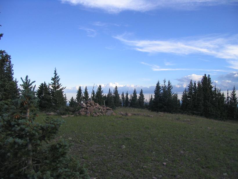 The summit, 7 p.m., August 11, 2007
|
Date: August 11 & 12, 2007
• Elevation: 11,561 feet
• Prominence: 4,281 feet
• Distance: 7 miles
• Time: 8 hours
• Gain: 760 feet up, almost 1,400 feet up on the "descent"
• Conditions: Nice, then slightly stormy, the calm and a lot of darkness
New Mexico
•
PB
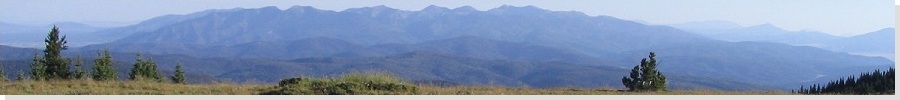
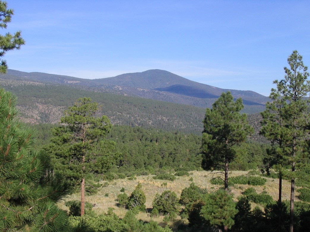
Chicoma Mountain is the highest peak in the Jemez Mountains, northwest of Santa Fe in northern New Mexico. The Jemez Mountains are arranged in a roughly-circular shape, with its main peaks, ridges and canyons arranged in a radial pattern, all emanating away from its center and ancient caldera, the grand Valles Caldera. The landscape is stunningly beautiful. The Valles Caldera, for 140 years a private ranch with its roots as a 17th-Century Spanish Land Grant, is now protected as the Valles Caldera National Preserve, managed by the United States Federal Government. Nearby Bandelier National Monument exhibits some of the amazing canyon and cliffs of the area, while much of the rest of the region falls under BLM, state, Indian and private control.
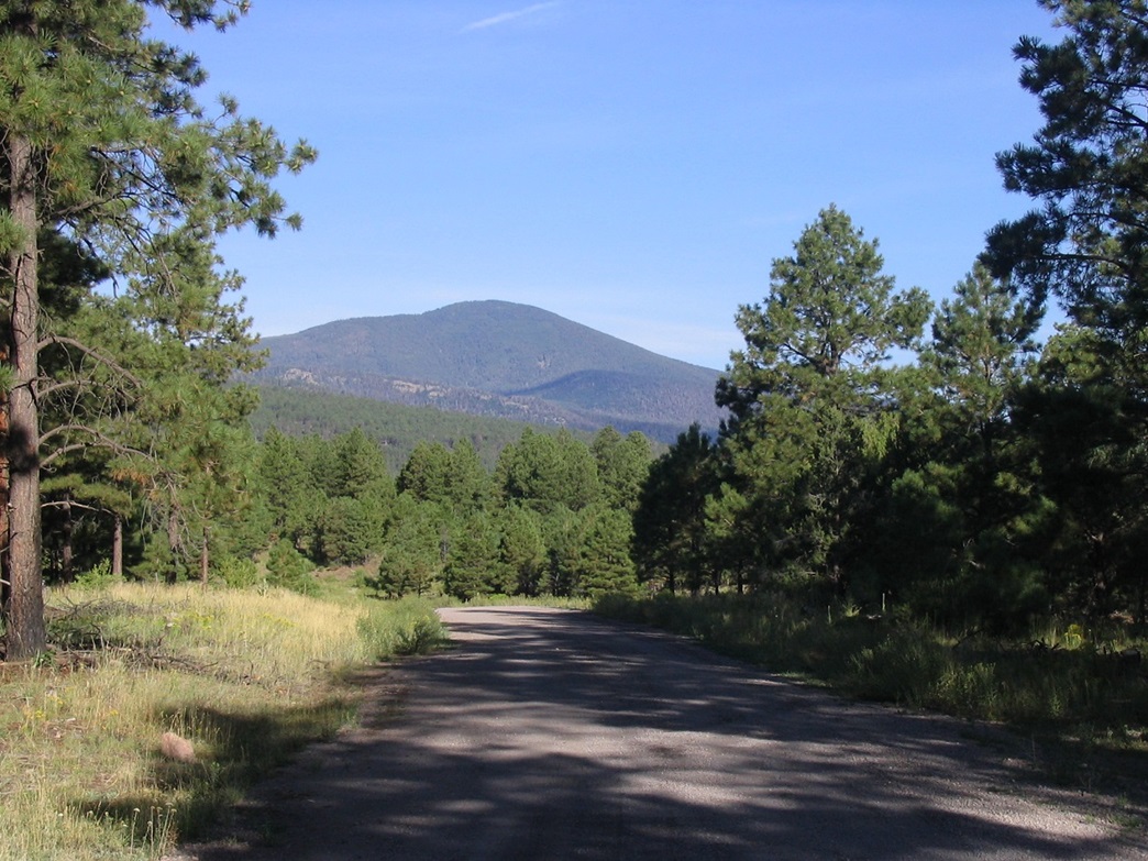
Chicoma Mountain rises to the north of the Valles Caldera, visible from the city of Espanola about a half-hour north of Santa Fe. Access into the range is via Santa Fe National Forest Road 144, which starts in Espanola off of highway US-84, just north of Fairview Road. Chicoma Mountain is roughly 25 miles from Espanola along this road, reaching a highpoint of 10,800 feet north of the summit. Thus, a hike to the summit of Chicoma Mountain is fairly short, starting at this 10,800-foot point. This was my plan.
I was on the end of a six-day tour of New Mexico in which I had climbed five other peaks, saving mighty Chicoma for last. I viewed Chicoma as a fine way to end the trip, with a short hike of a couple miles all that was needed to gain the top. I came into the area from the north, after a camp and hike of Cerro Vista earlier today. I arrived in Espanola about noon, but I chose not to drive toward Chicoma just yet. Storm clouds had developed, so instead, I killed some time in Espanola and Santa Fe, playing tourist for a few hours and catching a movie. Around 4:30 p.m. the big storms seemed to be breaking up, so I started north and west, planning to drive all the way in to Chicoma Mountain and find a spot to camp for the night.
The drive up Forest Road 144 is scenic, and the dirt and gravel road is well maintained. From Espanola, the road works its way up some hills to top out on a broad elevated bench of pinon and juniper woodland. It then turns north then west again as it contours across the south face of Santa Clara Peak. The road is good here, but narrow. Roughly half-way in, the road improves a little and enters into higher-elevation forest, and Chicoma Mountain is often in view for the remaining 12-13 miles. The road twists and turns on the east slopes of Chicoma Mountain and finally achieves its highpoint, as mentioned before, at 10,800 feet directly north of Chicoma's summit.
I pulled into a small pullout near a cattle-grate and fence at the Forest Boundary, and parked. It was 6:00 p.m., and the storms had nearly cleared entirely. This was unexpected, and I immediately considered hiking the peak now, then returning to my truck to camp. I figured I had sunlight until about 8:30 p.m. at the latest, and the hike shouldn't take me more than 90 minutes at my usual pace. Conditions were magnificent and I was drawn to the idea of a late-afternoon/dusk hike of the peak. Obviously, I was taking a chance by starting so late. Furthermore, there is no trail from where I started. It's a straight-shot up about 750 vertical feet of heavily forested slope, but only about a mile. My pack consisted of some water (two 500 ml bottles), no food, a jacket, a map with waypoints, my GPS, a compass, a flashlight, some extra batteries, my cell phone and my wallet. I started up the slope at 6:25 p.m.
At first I followed the fence line, hoping it might go all the way to the top, but the fence stopped after just a few feet. I continued straight up the slope. It was steep at first but then the gradient lessened. There were some sections of downed trees and even one small meadow, but by and large it was heavy dense forest cover the whole way up. Toward the top I found some small blue ribbons tied to tree branches. These seemed to go where I was headed so I followed them. Sure enough they led me to the top. By 7:00 p.m. I had summitted Chicoma Mountain, entering onto its bare summit and walking to the large cairn at its very top. The sun was low in the west, and it lit up everything in a beautiful dusky glow. I didn't stay long, just long enough for a photograph. I tagged the cairn then immediately turned right around to retrace my steps. I was confident I could find the ribbons again, and in my haste I didn't take a compass reading.
Walking down the slope, I didn't immediately find the blue ribbons, but I was not too concerned. Looking at the map, the road cuts all the way across the north slope of Chicoma Mountain. All I had to do was descend on any north bearing until I hit the road, from which I could walk back to my truck. The only rule I had was to not veer too far west on the hike down, since I could potentially find myself deep in some canyons away from the road if I went that way. So I descended, walking briskly down the slopes and making very good time, all the while assuming I was heading north.
I had descended about 400 feet in 15 minutes when I came upon some cliffs. These were unexpected, so I adjusted my route and veered to my right, thinking I was angling slightly east of north. As yet I had not taken a compass bearing of my travel and was assuming (incorrectly as it turned out) that I was trending mostly north when in fact I had come off the summit on a more east bearing than I intended. It was 7:20 p.m. and I still had about another hour of usable daylight left, so I wasn't too worried but I was starting to get concerned. Nothing was looking quite right, and I kept running into steep rocky cliffs, constantly forcing me to re-adjust my track. In doing so I almost always veered right, each time thinking I was veering more east when, after about four or five "easterly" adjustments, I was veering more to the southeast now.
After almost 45 minutes on the descent, I knew something was seriously amiss. Given the time it took me to ascend, my descent should not have been longer than my ascent time. I was utterly confounded by the absence of the road. Based on my descent rate and my presumed north bearing, I should have hit the road twenty minutes ago! Finally, at yet another cliff band I stopped and brought out the GPS unit. In the thick tree cover it took awhile for it to lock in on satellites and I grew impatient. Sunlight was waning and I made the foolish decision to put away the GPS and start moving again, figuring the road had to be somewhere down there.
With the remaining 15 minutes of dusky light, I descended more, thinking the road was nearby. I daresay I dropped another 500 feet in this time. I was very worried and upset, and it was apparent that I was lost. The acceptance of this fact was very bitter to me. True black of night would be here in minutes, and I had lost my gamble. I finally did something smart and sat my ass down in a small clearing and forcibly calmed myself. It was nearing 9 p.m. There would be no moon so I would have near-total darkness tonight. Fortunately the skies were mostly clear. Some lights of a city could be seen. Given I was now completely turned around, I did not immediately pick up on the fact I was looking at the lights of Espanola, east of me. This would have been useful had I realized it, but I didn't.
I sat in the clearing for 30 minutes and assessed my situation. I had to consciously keep myself calm, as the urge to panic and run was still there. I thought of βð. I looked around my area and got to thinking about a shelter. I brought out my GPS and this time, with all the time in the world available to me now, let it sit until after 10 minutes, it locked onto enough satellites to give me a position. My map was a poorly-copied topographical map from the web lacking a UTM grid or any lat-long scaling, but I had fortuitously written in some UTM positions for points along the road.
I also got out my cell phone with its low battery, and surprisingly, it had a signal, barely. I decided to swallow my pride and called the Espanola 911, letting them know of my situation, giving them my UTM position too. They would contact the New Mexico Search and Rescue, to be put on standby. From my own experience in SAR, I knew they would not be here for many hours at a minimum. I was in good shape and I had enough gear to keep me warm for the night. I was going to have to gut this one out. I sat and rested in the quiet forest, and it was peaceful. A small storm cell dropped a little rain for five minutes. I stayed dry by huddling under a big tree. Otherwise it was a clear, starry night, temperaturess in the 40s and 50s. After an hour, nearing 10 p.m., I decided to get moving, to right this serious wrong.
The UTM I had written on my map was for a point on the road with the junction of the old trail to Chicoma's summit, a trail that no longer exists due to downfall and no maintenance. I entered this UTM into my GPS and used it as a waypoint, and was surprised (a) where I actually was and (b) that I was less than an air-mile to this point on the road. I had descended 1,900 feet down the southeastern slopes of Chicoma, deep into Gallina Creek Canyon (with a nearly unobstructed view east into Espanola). I was nearly two miles from my truck, going by a straight-line distance. I have to admit that I was shocked how far off I had gotten myself, and appalled, too. I wasn't too pleased with myself at this very moment, to say the least. That was an understatement.
The road waypoint was about 0.9 mile to the northeast, about 20 degrees off true North. With my compass I took a bearing, followed north, walked around some trees and after five minutes, re-assessed my position: I had knocked off 4/100ths of a mile to the road waypoint. Woo hoo!! But at least this was progress, so I kept at this for awhile, going very slowly, each time trimming the distance off little bit by little bit.
After 45 minutes of this, my phone rang. It was Mr. Peter Dickson, the incident commander for NMSAR, based in Los Alamos. He had been apprised of my situation by the Espanola police. I told him what I was up to and he confirmed that I was on a correct path. We agreed to talk again once I found the road. In the meantime, he'd keep his team on stand-by. I thought this was fair. Heartened by this talk I charged up the slope fairly fast, gaining 300 feet to re-meet with the main ridge once again, knocking off about 0.15 mile in the process. By now I was still a half-mile from the road, and it was pushing 11 p.m. You'd think salvation was close at hand...
I was on the main east-west trending ridge of the range, east of Chicoma's summit. The old trail should have run through here somewhere, but I never saw any trace of it. Instead I saw (with my flashlight) some of the most dense and dreadful tree downfall I have ever seen. Whatever storm did this must have been a monster! The last half-mile to the road was spent dodging all sorts of trees on their sides, often needing to walk around them, climb over them or often, under them. Each variation in my travel needed to be re-checked since it was so easy to get off my bearing.
I was also concerned about spooking some big animals, such as bears. However I was making so much noise I think I scared off every creature in the county that night. Clambering up, around, underneath and across big rotting giant trees on their sides was very tedious, slow-going, messy and frustrating, and often I slipped, fell or bashed myself into branches and trunks and all-else. I was doing all this with a small flashlight to guide me.
Finally, I barged through one set of trees and there it was, the effing road. It was now 12:30 a.m., and I stumbled onto this glorious hardpack and sat there like a zombie, so grateful to be out of the forest. It didn't matter to me that I was still over 2.5 miles of meandering road to get back to my truck. The thrill and joy of extracting myself from the forest was wonderful. However, try as I might, I had no signal to call Peter. I sat for awhile and even contemplated snoozing on the road and walking back in the morning light, but I got cold and bored fast and figured I might as well get moving. So I did.
I was so tired, I walked like a stumbling drunk, lurching forward and doing all I could to move in a straight line. I got into some sort of a rhythm and after 10 or 15 minutes my phone beeped: a text message from Peter. I was in one of those random spots with a signal so I called him and gave him my updates. I did not need rescuing any more, but I have to admit I had some doubts if I had the energy to actually make it back to my truck, the 2.5 miles seemed like 25 in my head. I was forever grateful when Peter, without much debate, announced he was coming up. I could not express my appreciation enough. Realistically, though, we were looking at three hours for him to get to me. After hanging up I resumed my slow walk up the road to my truck. By now, tired as I was, and also very thirsty, I realized that things were not dire at all. The weather was quite pleasant, I was on a road and worst-case, Peter would help out if I couldn't make the final walk back.
My flashlight by now had died, so I turned it off and after allowing my eyes to adjust, I realized I could make out the road with just the dim starlight. There was no chance of me falling off any cliff, as the road was wide and bermed and the slopes very gentle. I just kept walking, taking breaks every twenty minutes, some breaks stretching to twenty or thirty minutes as I rested and even dozed. Mentally, I was a blank. My mind was thinking about nothing. Only after a couple hours did I think to look at my GPS again. I had also entered my truck's parking position in as a waypoint, and I was truly shocked (in the good sense) when it said the truck was only 0.04 miles away, in other words, about 250 feet. I brought out my keys and pressed the unlock button and stupidly laughed when I saw the lights all turn on. Holy freaking smokes I was that close! It was 2:45 a.m., over 8 hours after setting out for my hike, I was back to my truck. I had made it. I quickly changed into drier clothes and got some drinks.
Peter came rumbling up at 3 a.m. exactly. I was elated to see him, so very happy and thankful that he had come up to assist me. I apologized for my stupidity on the mountain and he would have none of that. He was extremely nice and we spent about a half-hour together. I gave him a full account of what I had done, filled out some paperwork, and did a quick self-medical check. Once he was satisfied I was good to go where I was, he got moving back down the road. Although I had essentially performed a self-rescue, I must give considerable thanks to him and his team for being on stand-by to help. It was knowing that I had them in a worst-case scenario that I think helped me summon the energy for the hike up the last few miles to my truck. I was very nearly convinced I didn't have the energy to do it.
I stayed awake until almost 4 a.m., partly out of adrenaline. I slept for about 3 hours in the bed of my truck, by which time it was daylight again and some other vehicles were rumbling up the road. I decided to pack up and drive down the road into Espanola. There, I stopped for a breakfast and texted Peter I was down off the mountain. I also received a text from Beth, who reported that she had stayed up the whole night, working off nervous energy for some "unknown, unidentifiable reason" (her words). I texted that I was safe, down, and "had a story to tell". My cell phone had no more juice afterwards.
I spent the day driving back to Arizona, taking a detour through Zuni Country, eventually spending the night in St. Johns, Arizona. There (and after I had re-juiced my phone), I called βð to tell her the whole story, and she told me hers, and that she had had some gut feeling "something wasn't right". I told her that I had concentrated my thoughts on her when darkness fell, that it had calmed me when I needed to be calmed. Although separated by 500 miles, I believe her "positive vibes", for want of a better term, really helped me through this situation.
Back home in Chandler the next day I gave another full account. By this time all the adrenaline had worn off, and I had a long proper night's sleep too. All the little injuries were now obvious. I had two big gashes on my legs from the tree branches, a big blister on my foot, and pulled muscles in my left quadriceps muscle. The emotion came forth and I broke down, realizing now just how lucky I had been and how lucky I am now.
I freely admit I made very serious errors in judgment. This experience was humbling and chastening to me. I am not proud that I got lost, but feel fortunate I had the proper tools and know-how to use them to extract myself. I feel like I was taught some serious lessons. What follows are my thoughts of my hike:
• I should have taken a bearing immediately when on the summit coming down. I have always had a strong sense of direction, which I have grown reliant on over the years. But in this case, it failed me completely. In the thick forest all visual cues were the same, and I led myself astray.
• I should have stopped sooner when I realized something was not right, and been patient about pegging my location and taking a bearing. As I said above, I gambled and stayed moving, against better judgment. I didn't feel like I was panicking but in retrospect, I had to have been. How else can I explain that I descended 1,900 feet (when my truck was just 750 feet down the slope)? How else can I explain that I did this for over an hour?
• I was so shocked to see where I was on the map. So much so that at first I refused to believe it. I felt the GPS was in error. The compass pointed properly but I didn't believe it at first either. Even after knowing I was lost my gut still felt I should head "that way", the direction I had been traveling. I had to consciously force myself to abandon my gut feeling here and trust the compass. The compass has no brain, it never lies. It just knows north.
• It is so easy to lose bearings in the trees. Even when I followed a bearing, I would sometimes correct to get around a downed tree or rock, then find that I was now hiking literally 180 degrees off my intended bearing. I had turned myself around. Even when conscious of my need to stay on track, it was so easy to get off track.
• Be calm and rational. In retrospect, I had a lot going for me: I had all the proper gear items, I was not injured, and the weather was mild. I had many years experience in the mountains on my own, plus seven years with Maricopa County SAR, so I had all the right training. I just had to calm myself down and use it.
I made a lot of grievous errors on this hike, and for an hour or so, acted stupidly and foolishly. This was a first for me, and it was a terrifying, chastening experience. However, in an odd way, I am grateful for it. I never want to have an experience like this again. This drove the point home to me, multiplied by a million. You can't fake getting lost. When it happens for real, it is gut-wrenchingly terrifying. I was damn lucky.
My infinite thanks to Peter and NMSAR, and infinite love to βð.
|


|