The Mountains of New Mexico
www.surgent.net |
| Carrizo Peak |
• Sacramento Mountains • Lincoln National Forest • Lincoln County |
 Carrizo Peak
|
Date: August 9, 2007
• Elevation: 9,656 feet
• Prominence: 2,696 feet
• Distance: 10 miles
• Time: 5 hours
• Gain: 3,100 feet
• Conditions: Clear but humid
New Mexico
•
PB
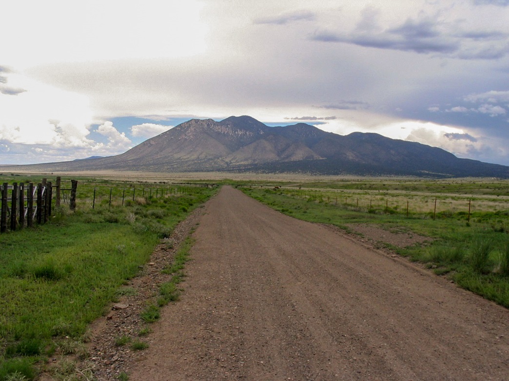
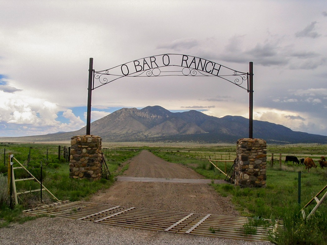
Carrizo Peak rises above the rangeland and lava plains near Carrizozo in central New Mexico. I was on the third day of a week-long swing through New Mexico, and I had already had success on three other peaks nearby. The weather had been active the past few days, with thunderstorms a daily occurrence, sometimes building by 10 a.m. Although the previous day had been relatively quiet, I didn't want to take any chances. This hike would demand an early morning start so as to be down and off the peak no later than noon. At 10 miles round trip and about 2,800 net feet of gain, I figured 5 or 6 hours, so I figured I should be moving by 7 a.m., and not a minute later. From my hotel in Capitan, I drove west on US-380 about 12 miles to the O-Bar-O Ranch sign along the highway.
The drive to the O-Bar-O Road went quick as it is a well-maintained all-weather gravel road for the first 5 miles. It's laid out slightly different than the map shows it, but navigation is simple. The road follows a gentle slope across pinon and juniper countryside before entering into canyons and tight turns. Quickly it enters onto the actual O-Bar-O property, where signs point the way to get to the Forest lands. I stayed on the public right-of-way and met the local O-Bar-O barking dog, who chased my truck for a few hundred feet.
The ranch property ends at a cattle grate, and the road is now called Lincoln FR-441, but it is not in good condition. Fortunately all I needed to drive was about a mile farther along FR-441, but in this short distance it fords a creek about 4 times as it works north up Benado Canyon. I drove it to a clearing in a meadow, not far past a small sign mentioning Benado Canyon. The Johnnie Canyon Trailhead and sign are located on the left (west) side of the road. I backed my truck into the lone parking spot/campsite in this meadow. The weather was cool and stable, but humid. I stayed true to my schedule and started hiking by 7 a.m., heading up Johnnie Canyon Trail.
The trail is easy to follow at first, but rocky for the first mile. The forest is mostly juniper, with light undergrowth including cactus. I got about a mile in and had to take off some layers of clothing. Even though it was cool and I was still mostly in shade, the still, humid air was uncomfortable. I literally stripped down to my t-shirt and undies. In time, the trail started to be hemmed in by ridges coming off the mountain, and the flora changed to larger fir and pine. The trail itself improved, losing a lot of the rocks and now a nice dirt foot-pad. I made good time up this section as the trail was never too steep.
Higher into Johnnie Canyon, it passes through little openings and on occasion the trail became faint in the grasses, but common sense and strategic cairns helped me stay on the correct path. Finally, the trail began to steepen as the canyon closes in on it. The last half-mile and few hundred feet of gain up the headwall followed steep switchbacks and rocky segments. The trail then flattened as it gained onto the ridge, where it met another trail. To here I covered 3.5 miles in 90 minutes, hiking at a quick pace. There were no views other than trees so I didn't stop. The weather was still holding up, but the humidity was killer. I turned left onto Carrizo Peak trail #72.
A sign mentioned Carrizo Peak as just 1.5 miles away, but the forest blocked all views. The trail works up onto a subsidiary peak's ridge, eventually getting as high as 9,200 feet. It runs for about a half-mile mostly level to the south, amid pine and aspen and lots of shrubby undergrowth. There was deadfall to negotiate and on occasion I lost the track.
About a mile past the junction and a half-mile below the top, the trail lets out onto a grassy meadow, straddling the ridge that connects Carrizo Peak with the subsidiary peak to its east. The trail is scant here, and only occasionally visible in the waist-high grass. Pink ribbons tied to tree branches helped, but I had to memorize where the trail would re-enter the forest for the hike down. In the meadow the route drops about 100 feet. This put me at the base of the final 600-foot push to the summit, with just under a half-mile to go. I had my first views of the peak from here.
I started up this steep slope. The first third was along a good path through trees. Then it broke into the open, into one of the grassy meadows I viewed from below. The trail here was overgrown, but more orange tape was tied in strategic places. The grass was waist-high and sometimes higher. Toward the top of the grass, the trail works through a small set of trees then enters onto another bare patch, this time with low grass. The top was in view. I huffed and puffed the last few feet to arrive onto the main summit ridge, coming upon a simple cairn of piled rocks with the Carrizo Peak sign laying on its side. I leaned it up for a photo opportunity. I had made it, so I thought.
Immediately I noticed higher land to the north, so I walked over that way, no more than 500 feet, and came upon another hill with another cairn, this one more substantial and built of flat flagstone. This one seemed to be higher than the one to the south. I signed in at both registers. I had left my pack back at the first cairn, so I returned to retrieve it. I had been on the top for 10 minutes, when a distant roar of thunder caught my attention: looking south toward Sierra Blanca was a serious-looking storm, already in full vigor, dropping rain and lightning. Looking east I saw more clouds. Even though it was just 10 a.m. the storms were kicking up already. Thus, I decided to get moving. Fortunately, there is very little ridge-walking (and exposure) on this hike, so once I started down I was immediately off any exposed ridges and in with the trees.
I descended to the meadow in about 10 minutes, then up it to the trail again in another 10 minutes, moving quickly. I heard a rumble of thunder every few minutes, and the sun was now obscured by the haze of clouds above me. Although relatively safe where I was, I moved fast as I wanted to take no chances. I wanted to be back down into Johnnie Canyon as soon as possible, so I hustled, descending into Johnnie Canyon after just 30 minutes from the top. The thunder was still evident. Every minute or so, a rumble. But so far, nothing directly above me. No loud sharp "cracks" of thunder to suggest lightning close by. No drizzle or rain either. Actually, a light drizzle would have felt nice.
Down low, it was warm and very humid, which was cause for alarm as well. Once back onto the gentler grades where the trail wasn't so rocky, I jogged. I could see the clouds better too. A big cell was forming north and east of my position. The last mile, where the trail was rockier, went slower, but I was back to my truck by noon, a five-hour hike overall. Only now did a slight drizzle begin to fall, but it was very light. I changed into dry clothes and made the drive out carefully. Back onto the main highway, I stopped for photographs, those you see here. You can see the storm clouds above Carrizo Peak clearly.
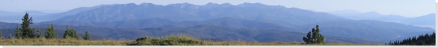
The hike of Carrizo Peak was fun and enjoyable, but the scenery is limited due to the thick forest, except at the summit where the views are outstanding. I headed north with no real destination in mind. The plan now was to look at a few peaks in the Taos/Espanola area. But four peaks in the past three days had tired me out, so I opted for an off day in between. Driving north on US-54 near Corona (and Gallinas Peak from the day before), I drove headlong into one of the blackest, scariest storms I've ever been in. Just as I entered town, the wind kicked up and bolts of lightning were hitting the ridges east of town.
I decided to lay low at a gas station and sit it out in my truck, enjoying lunch while there. The worst of it passed the town to the south, and in about 30 minutes it was slightlier sunny, so I drove an extra hour to the town of Vaughn, where I got a hotel in town and enjoyed a long night's sleep, not having to awake before dawn and letting my legs rest. Vaughn sits on the fringe of the plains, so the next day (all storms gone, by the way) I went sight-seeing, getting photos of old county highpoint mesas I visited years ago. By the end of the day, I had worked my way north through Las Vegas and Mora and into the Sangre de Cristo Range for the next day's hike up Cerro Vista.
|


|