The Mountains of New Mexico
www.surgent.net |
|
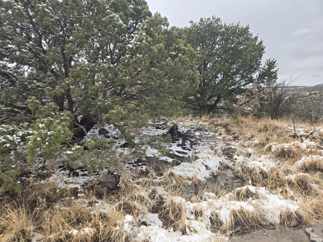
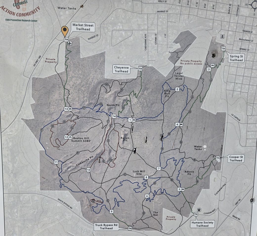
Boston Hill • Silver City Highpoint The Boston Hill Open Area is a small batch of hills and old mine pits in the southwestern part of Silver City. It has been developed into a hiking venue with trails and benches and is apparently popular with the locals looking for a place to hike, walk or take the dog out. I was in Silver City with a day open, but the weather was active, with two storms passing through the region within 48 hours. It has been an extremely dry winter throughout the Southwest, so any moisture is welcome. The first wave passed through starting late last night, dropping a couple inches of snow. The actual snowing ceased by early morining, but it was still very cloudy and cold, with a brisk wind. I was with this lady I met on the internet, and we spent the morning staying in, for obvious reasons. We watched a lot of tennis, the Indian Wells Tournament. By mid afternoon, things outside were calm, but still cold and gray. She recommended the Boston Hill area, as she has been there a number of times herself and said it's very nice.
Date: March 14, 2024
• Elevation: 6,395 feet
• Prominence: 168 feet
• Distance: 1.5 miles
• Time: 1 hour
• Gain: 315 feet (total)
• Conditions: Fresh snow, brisk, cold, some light snowfall
New Mexico
•
Main
•
PB
•
LoJ
From her place, I did not have far to drive, about a mile on US-180 to Market Street, at the northwest corner of the park. I parked in a small lot, one other car there. I went light, just me bundled up, one hiking pole, and my camera. I did not even take any liquids. I figured if I got very thirsty, I could eat some snow.
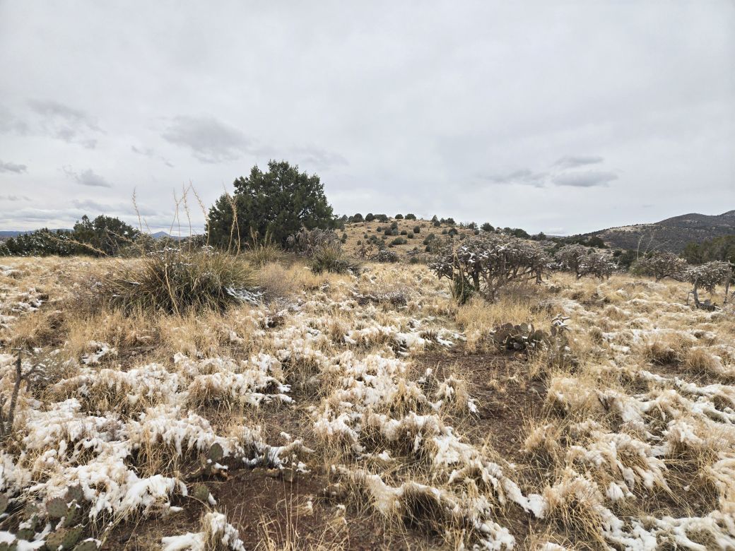
I picked up the trail and started in, hiking southbound. The trail was mostly clear of snow, while the surrounding grass, brush and trees were still covered in a couple inches. The trail makes a few switchbacks, then Boston Hill appears, a long ridge-shaped peak.
Suddenly a pretty dog comes bounding down the trail toward me, followed by its owner a few yards back. The dog came right up to me and licked my hand. The owner, a young woman, apologized, but I would have none of that. It was a friendly dog full of energy.
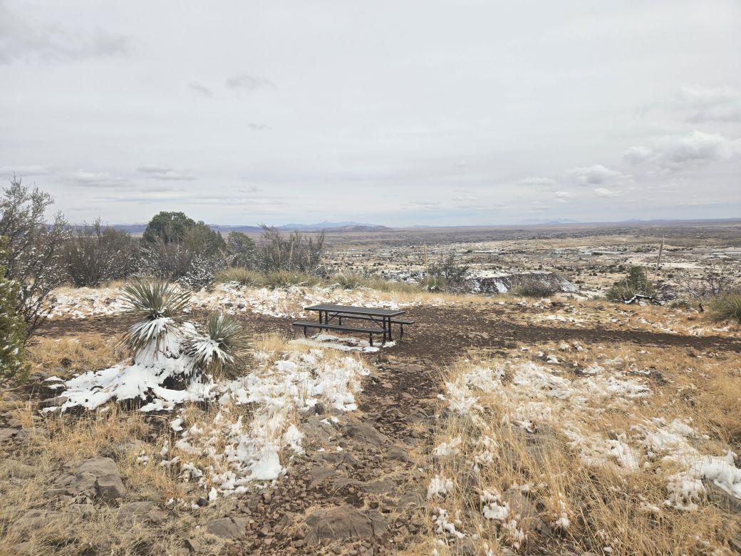
The trails can get a little confusing as there are many junctions, but in the general sense, I followed anything that went up, and it worked well, and I was soon on top of Boston Hill. There is a bench here and a table, with fine views to the south.
I walked the ridge-top east and found some higher ground this way. The summit is off trail and in the trees a little, but easy to find. I had not hiked far, about 0.4 mile, in about twenty minutes. It was very cold and when the breeze picked up, very biting. I had one small snow flurry, but otherwise, nothing fell.
Now on the east slope of Boston Hill, I could see a lower hill to the east.
Elevation: 6,330 feet
• Prominence: 60 feet
PB
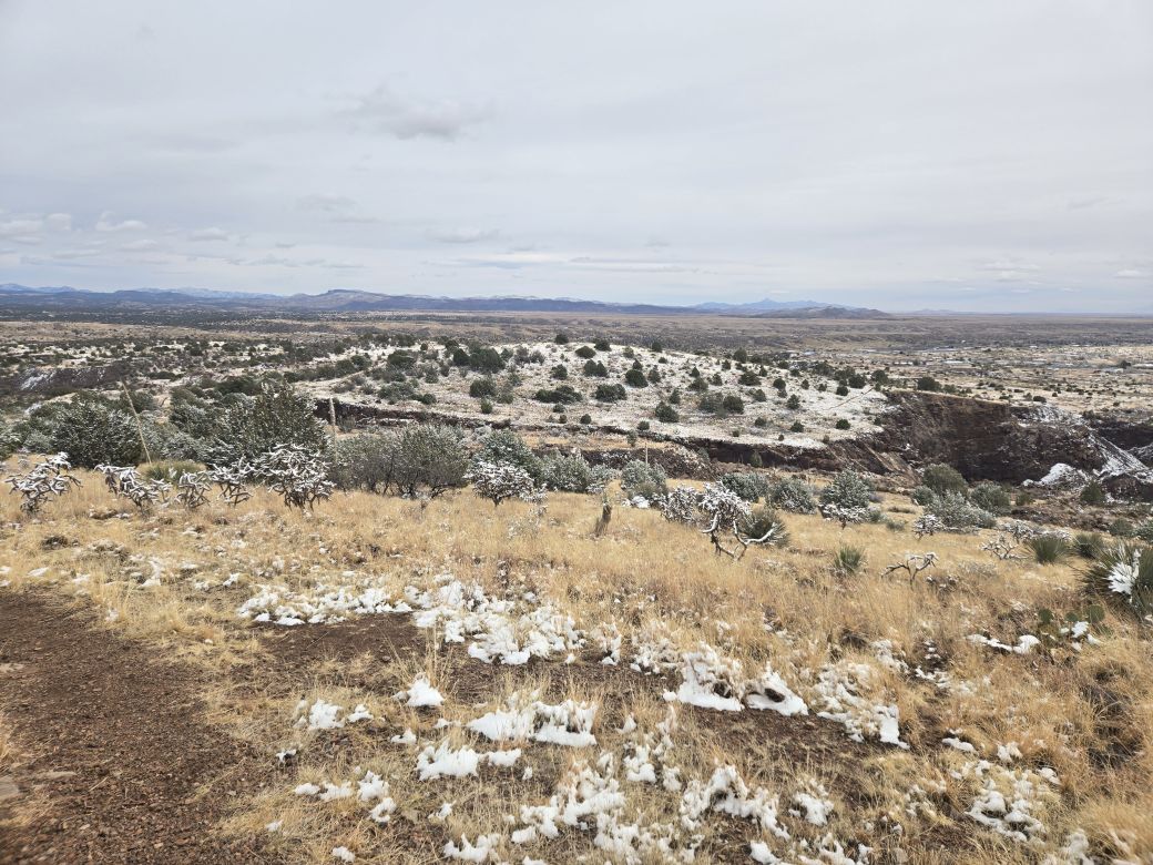
This lower hill has no name but is the highest point inside Silver City corporate limits. The city limits run north-south between the two hills, placing Boston Hill technically outside the city.
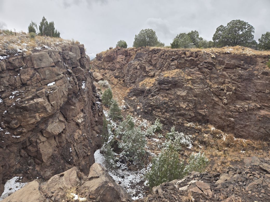
I descended downward, then had to drop more downward because of a giant cleft between the two hills, a remnant from the hill's mining days. I followed any trail that looked good, and was soon on top this gentle hill.
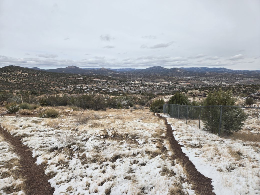
The views from here were good, and I got a lovely image of Boston Hill from this vantage. The weather was holding steady. I was properly bundled up and overall, felt very comfortable despite the cold and breeze.
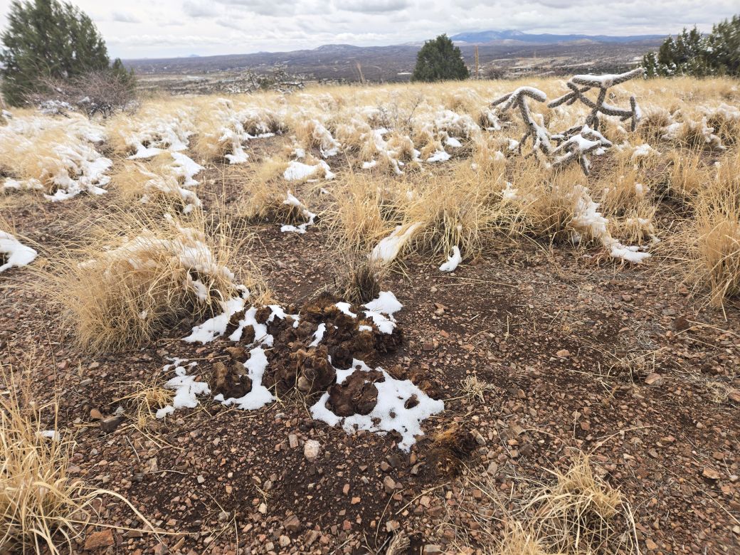
The summit is gently rounded and not easy to discern one "exact" highpoint. I found what looked like a cairn covered in snow on what I thought was the highpoint. This cairn turned out to be cow poo, as I discovered with a soft kick.
Going down, I followed trails as I found them, and actually got off route once when a trail kept dropping instead of cutting over to where I had parked. I had snapped an image of the trail map so I looked at it and got myself back on route. The hillsides are covered with pits and clefts, so going cross country is difficult, being blocked by small cliffs and unstable sides.
I was back to my car quickly, the total hike covering about an hour and about 1.5 miles, including my off-route portion. I was surprisingly beat afterwards, and had got a better work out than expected.
Given the day's conditions, these hills were a perfect way to work off some energy and enjoy the outdoors. I am sure that in summer with the rains, things are much greener giving the whole area a different look.
The second wave passed through overnight, dropping a little more snow, about 4 inches in town. Two days later, with the storm passed, I hiked a couple peaks on my way home to Bisbee, starting with Table Mountain in the City of Rocks State Park.
|


|