
Missouri
www.surgent.net |
| Mount Taum Sauk |
• Highpoint: State of Missouri • Highpoint: Iron County • Highpoint: St. Francois Mountains |
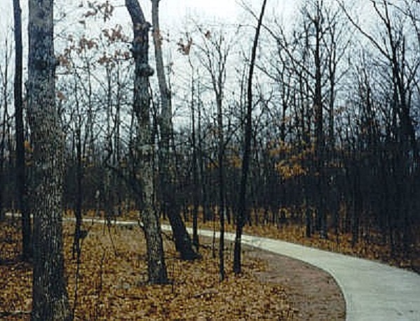 Paved pathway 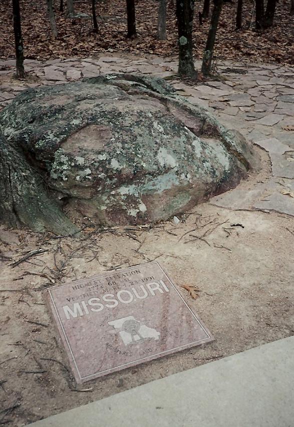 Summit rock |
Date: January 7, 1997 • Elevation: 1,772 feet • Prominence: 512 feet • Distance: 1 mile • Time: 20 minutes • Gain: 20 feet • Conditions: Cold and ominous
Main
•
PB
I started today in Corinth, Mississippi, where I had stopped yesterday after visiting Mississippi's state highpoint. A storm was coming in. the skies were dark gray and it was very cold. Things could get interesting today (and they would...). I headed west across northern Mississippi toward Memphis, Tennessee. The scenery was gentle hills and lots of forest. The weather grew worse by degrees: it was sleeting by the time I rolled into Memphis.
The plan for the moment wasn't a highpoint, but to go see Graceland, Elvis Presley's old home. I'm not much of an Elvis fan, but since I was in the area, I thought I'd at least drive by and check it out. It wasn't too far off the interstate, and within minutes I had found my way to Graceland, where I pulled into the parking lot. The sleety weather kept people away, and I caught a break as it was his birthday today (I had no idea), so they had lowered the prices.
The mansion tour would have taken a few hours and I was not interested in that, but for $5 I could tour his automobile and motorcycle collection, and that was worth it. My Elvis pilgrimage now satisfied (forever), I resumed my journey back onto the sleety and icy highways.
I entered into Arkansas, then north into the bootheel of Missouri toward Cape Girardeau. From there, I veered west into the Ozark Mountains, aiming for Mount Taum Sauk. Once off the interstate, I drove slowly and carefully to enjoy the scenery and stay safe given the deteriorating conditions. As usual, I got slightly lost, over-ran the turnoff, that sort of thing, until I found the parking area.
The trail to the highpoint is a concrete sidewalk running a half-mile into the dog-hair forest. The highpoint itself is marked by a polished stone marker and a large rock. I stuck around long enough for photos and a look-around, then hustled back to my car.
It was 3:30 p.m., but the storm was coming in and the sun would set in an hour. I wanted to be out of the Ozarks and back onto the interstate (44 in this case) pronto. No one was on the roads. Everyone was hunkered in their homes, fireplaces blazing, filling the whole area with a wonderful smokey scent. Me, I was racing against time, weather and daylight. The snow started to fall as I arrived to the interstate, and darkness was just a few minutes away.
The storm was tracking to the southeast and I hoped that by driving west, I could mitigate the worst of its effects. I intended to be in Branson by tonight, but in reality got no farther than a dozen miles. I witnessed a couple skid-offs and one wreck on the icy highway. So I bailed at the next exit and stayed the night in a hotel in the town of Waynesboro. The adjoining restaurant served some of the worst-tasting food I have ever had, and I am not normally a picky eater. But at least I was safe for the night.
|
|