County Highpoints of Maryland
• www.surgent.net
|
| Hoye Crest |
• Highpoint: State of Maryland • Highpoint: Garrett County • Backbone Mountain |
|
Date: May 25, 2001
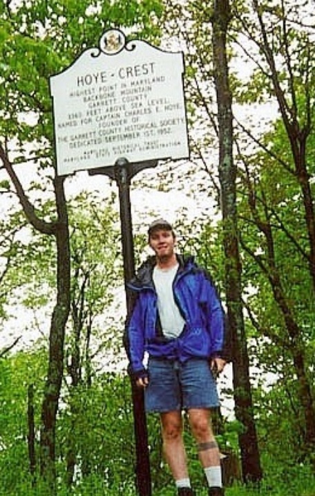
• Elevation: 3,360 feet
• Prominence: 80 feet
• Distance: 2.5 miles
• Time: 1 hour
• Gain: 800 feet
• Conditions: Humid and drizzly
Main
•
PB
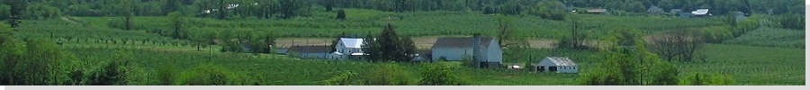
Backbone Mountain is a ridge in the southwest corner of the western tip of Maryland, the part that extends into West Virginia. It contains the highest point in Maryland, called Hoye Crest, but the highest point of the ridge is over the state line in West Virginia.
I started the day in Morgantown, West Virginia, after a night of heavy rain and thunderstorms. I awoke early and drove south and east along curvy West Virginia highways to the community of Silver Lake (WV) on US-219 about a mile south of the WV-24 junction. An old logging road serves as the trail, and a hand-made sign nailed to a tree along the highway marks the trailhead, as do some inelegantly spray-painted markers. I parked off the highway and geared up. There was a steady rain, but not too cold, so I wore shorts but also my parka, and started in.
The road is a good trail, and it gains consistently for a little less than a mile to the ridge, at which point the road ends and a use-trail continues north. Here, signs point to the West Virginia state-line marker and the Maryland highpoint. It seems to indicate that either direction in the fork will take one to the Maryland highpoint, but a right turn at the fork will mean less bushwhacking. I know, because I tried both ways.
I went left first, a short distance to the cement state-line marker, then I retreated back to the junction and went the other way a few hundred yards to Hoye Crest. A metal sign marks the highpoint amid the trees, a clearing and a picnic table. There are good views east into Maryland. I signed in the register, snapped a photo, then hiked back to my car. The rain was steady but not annoying, but I was fairly wet upon my return. Fortunately the fog was minimal and I had good views and an enjoyable hike.
|
|