The Mountains of California
www.surgent.net |
| Whipple Mountain |
• Highpoint: Whipple Mountains • Whipple Mountains Wilderness • San Bernardino County |
|
Date: February 28, 2010
• Elevation: 4,130 feet
• Prominence: 2,790 feet
• Distance: 9 miles
• Time: 6 hours and 40 minutes
• Gain: 2,700 feet
• Conditions: Cool and breezy with puffy clouds
• Teammates: Scott Casterlin & John Hamann
California
•
Main
•
PB
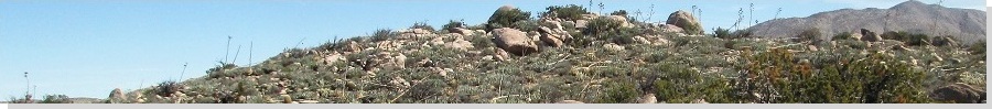
The Whipple Mountains are in eastern California beside the Colorado River and near the cities of Lake Havasu and Parker, both in Arizona. The Mountains are enclosed within the Whipple Mountains Wilderness, covering nearly 80,000 acres, and Whipple Peak is the range highpoint, at 4,130 feet (the USGS map shows it as "Benchmark Axtel"). Most everyone calls the summit "Whipple Peak" or "Whipple Mountain". The range is apparently named after a Lieutenant Whipple of the Pacific Railway Expeditions.
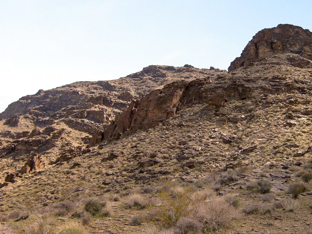
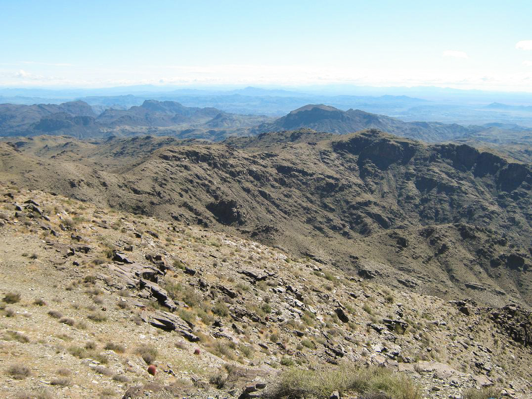
The Whipple Mountains show a variety of geological formations: the western and northern portions are a complex of ridges, canyons and raised benches, with gentle slopes down low and steep slopes and cliff bands higher up. Toward the east, the range is more severe, with steep cliffs and impressive spires. The mountains are easily viewed from Parker (looking across the river) and from Lake Havasu (looking southwest). From Parker, the spires of the eastern half of the range are most evident.
A few mines operated in the Whipple Mountains during the early 20th Century. Today, none of the mines are active, and the range is now protected as Wilderness. Other than a few roads on the fringes, the only access into the heart of the range is via foot travel. The summit is a natural destination, and is most popular (in relative terms) with the Sierra Club's (CA) Desert Peaks Section group.
The peak is close enough to Arizona to have caught my attention, and I was invited by Scott Casterlin to join him and John Hamann for a hike up this peak for this weekend. Scott picked me up at my home, and from there we picked up John at the airport. After getting supplies, we headed west to Parker, made a detour to the famous Desert Bar northeast of Parker for a beer, then continued on our way to the Whipple Wilderness.
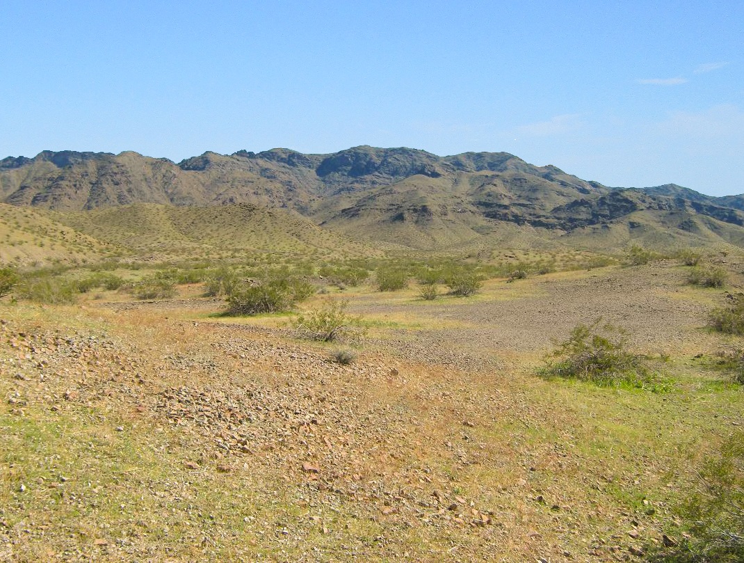
Despite the fact the range is so close to Parker and Lake Havasu City, there is no easy access to it from Arizona. Instead, we had to drive 17 miles from Parker to Vidal Junction in California, then nearly 30 miles north on US-95, then southeast on Havasu Lake Road, which is paved and leads to a small Indian (Chemehuevi) Reservation on the California side across from Lake Havasu. We didn't get that far, as we left the pavement and onto a series of power-line easement roads and BLM roads, heading to the War Eagle #1 Mine, located about four miles north of the summit. From Parker, we had driven nearly 60 miles to the trailhead, for a range whose summit sits about 5 miles from the town.
We arrived at sundown in cloudy and unsettled weather. There was enough light for us to set up our tents and inspect the area. Old mining junk is littered in the area, including cement mixers, truck parts, and two over-turned vehicles used for target practice. However, not long after nightfall, the clouds grew thick and rain started to fall. We sat in the vehicle for awhile, but in time John went to his tent and me to mine. The rain fell for a couple hours and soaked the whole area. John apparently got soaked in his tent. I stayed mostly dry but my stuff was damp. We were ready to move by 7 a.m. (California time), and it looked like the storm was gone, so we laid out our wet items in the open to dry, figuring no one would be coming by.
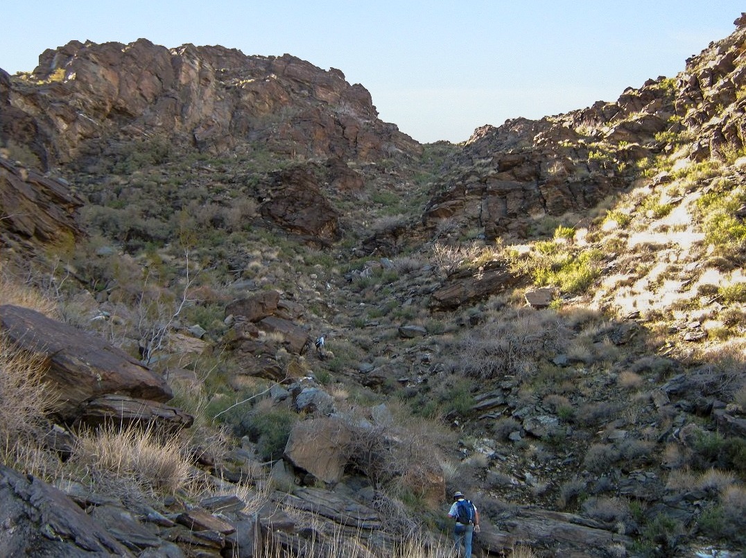
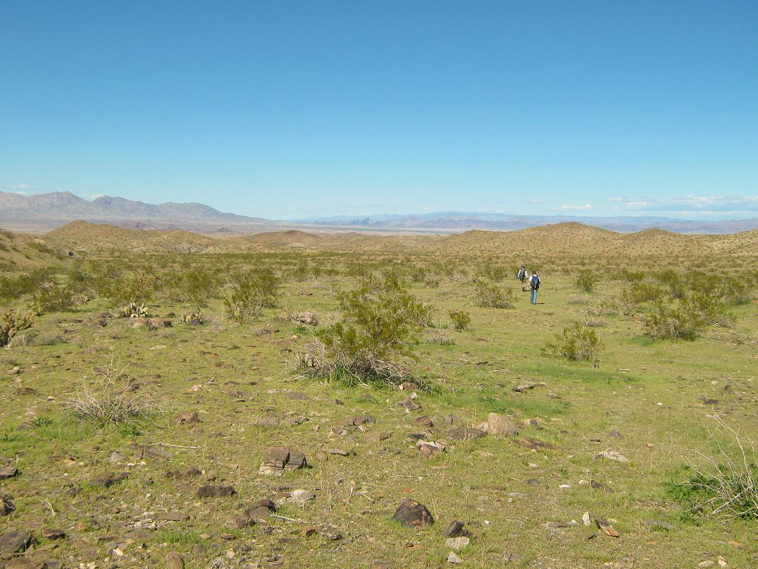
We dropped into the broad wash that parallels the road to War Eagle Mine, and started the long walk south toward the range. This stretch covered about two miles, during which time we gained about 200 feet, barely enough to sense a gradient. The only junction of concern was to make a right about 0.8 miles from the start, following the southerly wash. The going was easy, and we could keep mainly to the sandy channels and avoid the brush and rocks. The wash then makes a turn to the left (east), and quickly enters into a well-defined canyon, where the gradient increased noticeably. We started seeing cairns and paths which helped to expedite our progress, even though the navigation was easy.
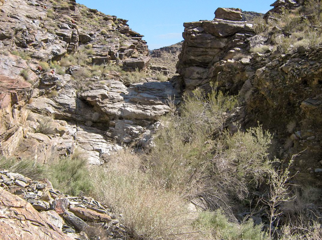
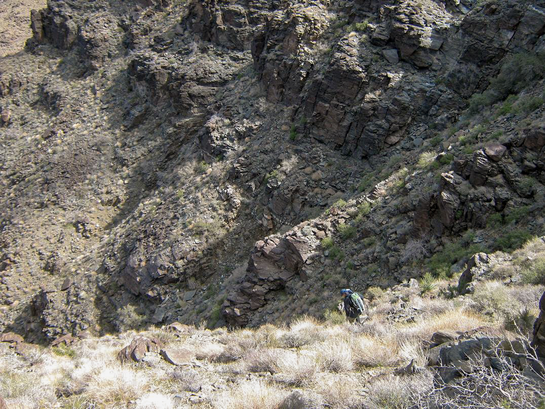
We hiked up this canyon for another half-mile, coming to the one main obstacle of the climb: a 25-foot high dry waterfall hemmed in by high walls. It looks challenging, but once actually on the rock, it sloped back nicely, and we were able to walk up the rock with no problem.
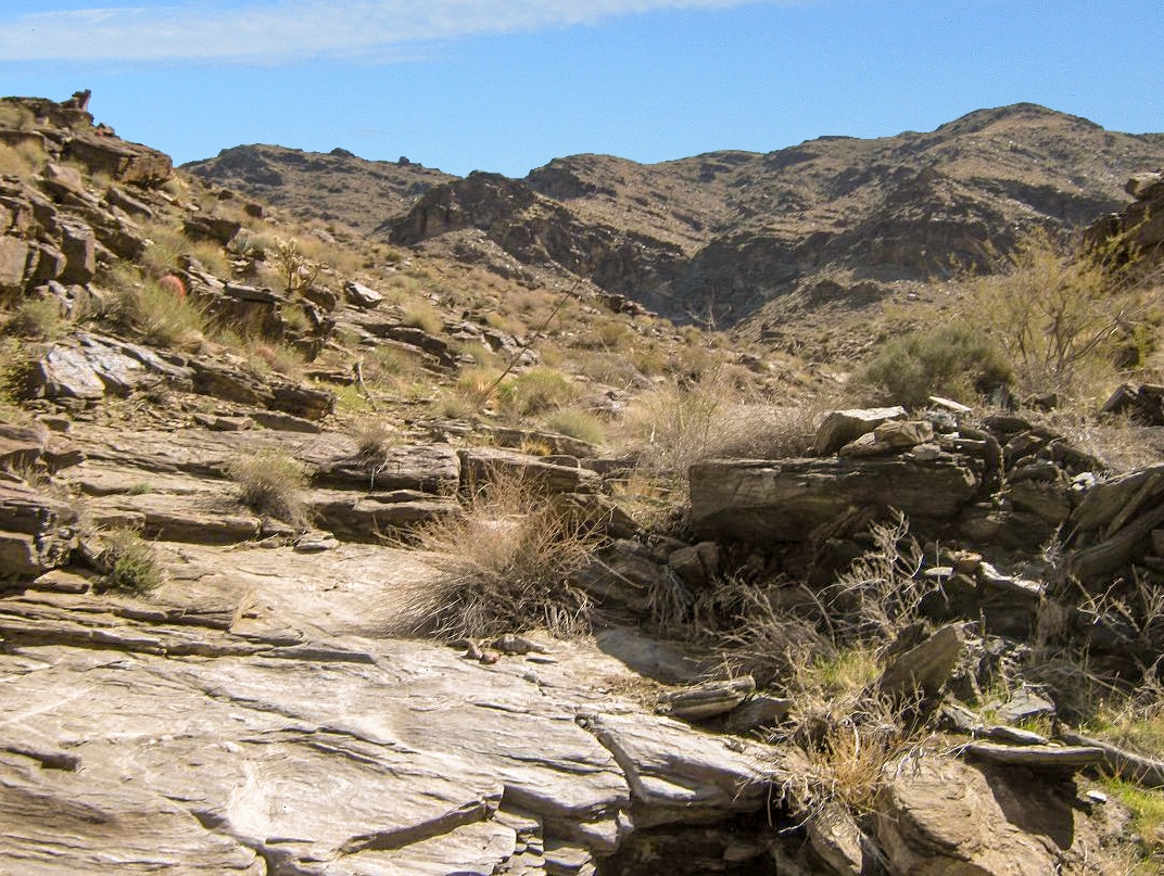
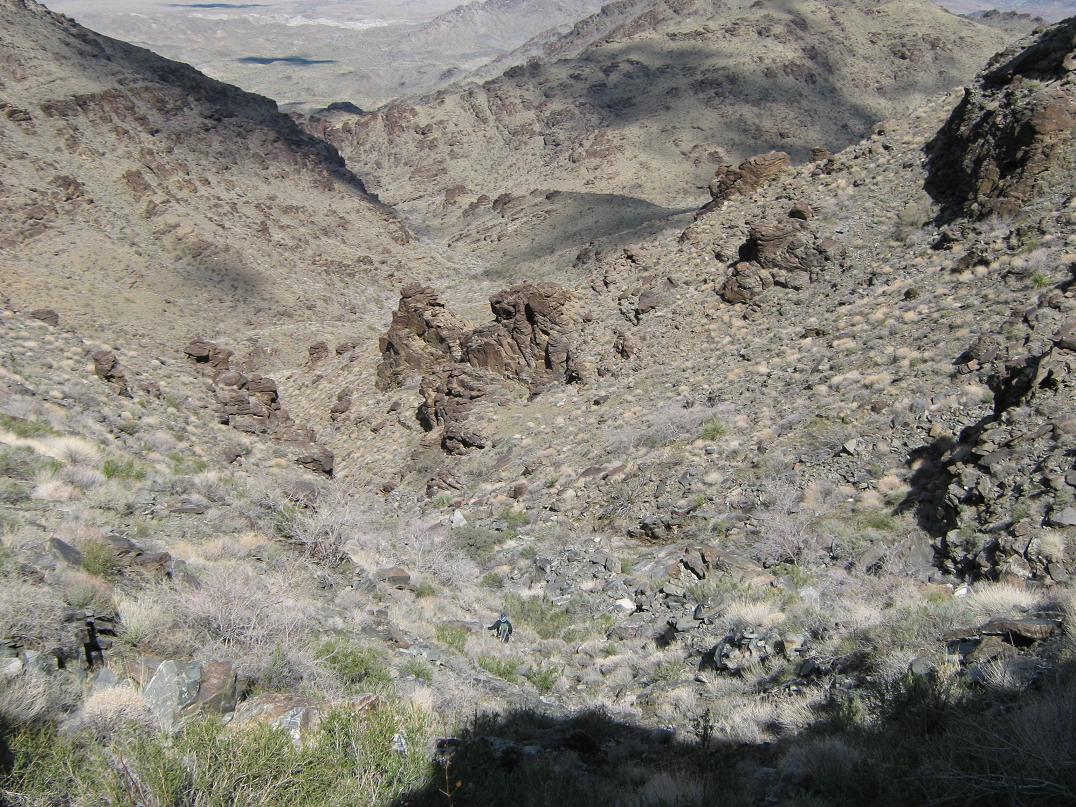
Above this dry-fall, the canyon took on a different look, with more bare rock sections (and little rivulets from last night's rain) interspersed with the usual rocks and brush. These bare-rock sections were wonderful and allowed us to make great time. There were a few other obstacles, maybe 10 feet high, but there was always an easy alternative to get up these sections. The canyon then opens up at about 2,600 feet. We hung a left and walked up the remaining canyon as it went left, then right, to put us up onto a broad saddle, elevation 3,000 feet, directly south of Hill 3,292. We had gained about 1,600 feet from our camp, covering about 3 miles. The canyon itself is quite beautiful.
At the 3,000-foot saddle, we looked up at the real climbing ahead. We were going by the DPS reports which suggested to angle left (southeast) past an obvious rock wall, then work up a gully behind it. We climbed the slope to near the base of this rock wall, then walked around its end, following cairns, before descending into a drainage, a drop of 30 feet (again following the cairns). On the other side of the drainage, the real upward climb started. Keep in mind we still had about 1,100 feet of uphill to go.
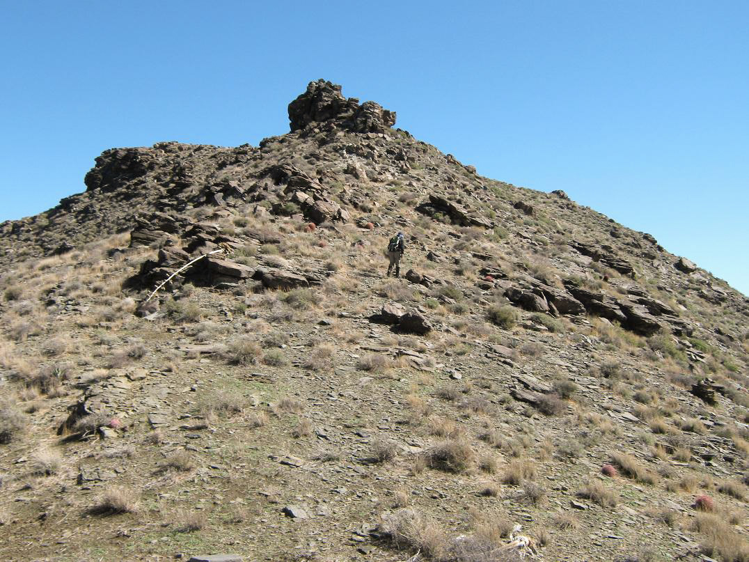
Looking up this gully, it all looks equally nasty, but a few options become clear. First, there's an obvious rock obstacle in the main part of this gully. Bear left and walk up a steep slope to gain the high ground above it. Looking up again, there's another point at which the rock walls seem to naturally constrict up on the the higher slopes. We walked to this point, then through the constriction, and once above it, angled slightly right (west), walking up more steep slopes to gain a sub-ridge directly off the main range crest. This stretch gained about 600 feet, but it was steep with brush and loose rock.
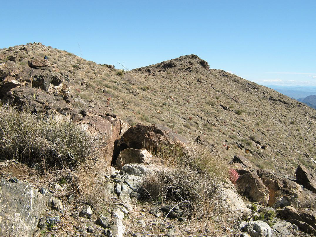
Once on this sub-ridge, we turned left (now south again) and walked up its steep slopes, but here, the rock was solid and our movement was much faster. We quickly met the main range crest at a saddle at 3,940 feet elevation. The summit was to the northeast, but hidden by a rock pinnacle. A good path leads from the saddle to the top. It skirts the pinnacle to the north, gains again onto the main range crest, and from here, the summit was visible and no more than a quarter-mile distant across easy, open slopes. We arrived here at 10:30 a.m.
At the summit, we sat and rested. We looked around at the surrounding ranges and landforms. Lake Havasu City looks like a mush of buildings and homes set against the hills overlooking Lake Havasu (Scott said it looked like a refugee camp). Parker was much more rural, a simple grid of streets and not a whole lot of buildings. The big Chemehuevi Mountains are directly north, and other ranges we could make out were the Turtles, Marias, Mojaves (with Crossman Peak inside Arizona), the Hualapais and way off to the south, the unique cliffs of Signal Peak in the Kofa Refuge.
We spent about 20 minutes up top, taking it easy. The weather was pleasant, but we could feel a noticeable chill having gained the elevation (I would guess it to be in the low 50s). In time the steady cool breeze prompted us to get moving downward.
The hike down went well. None of us looked forward to the steep 600-foot descent down the rocky and brushy gully, but it went fine, albeit slow, and we were quickly down 1,100 feet back onto the saddle at 3,000 feet. The hike down the canyon was a lot of fun, and we found other paths that skirted some of the brushy sections, which helped (we had not seen these paths going up). In 90 minutes, we were back down onto the lower slopes into the broad wash, now making the long trek north back to camp.
Here, we found more paths that were not evident on the upward hike, paralleling the wash, staying above along low hills of sparse brush. This was welcome as we could hike quickly without the need to constantly pick our way through brush and rocks. By 1:30 California time we were back to camp, everything now dried out after a day in the sun.
We broke down the tents, packed everything up and made a final check before leaving. Our round-trip time was 6 hours, 40 minutes, which included breaks, for a nine-mile hike with about 2,700 feet of gain. The recent rains had left a fine carpet of green grass everywhere and it looked like a park. It was absolutely beautiful, nothing like it will look (or feel) when summer rolls around.
The drive out was uneventful. We backtracked through Vidal Junction and Parker before making a drink and chips stop in Quartzsite. We were back in Phoenix by mid-evening. We got John to the airport with time to spare, and I was home before 8 p.m. Once again I thank Scott and John for their comradeship on the climb.
Comment on the route:
The various paths are very helpful but often not obvious on the ascent. It may be just as well to stay low in the washes, in which the navigation is idiot-proof, than to try to find and follow one of the paths, where they do come and go with other paths (we surmised they may be game routes enhanced by man over the years). On the descent, once out of the main canyon and back onto the lower desert slopes, then it may be a good idea to ascend out of the wash to the west and find one of these paths. You can see War Eagle Mine from a long ways and hike by sight to it. We found ourselves following paths, then cross-country, then paths again, for most of the last two miles back to camp.
|


|