
The Mountains of California
• www.surgent.net
|
| Middle Sister & Point 10,580 |
• Highpoint: Sweetwater Mountains • Mono County, CA (Summit) • Highpoint: Lyon County, NV • Toiyabe National Forest |
|
Date: August 13, 2005
• Elevation: 10,854 feet (Middle Sister Summit), 10,580 feet (Lyon CoHP)
• Prominence: 854 feet (Middle Sister), 10 feet (Lyon CoHP)
• Distance: 6 miles
• Time: 5 hours
• Gain: 3,300 feet
• Conditions: Marvelous
California
•
Main
•
PB (Summit)
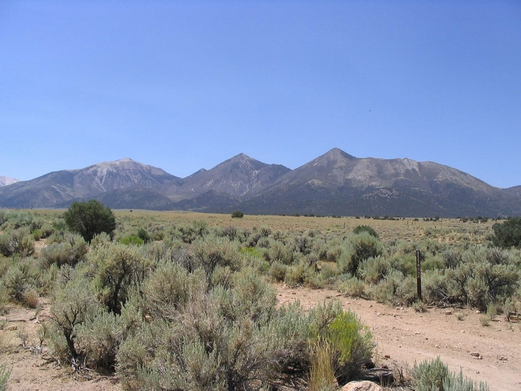
The Sweetwater Mountains straddle the California-Nevada border, about 50 miles south of Lake Tahoe. The highest point of the range is inside California, but its north and east slopes enter into Nevada. Wherever the boundary is, it's the highest point of Lyon County, Nevada. In fact, because the boundary has been wrongly surveyed in the past, there are two possible points where the county highpoint could be. However, both are easy to visit, as is the summit.
I originally planned to hike this peak in 2002, but a huge fire was raging, and did not return to the area for three years. For this trip, I planned to hike a number of peaks in Utah, but weather forced me out of that region, and on the spot, I reconfigured my hiking options. I headed west, figuring the weather would be drier.
Two days ago, I hiked Ibapah Peak in Utah. From there, I spent a few hours at the Lehman Caves in Great Basin National Park, going on a tour with a group of 12-14 year-old boy scouts. The tour was just starting and they had room for one more. It was either go now, or wait an hour, so I went with the scout group. The caves were spectacular, but the scouts were a bunch of idiots. Granted, most 12-14 year old boys are like that, but get 30 of them in one room and everything snowballs. They were running around, screaming, playing grabass, yelling ... one kid openly said he was bored. The scoutmasters had to do some damage control.
Anyway, I enjoyed the cave tour a lot, then spent the day driving west to the Sweetwaters. I got supplies in Yerington, then drove south along state route NV-338 to Toiyabe Forest Road 50 (Risue Road), then north on that road about 4 miles to a side road that bent west into the range. It was dusk when I rolled in, and I parked in a glen of pinon trees, having the whole place to myself. The night was clear, mild and cloudless, with a gibbous moon. I spent long stretches in my campchair staring at the stars.
I awoke the next morning and got moving at 6:30 a.m. I drove the rest of this west-trending road, probably no more than a mile and a quarter, as it gained about 400 feet into the hills. I had to use 4-wheel drive for the rocks and pass through a couple wire "crumple" gates along the way, before coming to the road's end at a corral, where there is a large turn-around and room for a few vehicles. I got my stuff in order and started hiking a bit past 7 a.m. in cool conditions, just as the sun was rising above the mountains to the east.
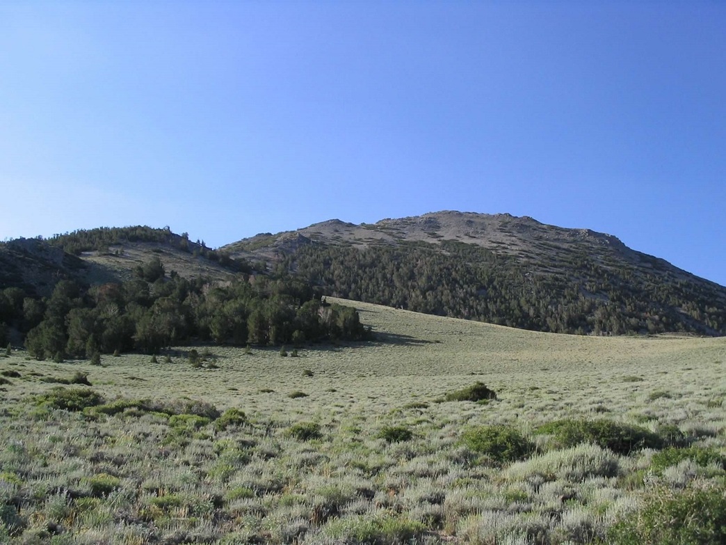
The trail starts where the road ends, and is wide at first. Soon, the trail narrows and runs in and out of a rocky creek, sometimes following the creekbed itself and other times paralleling on the bank. The gain is steady but the gradient is consistent and moderate. The trail then curves slightly left along with the drainage, with the thick forest of pinon, juniper and pine quickly giving way to open slopes of sage. After an hour, and a mile of hiking, the creekbed itself grows faint as it gains and meets the broad saddle at Little Smith Valley.
In Little Smith Valley, the trail, still obvious to follow, runs for a few hundred more yards on a near-level gradient. It hangs a slight right to bypass a small bulwark and tops out directly below a rounded hill, marked 9,040 feet on the map. Off to the south, the bare mass of Middle Sister is in view, with East Sister Peak to the left. The sun was still behind East Sister's mass and I had lots of shade. I chose to leave the trail and hike cross-country south toward Middle Sister, aiming for the prominent ridge that sits to the right of East Sister's mass. Once in the sun, I stopped and took a breakfast break. I had covered 1.5 miles with 1,300 feet of gain. The great scent of sage was everywhere!
Once rested, I started again. I could see my route: a gully and ridge system that needed to be climbed about a thousand feet to a meadow at 9,700 feet. I could see bare slopes and sections of forest, and it seemed logical to gain the summit from the northeast, via the saddle that connects East and Middle Sister Peaks.
Figuring staying low in the gully would mean lots of brush, I worked my way up a ridge into the trees, and did alright for awhile until I found myself in a thicket of brush. I backtracked, then bulldozed my way through thick scratchy brush to get back onto more open terrain, lower in the gully. Here, I found a faint path, which I followed (when I could) up to the high meadow. Navigation was simple as by this time the thick forest was long gone. I aimed left toward an open scree slope ringed by gnarled bristlecone pine. Once high on the meadow and below the scree, I took another break, another hour in and a bit less than a thousand more feet of gain. The conditions were spectacular.
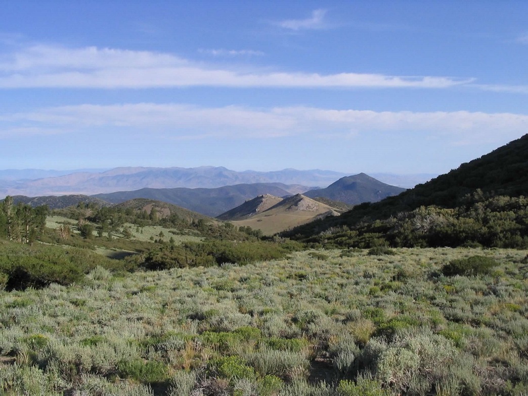
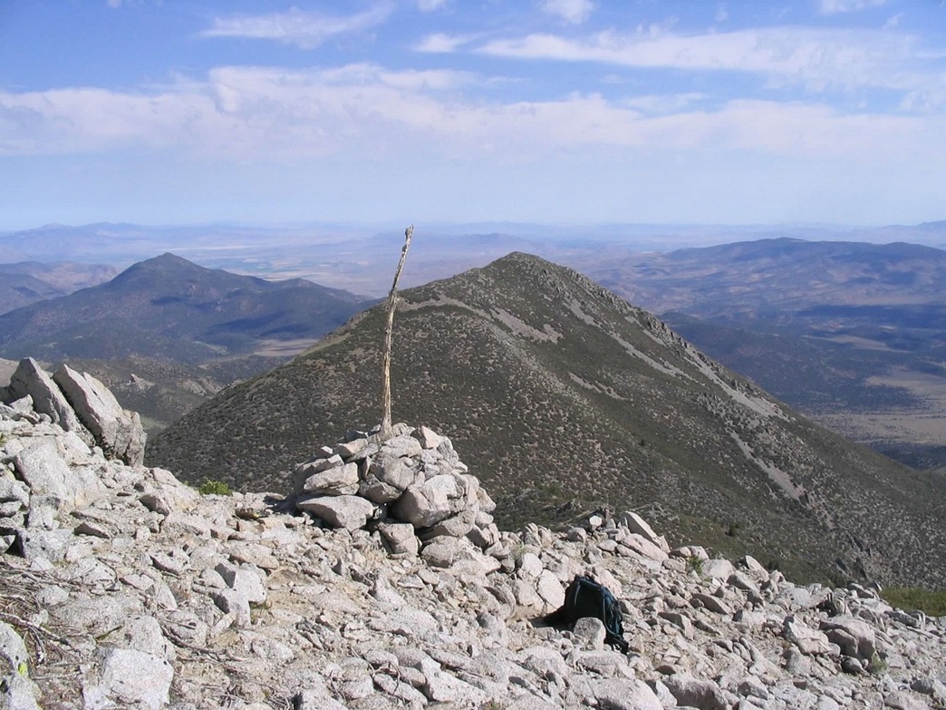
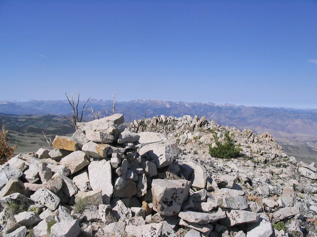
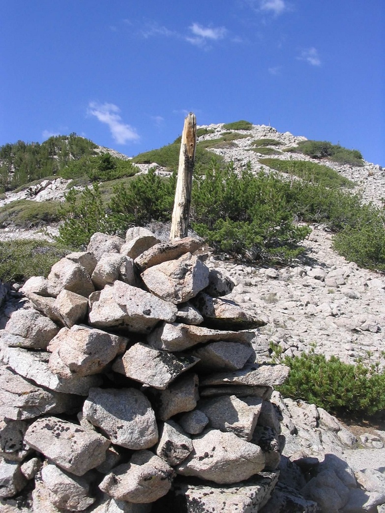
I began the final push to the summit. I started up the scree slopes, which in places was quite loose and somewhat difficult to keep from sliding backwards, not to mention the little pebbles that fell into my boots. It wasn't too nasty and there was enough foliage and rock sections to keep from having to step on scree the whole time. I gained the high saddle and climbed up moderate-sized talus, which glinted white in the sun. I traversed along Middle Sister's north and northeast flanks across scree and talus until I spied a large cairn topped by a measly-looking stick. I beelined to it, and once there, dropped the pack to rest and see what I had found.
At this cairn, a register was inside, even though the cairn was still well short of the summit. So now I need to explain some things here. Middle Sister's summit, at 10,854 feet, lies inside California, while the Lyon County highpoint is on its north ridge, at roughly 10,580 feet, where the California-Nevada state line runs across. What I had found was the cairn for the Von Schmidt boundary (approximate elevation 10,700 feet), in which an early surveyor (Von Schmidt, presumably) had erroneously put the state line slightly west of where it should have been. So the register at this cairn held a few names, some of who signed in thinking they were at the real Lyon County highpoint, while a few others signed in and made it clear this wasn't the real county highpoint. I signed in, too. What the hey.
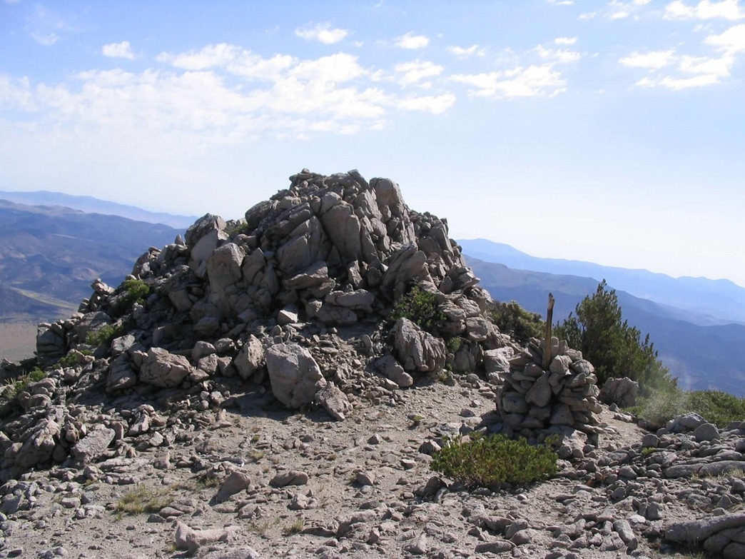
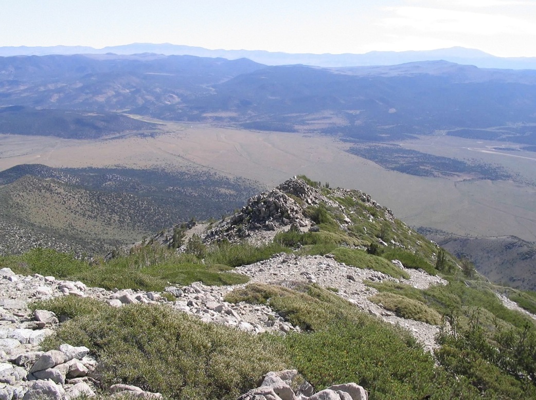
I dropped my pack and made a quick dash up the final 150 feet to the real summit, which I did in 10 minutes. Back at the Von Schmidt cairn, I looked down and saw another large cairn, this one topped by a good-sized post, signifying the actual state boundary. Just a few feet north of the cairn was a rock outcrop, the Lyon County highpoint. I hiked down to it in a few minutes and then scrambled up 15 feet to the top of this outcrop. I stayed here awhile and enjoyed the scenery and weather. From my truck to the summit was 3 miles and about 3,300 feet of gain, and it had taken me 3 hours, including breaks. I stayed at the highpoint for 20 minutes, then started down. The day was just gorgeous, and I was in no hurry.
Going down was a breeze. The scree that had been so aggravating going up made it easy for me going down. I would take a step and it would let me slide 5 more feet each time. The scree itself was just the right size and the slopes just right, so that I was down to the high meadow in 15 minutes. I continued on, finding the use path which I followed all the way down in the gully. I was back to the Little Smith Valley (saddle) within an hour. Once back on the actual trail I decided that the weather was just too damn nice to rush out of here so I stopped and took a long, 30 minute rest where I just sat there and stared at the peaks and the blue sky, all the while wallowing in the scent of sage and pine in silence.
Soon, I was moving again, and I made the final hike down to my truck in 40 minutes. I drove out the bumpy road and back onto pavement, where I stopped for one last photo and a friendly salute to the range. I drove 15 more miles into Bridgeport, California, where I planned to while away the day and attempt Sonora Peak, the Alpine County (CA) highpoint, the next day.
I stuck around for a few hours in town, and even drove the highways up and over Sonora Pass to find a good camp spot, but the weather started to deteriorate, and frankly, I had lost interest. I'd been on the road now from home for almost 3 solid weeks (counting my trips to my sister's wedding and to Virginia), and I missed my wife and I was just wanted to go home now. So I started the long drive home. I passed south through Bridgeport at dusk and got as far as Lee Vining on US-395 in the dark, camping in the desert south of Mono Lake. The next day was a long drive to Henderson, Nevada, and a day with my folks, then on home the day after.
|

|