The Mountains of California
www.surgent.net |
| Stonewall Peak |
• Cuyamaca Mountains • Cuyamaca Rancho State Park • San Diego County |
|
Date: February 14, 2015
• Elevation: 5,730 feet
• Prominence: 860 feet
• Distance: 4.2 miles
• Time: 1.75 hours
• Gain: 860 feet
• Conditions: Warm and clear
• Teammates: Just me, but crowded with others
California
•
Main
•
PB
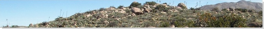
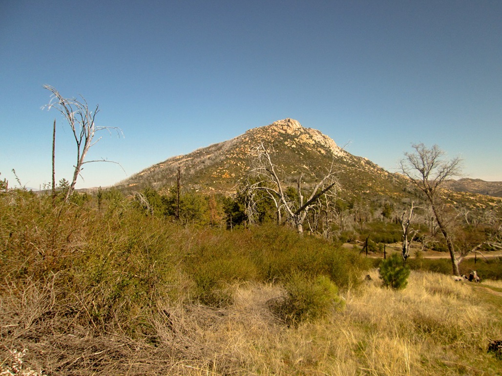
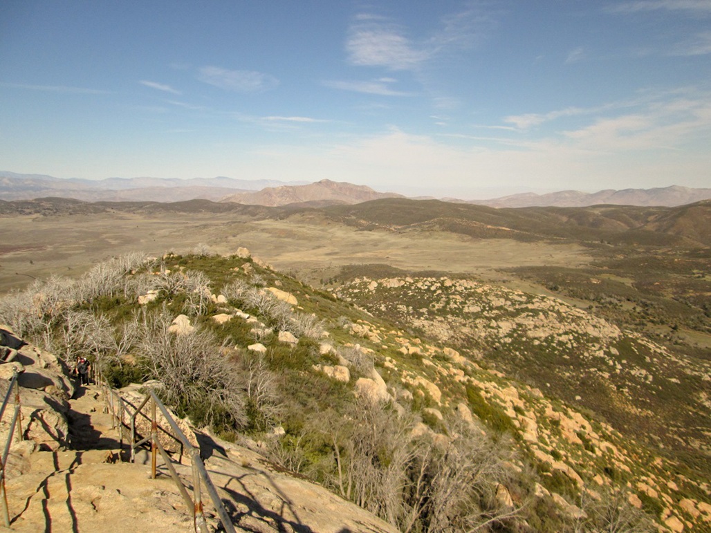
Stonewall Peak is a rocky peak east of Cuyamaca Peak in central San Diego County. I was here back in 2008, hiking Cuyamaca Peak with Adam Helman. I asked about Stonewall Peak and he said it's a nice hike along a trail, which was good to know. From up close, it's a rocky, brushy peak and it seems it would have been difficult to put in a trail. I filed this peak into my "next time I'm here" list.
Unfortunately, the next time I was here was now, to attend a memorial for Adam, who passed away last month. I had driven out from Arizona yesterday, hiked Tecate Peak, then camped at the Potrero County Park. Earlier today, I got some exercise in by hiking Potrero Peak. That was a short hike, and I was done by 10 a.m.
From the Potrero area, I followed a series of backroads -- State Route 94, Honey Springs Road, Lyons Valley Road and Japatul Road -- to Interstate-8, where State Route 79 begins if heading northbound, as I was. Now on CA-79, I followed it north and up to the Cuyamaca Ranch State Park, planning to score a campsite at the Paso Picacho Campground (where I camped in 2008), and hike Stonewall later in the afternoon.
I deliberately went slow to enjoy the drive. There was very little traffic ... until I got to the Interstate-8 underpass. A whole stream of cars was exiting and going north. Cars with trailers, obvious camping stuff tied to the top, or kayaks, and so on. Yes, it was a three-day holiday weekend and the weather was unseasonably warm. Was everyone heading to the same place I was? I thought San Diegans all hated the mountains and only went to the beach, but I guess the 3% who actually like the mountains were all here right now.
I got into a line of cars as we slowly drove to the Paso Picacho Campground area. A few turned off earlier, and some continued northbound toward Julian, but plenty were like me, looking to camp at the campground. I rolled into the entrance and saw that they were charging $30 per night to camp! And cash only, too. I didn't have $30 cash on me. I also discovered they were out of spots anyway. And it was just 11 a.m. I had no choice but to turn around and exit.
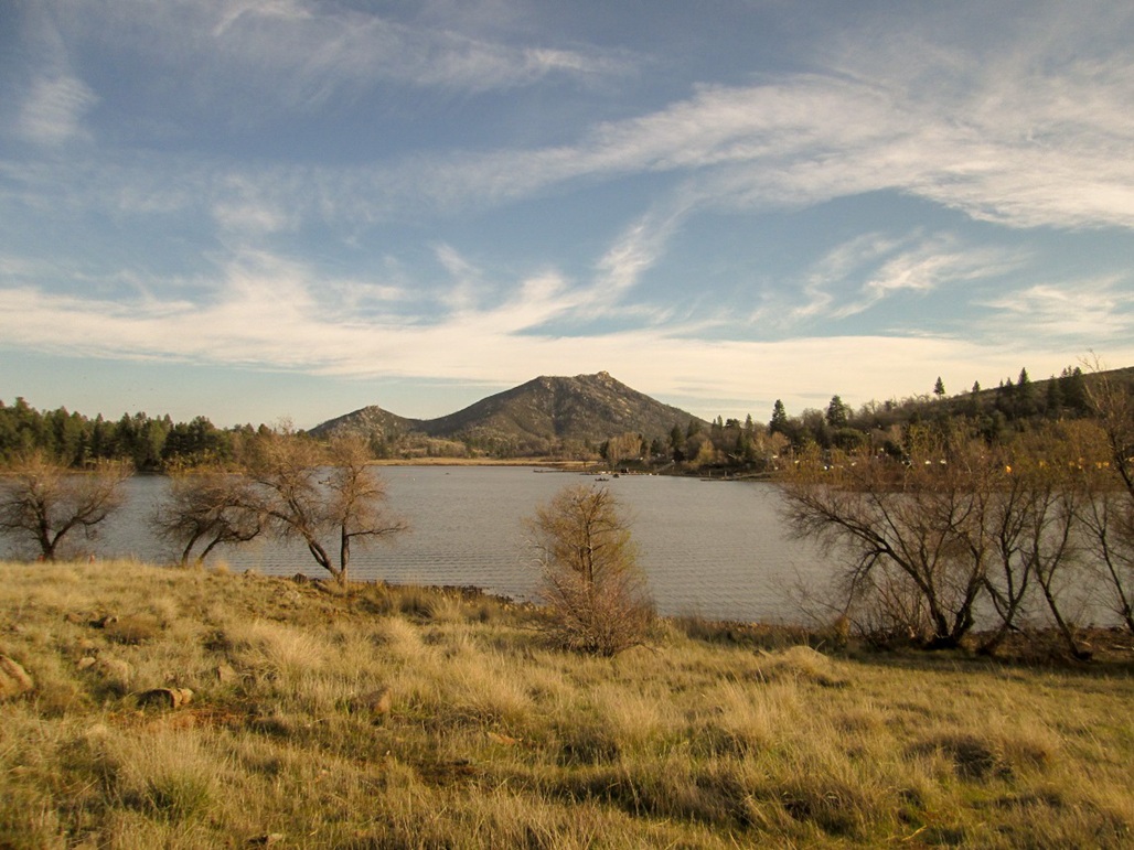
I drove north down off the mountain toward the Lake Cuyamaca area, about five miles away. This is a privately-run outfit that rents boats for sit in and fish from, as well as offering spots for RVs and camping. I parked and got in line. The whole place was overrun with people, and I assumed they were out of spots, too, but to my surprise, they had a few still available, for $15, so I grabbed one. I camped at the Lone Pine Campground on the north shore of Lake Cuyamaca, immediately below North Mountain. It wasn't much of a spot, but it was better than nothing. My only other option was to drive farther and bush-camp somewhere, but I wanted to stay close to the area for my still-planned hike of Stonewall Peak, plus for tomorrow's memorial, as well as maintaining a cell signal.
I parked into my spot, got out my chair and a beer, and just sat there, drinking a beer. The day was sunny and warm. People were all over, walking their dogs, kids running, coming and going to the lake. Soon, a trio of younger people, early 20s, rolled into the spot next to me (I was on the end, so no one was on my other side). They were here to fish, and they seemed cool. They turned on their car radio and played classic rock tunes such as the Eagles, Santana, Mountain, stuff from the early 1970s. This was a pleasant surprise. I still have hope for our young people. They even asked if they were being too loud, and I said not as long as you continue to play that music.
After an hour, I decided to drive back up and hike Stonewall Peak. I had no tent with me so my campspot would remain bare. The people next to me said they'd keep an eye on it, which was nice of them. So I got my stuff together, drove back to the day-use parking area nearby the Paso Picacho Campground, paid $8 for the priviledge to park, and started my hike. It was about 1 p.m.
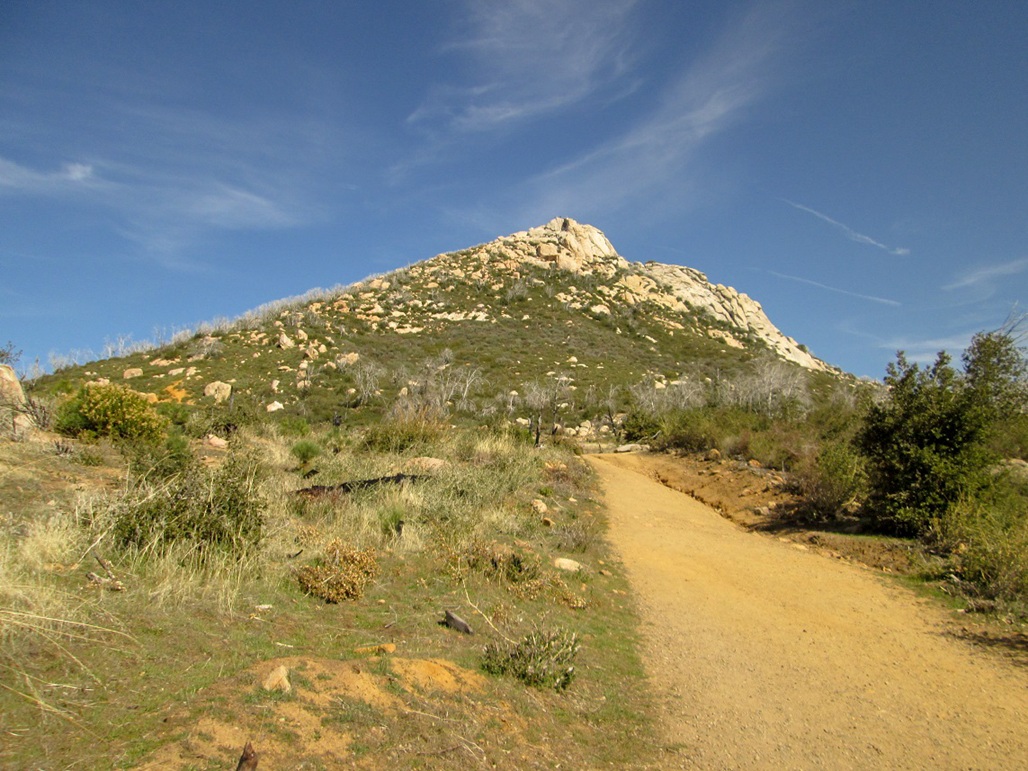
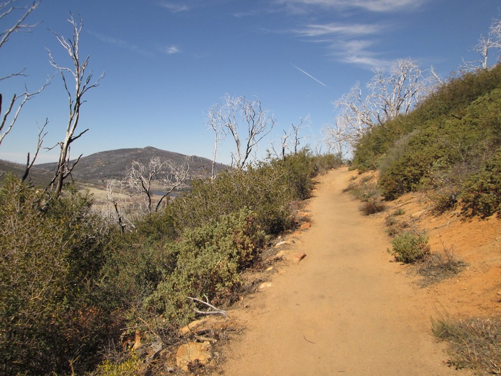
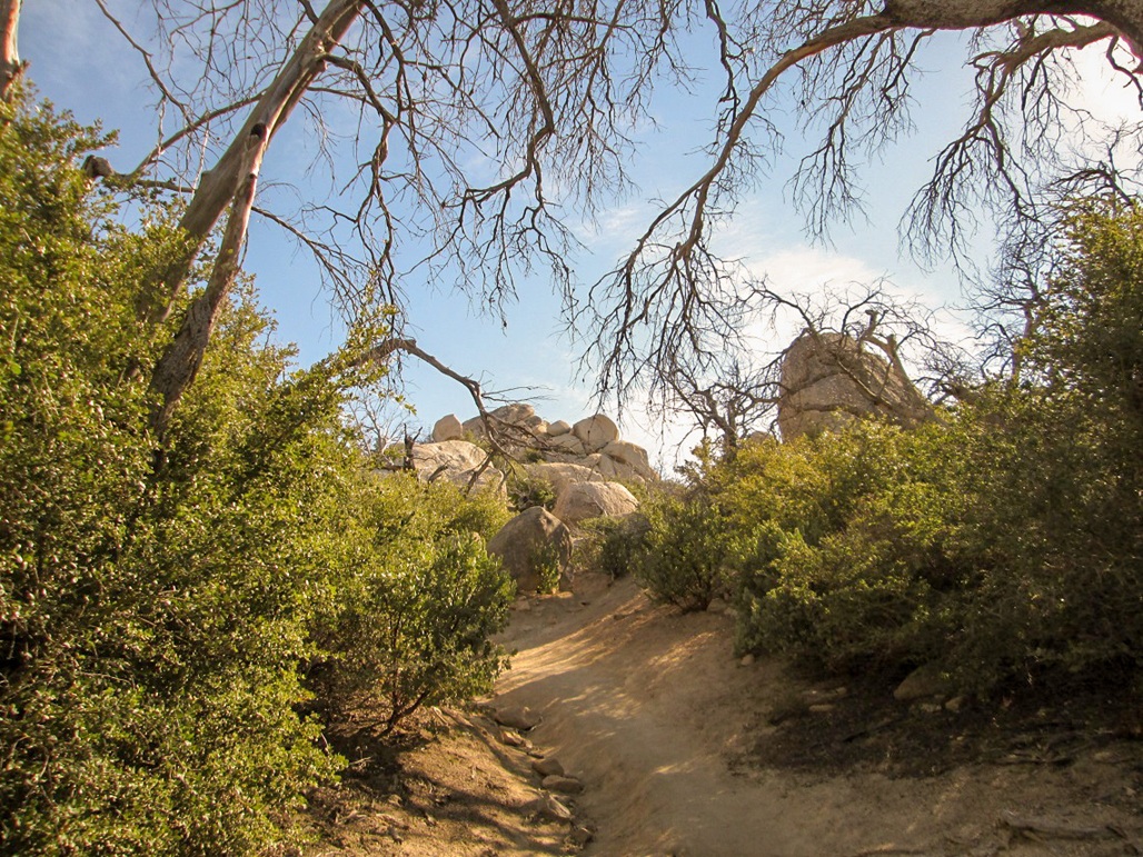
I walked across the highway to the trailhead and simply followed the trail. It switchbacks a lot, worming its way through the rocks that lie all over the peak. What's not trail or rock is usually a woody plant of some sort, including a few good-sized trees. There were also numerous dead trees everywhere from a past fire, completely bare of leaves and lifeless gray.
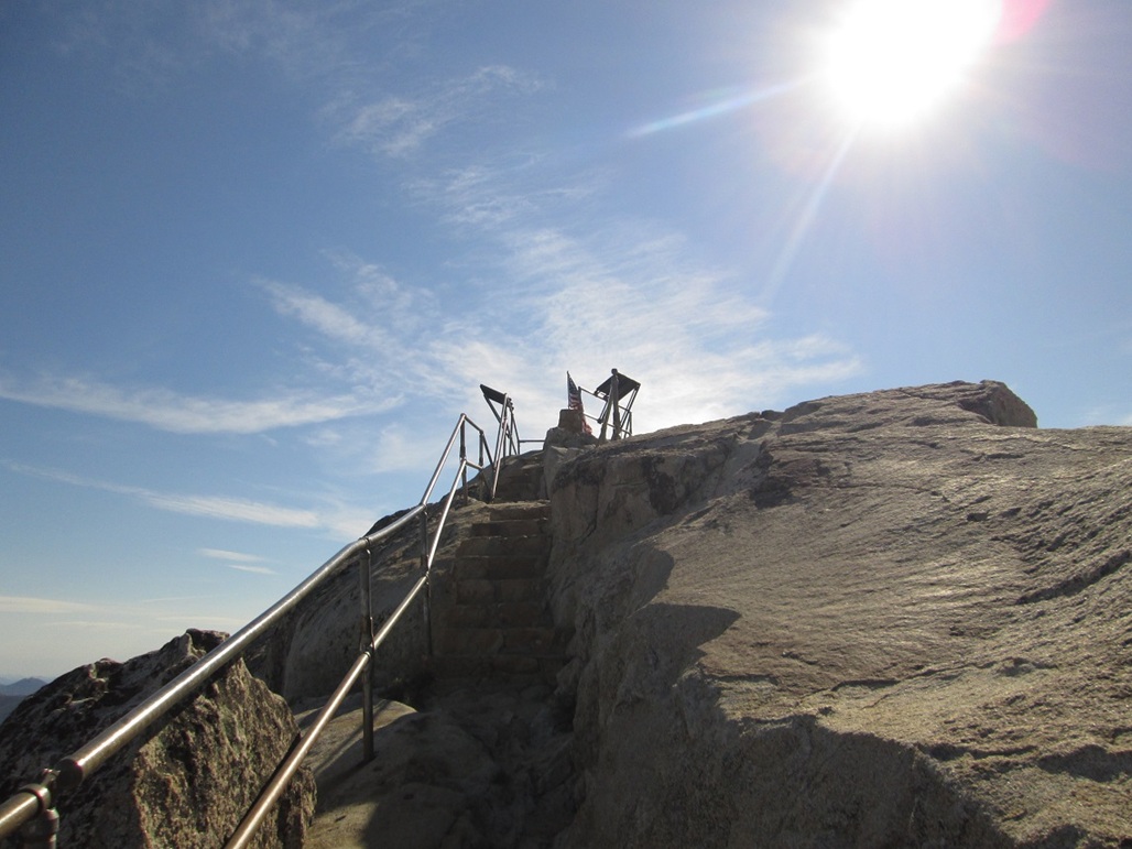
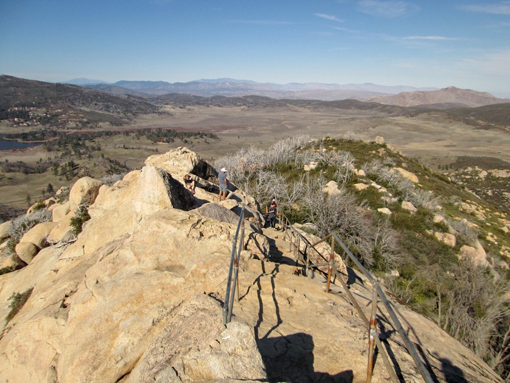
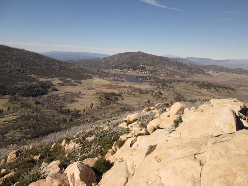
I made good time up the trail, which is about 2 miles each way (a little longer going by most GPS readings). The last hundred feet works through a rock outcrop, the final few steps being hewn into the rock, protected by some guard rails. The very top is atop the big rock, with great views in all directions. Just as I arrived, a group of about ten people arrived, crowding me. The platform can only hold about ten people. I got some photos and looked around, spending about ten minutes up here. The hike down took just a half hour, the whole journey a little less than two hours.
I returned to my camping spot, where my neighbors had placed a couple folding chairs in the spot (that was nice of them). I sat in my campchair and relaxed. Later, Edward Earl, whom I had not seen since 2004, rolled in and would camp with me. He was here too for Adam's memorial service.
The next day, we all convened to hike Cuyamaca Peak in Adam's honor.
|

|