The Mountains of California
• www.surgent.net
|
| Mount Pinos & Sawmill Mountain |
• Highpoints: Ventura & Kern Counties • Highpoint: San Emigdio Mountains • Highpoint: Los Padres National Forest |
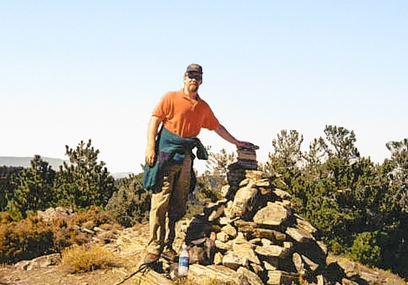 At Sawmill Mountain's cairn
|
Date: October 14, 2000
• Elevation: 8,831 feet (P), 8,818 feet (S)
• Prominence: 4,800 feet (P), 418 feet (S)
• Distance: 6 miles
• Time: 4 hours
• Gain: 1,500 feet
• Conditions: Cool, spotty snow on ground
• Teammates: Slasher
California
•
Main
•
PB (Pinos)
•
PB (Sawmill)
Mount Pinos is the highest point of the San Emigdio Mountains, and is the highest point of Ventura County. The county line separating Ventura and Kern Counties runs slightly north of Mount Pinos. A smaller peak called Sawmill Mountain lies just north of the county line and is the highest point of Kern County. Both peaks are hiked together. The trail comes to Mount Pinos first, then continues on to Sawmill Mountain.
I drove in from Arizona, staying the night with my brother's family in Cucamonga. My mother was there too, this weekend being her birthday. My niece was now a few months old, old enough to grab and pull handfuls of my beard when I held her up. I visited with everyone and had a restful night.
Early Saturday (the 14th), I followed Interstate-10 to the 210 and then to the 5 north of Los Angeles. For this hike, I was joined by my college pal Jeff, who you may better know as Slasher, the heavy-metal guitarist, who lived in the L. A. area. We met at a Denny's in Santa Clarita, battling the crowds who were all heading to Magic Mountain. I then drove us to the trailhead. We left the interstate at the Frazier Park exit, headed west to the town of Lake-of-the-Woods, then up curvy roads to the Mount Pinos parking area.
As we drove this road, we saw signs saying that we needed an "Adventure Pass" to park anywhere, but that meant backtracking back to the Ranger Station in Lake-of-the-Woods, which meant doing something I did not feel like doing. So I decided to take my chances and park without the pass (more later). Today was the first day of deer-hunting season and there were many hunters. There were also lots of hikers and mountain bikers so we didn't feel particularly concerned about the hunters. We stayed on the trails and wore orange.
The hike to Mount Pinos is along an old dirt road that is gated shut at the parking area. We were on the trail at 10:30 a.m. The weather was cool, clear and calm. There was patchy snow on the ground, which was quite surprising since these mountains don't get a whole lot of snow, and certainly not in October, so this was a rarity. The road is well maintained and has a very gentle grade.
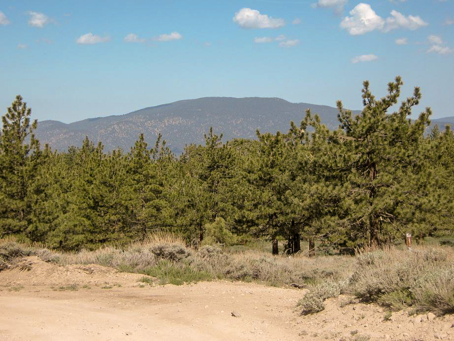
We walked at a leisurely pace and arrived to the summit of Mount Pinos in 45 minutes. There is a benchmark in the center of the rounded summit and a witness marker located in a jumble of rocks, which to our eyes seemed to be the true highpoint. We separately surmounted the rocks to get photos, then took a lunch break. Looking north, we gazed down almost 8,000 vertical feet into the fog-shrouded Central Valley. Way off to the Northeast, we could make out the Sierra Nevada and the Tehachapi Mountains.
We also walked down the north slope a few feet, putting us about 8,820 feet. Assuming the county line to be accurate, this area has a small chance to be the highpoint of Kern County. Given that the exact line is probably not well defined anyway, this just covered all bets, nothing more.
We continued west along the road another hundred yards to the old Wildlife Viewing Site, where the condors used to be released back in the 1970s and 1980s. From here, a trail proceeds west and switchbacks down to a saddle between Pinos and Sawmill Mountains, losing 500 feet. From the saddle, we hiked steeply up the other side until the trail leveled again. Leaving the trail, we hiked cross-country to the ridge, then followed it to a large cairn and the summit of Sawmill Mountain. This cairn is huge, and we added to it, rested again, took photos and looked out at the other mountains like the Coast Range to the west and the Temblors to the north.
The weather was pleasant, but growing windier, so we decided to get moving. We descended to the saddle, re-ascended up most of Mount Pinos, then walked out back to my truck. The entire round trip was a little over four hours and covered six miles. And yes, I was cited for not having an "Adventure Pass" permit. All I needed to do was take the citation to the Ranger Station, pay for a pass (no penalty), and mail the citation and the pass to the address on the citation and all would be resolved. I paid the same amount, but I was not amused by the signs mentioning the need for a pass AFTER we'd passed the ranger station, and also the phone number given on the signs was wrong. Hence my decision to take a chance.
|
|