The Mountains of California
www.surgent.net |
| Hot Springs Mountain |
• Highpoint: San Diego County • Highpoint: Los Coyotes Indian Reservation • Highpoint: Hot Springs Mountain |
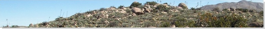
 The San Ysidro Mountains are the darker-colored peaks to the right in this photo, taken from Anza-Borrego State Park Desert, Dec 2006
|
Date: July 7, 2001
• Elevation: 6,533 feet
• Prominence: 2,613 feet
• Distance: 4 miles
• Time: 3 hours
• Gain: 500 feet
• Conditions: Cool and sunny, then cloudy
California
•
Main
•
PB
I was supposed to be in New Mexico this weekend. I had tickets and everything, but when I got to the airport, our plane was late, and then we were informed it had not even left its previous airport yet. This meant I'd be getting into Albuquerque probably in the middle of the night. So I bailed, took a credit, and then went home.
To salvage the weekend, I looked west and honed in on Hot Springs Mountain, highest point in San Diego County. The hike should not take long, so I built in some time at the beach then a visit with my brother's family.
Given the intense heat this time of year, I left in the middle of the night, so that I was passing through Borrego Springs close to dawn, then up that steep grade to Warner Springs. I then followed a bunch of wiggly backroads to place me at the entrance to Los Coyotes Indian Reservation, which contains the mountain. The cost to enter at the time was $10. I paid it and entered.
Since this was an impromptu trip, I had no maps with me. All I had was the description of the hikes in Gary Suttle's California County Summits book. I first tried to access a trailhead eight miles past the entrance gate, but nothing seemed to match, so I drove back to the gate, and tried plan B, which was to drive the road that leads all the way to the top. The road was rough and I had hoped for a hike, but it seemed now I had no other choice.
The road is steep at first, and not in the best of condition. My stock 4-wheel drive Nissan did fine, but in sections the road was littered in rocks or very rutted. This went on like this for a couple miles, then once high on the ridge, the road leveled and generally followed the contours of the hillsides for another three miles. I parked where I found a pullout, still about two miles short of the summit. Although the road continues nearly to the top, I still wanted to hike some of it. Plus, the pull-out was wide and too good to pass up.
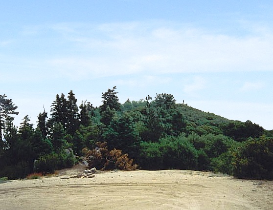
The hike up the road was easy, and in less than an hour I was at its end in a big turn-around, slightly below a derelict lookout tower. I walked to the tower and inspected it, but dared not climb it. But this is not the highpoint. The true highest point is atop a bare rock, surrounded by a thick blanket of chapparal and woody trees, all growing close together to create a formidable mesh.
Past visitors have beaten in a scant path through this woody mesh, but still, I found myself needing to hunker my shoulders in and squat down to avoid the scratchiest stuff. Momentarily, I was at the summit boulder. Looking for a way up to the top, I walked around, where I found a slit and a well-placed tree that provided enough holds to allow me to shimmy up 15 feet to the top. A concrete slab is placed here to mark the summit. I spent just a moment here, immediately clambering down and back out through the woody crud back into open land, where I then took a short break. My one-way hike took me an hour exactly with 500 feet of gain.
I had seen no one on my hike up, but as I hiked down, a met a few hikers and people in their Jeeps. There were also campers on the side roads. I was back to my truck at noon, exited, and located myself in Oceanside. There, I frolicked in the beach and stayed the night in a hotel in town. The next day I drove north to visit my brother's family for a couple hours, engaging with my niece who is 14 months old and starting to talk. Then, the six-hour drive home.
The Los Coyotes band closed access to their lands (and the peak) for the better part of a decade, re-opening it around 2010. As such, access may not always be guaranteed. Hot Springs Mountain isn't the most amazing peak, but it is a nice short hike and worth the trouble to come here, if you're allowed to. They closed it not long after I was there. My timing was good.
|
|