The Mountains of California
• www.surgent.net
|
| Alamo Mountain |
• Transverse Ranges • Los Padres National Forest • Ventura County |
|
Date: August 15, 2010
• Elevation: 7,367 feet
• Prominence: 2,487 feet
• Distance: 2.2 miles (hiking)
• Time: 4 hours (whole journey)
• Gain: 850 feet
• Conditions: Pleasant
California
•
Main
•
PB
Alamo Mountain is a broad mountaintop in the Transverse Ranges of Southern California. It has respectable prominence and is visible from major highways, but does not really stand out amid its similarly-shaped neighbors. It's close to Frazier Mountain, which is the big peak everyone sees when passing through Gorman along Interstate-5. Alamo Mountain is located within the Hungry Valley Off-Highway Vehicle (OHV) State Park, meaning that my journey would partly involve avoiding dirt bikers, ATVers and the like.
Truthfully, the only reason I was interested in Alamo Mountain was for its prominence. I was "in the area" twice in recent years, but a fire closure and a weather closure stopped me on both attempts. This time, I knew the roads were open. I was in Southern California hiking a couple of prominence mountains before starting the Fall semester of teaching back in Arizona. I had driven from Arizona yesterday morning, and spent yesterday afternoon in Wrightwood with my mother, niece and nephew. We hiked a little on the Pacific Crest Trail.
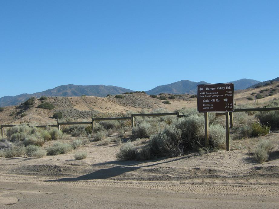
Today, I had driven to Gorman from Wrightwood via Palmdale, about a hundred miles. I arrived to the Hungry Valley Park entrance in the mid-morning. I showed them my Adventure Pass, and they let me in. Angling south, I followed Hungry Valley Road for 5.6 miles to Gold Hill Road (Forest Road 8-N-01). As expected, I shared the road with dirtbikes, ATVs and some sandrails. There were a lot of them about, and not everyone pays attention.
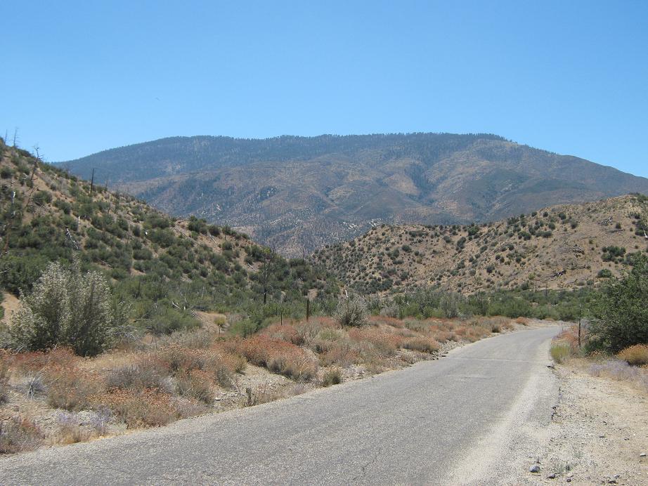
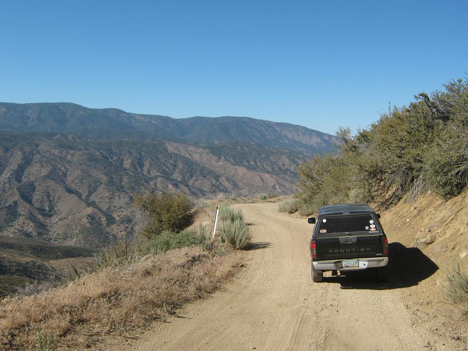
Now on Gold Hill Road, the road narrows, but is still easy to drive. A sign said that Alamo Mountain was 10.5 miles ahead. Shortly, the road comes to Piru Creek. A lot of people come here and no farther. The road dips into Piru Creek and fords it, then starts steeply up the other side. In a couple miles, the pavement ended, giving way to hardpack dirt. I still had over five more miles to drive, so I drove slowly and carefully. The roads are good, but narrow, and more than once some one would fly around a corner going way too fast. It was nerve-wracking.
As I neared Alamo Mountain, the number of ATVs and dirtbikes and Jeeps had dwindled down to near zero. Finally, a little over 18 miles since the entrance kiosk, I had arrived onto Alamo Mountain Road, which encircles Alamo Mountain. I went right briefly, then sharply left, following a spur road to the Twin Pines Campground, which is just a couple cleared areas and no development. There was no one here. After all the driving I had done, it was pushing 2 p.m. when I finally started hiking. The weather was pleasant.
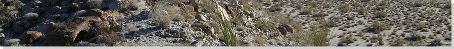
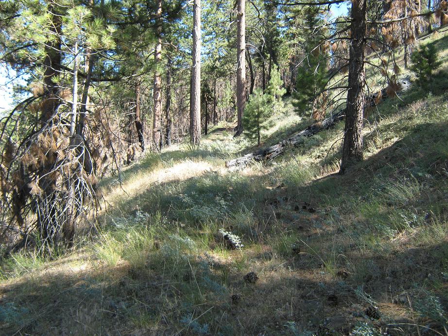
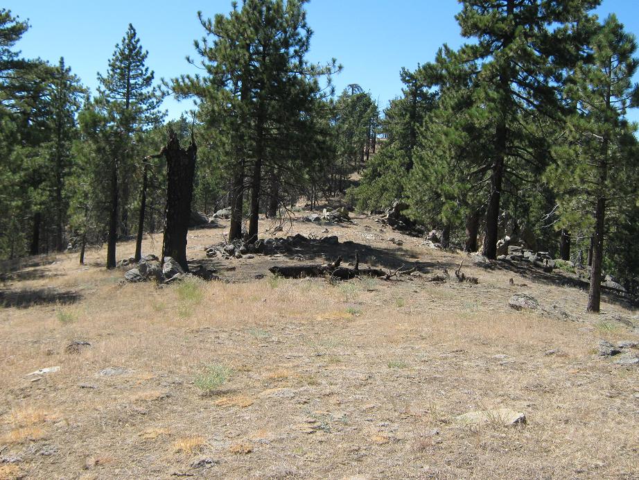
The route to the top starts at an abandoned road not shown on the topographic maps. This road starts at the high-point of the road into Twin Pines Campground, and is marked by a small sign. I hiked up this road and followed it through the pine forest. The road itself is thickly vegetated and has essentially disappeared altogether, in places it was kind of tricky to discern it against the hillside. I walked up this road for 0.75 mile to where it was blocked by a giant downed tree. Passing this tree seemed a hassle, so I decided to charge up the hillside instead, aiming for a rock outcrop directly above me. The hillside was steep and loose, but mostly open, with little undergrowth to impede me.
I gained the main ridge near this rock outcrop, and walking past it, could make out the highpoint hill, about another quarter-mile northwest. The hike here was through pleasant grassy meadow with thickets of trees. Shortly I gained the last few dozen feet and scampered up the summit rocks of Alamo Mountain, the highest point a distinctive "mini" pillar of rock. I signed in the register, noting I was the first person here in two months, which seemed surprising to me.
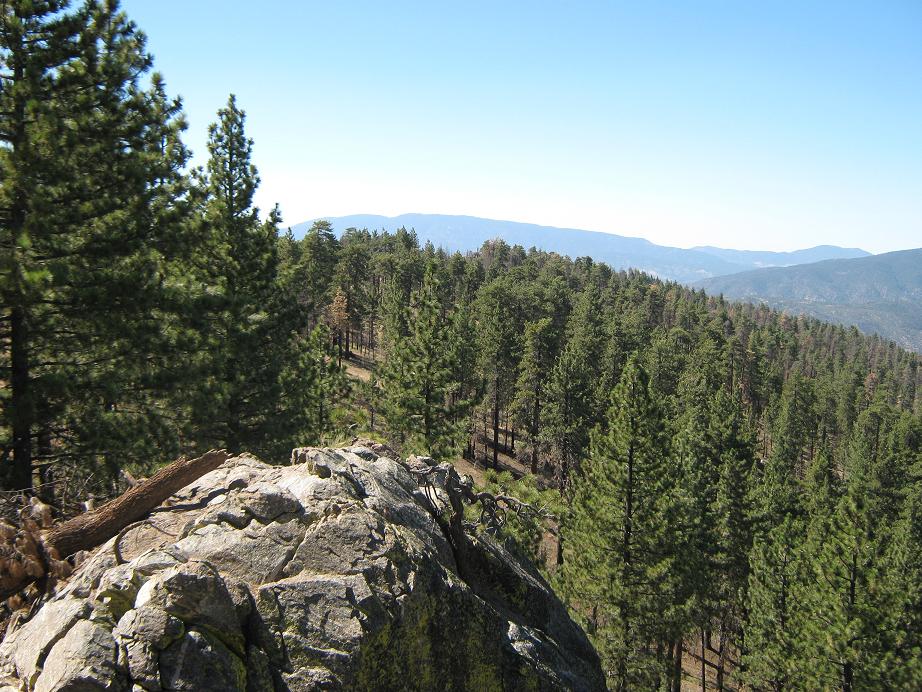
The views were very nice. There was Frazier Mountain to the north, and behind it to the northwest, the broad outlines of the San Emigdeo Range. To the east I could make out an expanse of grassy hills and summits. My view south was blocked by trees. The dry air allowed for some fine detail in the distant ranges. It's surprising how rugged the land here is, so close to Los Angeles. You'd never know there are 10 million people just down the road aways.
After 15 minutes, I started down, which went very quickly. I followed the same route back to my truck, and I was gone for one hour and ten minutes. The Sierra Club Hundred Peaks Section calls this hike 2.5 miles round trip, but with my variation due to the downed tree, I figure I hiked a little less than that (I'd say 2.2). I gained 740 feet, and another hundred feet of up-and-down on the main ridge.
I considered staying here for the night, but the noise of dirt-bikes, even from afar, was not enticing. Plus, I didn't want a whole bunch of them coming into my camp area. I decided to descend and get myself into Santa Barbara for my next hike, Santa Ynez Peak. The descent drive was fun, given the sheer drop-offs and amazing views. Since the actual hike is so short, Alamo Mountain is a peak that falls into the "hike by truck" category, where most of the uphill effort and gain is done in the truck. I enjoy these as much as the regular hikes.
Some of the people on this road were going a bit quick, though. One guy in a Jeep turned a blind bend coming my way going about 30 m.p.h., skidding to a stop and kicking up a boatload of dust. Another person was in a passenger vehicle, going haywire over the bumps. That kind of yahoo-driving was not cool, and was another reason I opted to leave sooner than later. That was the only downside of the whole hike and drive. Otherwise, I had fun on Alamo Mountain, and the entire journey from Gorman and back took about 4 hours at a very lenient pace.
Comment on the summit elevation and prominence figure: The map shows two regions enclosed inside 7,360-foot contours. The smaller one has a listed spot elevation of 7,367 feet, but the larger region is clearly higher, although no elevation is given. The prominence figure is based on the 7,367-foot elevation, placing it 90th on the California list. My gut tells me the summit is higher by probably 8-10 feet than the 7,367-foot region.
|


|